El Malpais National Monument
The Spanish called it El Malpais -- the badlands -- and the name stuck. From above, this stretch of western New Mexico looks like the earth split open and bled black, a vast apron of frozen lava sprawling between sandstone mesas and the distant peak of Mount Taylor. But what the Spanish name fails to capture is the strangeness hiding beneath that tortured surface: caves where ice has persisted for two thousand years, lava tubes sheltering bat colonies and rare ferns found nowhere else west of the Mississippi, and an ancient trail the Acoma and Zuni peoples carved across a hundred miles of razor-sharp basalt to link their distant pueblos. Designated a National Monument in 1987, El Malpais protects one of the youngest and most dramatic volcanic landscapes in the continental United States.
Fire Beneath the Plateau
The lava flows, cinder cones, and volcanic vents of El Malpais belong to the Zuni-Bandera volcanic field, the second largest volcanic field in the Basin and Range Province. Situated on the southeast margin of the Colorado Plateau along the ancient Jemez Lineament, this is a zone of deep crustal weakness where magma has been pushing toward the surface for millions of years. The eruptions filled a massive basin created by faulting along the Rio Grande Rift, leaving behind both smooth pahoehoe and jagged aa lava flows. Bandera Crater, El Calderon, and more than a dozen cinder cones mark the vents where molten rock breached the surface. Some of these flows are so young -- geologically speaking -- that vegetation has barely gained a foothold, leaving miles of black basalt exposed to the New Mexico sun.
Ice in the Darkness
Beneath the lava crust lies a hidden world. El Malpais is riddled with lava tubes -- natural tunnels formed when the outer surface of a lava flow solidified while molten rock continued to drain beneath. Some of these tubes trap cold winter air so effectively that ice accumulates year after year, never melting in the perpetual darkness. The Acoma Pueblo people discovered this phenomenon centuries ago, using the ice caves as cool refuges from summer heat and melting ice along their cross-desert trail as a water source. Two caves, Giant Ice and Lava Bomb, are open to exploration with a free caving permit. The Junction Bridge lava tube is accessible along the El Calderon trail. These same underground passages serve as critical roosting habitat for diverse bat species, so vital that all caves were temporarily closed from 2010 to 2013 to protect colonies from the spread of White-nose Syndrome.
Life on the Lava
Despite its forbidding appearance, El Malpais teems with life in unexpected forms. Some of the oldest Rocky Mountain Douglas-firs on Earth grow here, their roots threaded into cracks in the basalt. In 2020, scientists discovered a population of hart's-tongue ferns inside a lava cave -- the first confirmed occurrence of the species west of the Mississippi in either the United States or Canada. Moss and liverwort gardens flourish at sunlit cave entrances where meltwater drips through cool, humid air; 95 mosses and 15 liverworts have been documented, including species not typically found in New Mexico's arid climate. Above ground, over 190 bird species occupy habitats ranging from piñon-juniper woodland to ponderosa pine forest. Horned lizards inflate to double their size in self-defense, bullsnakes mimic rattlesnakes, and canyon treefrogs lay eggs in the rain-filled rock pools called tinajas.
Trails Through the Badlands
Long before the Spanish arrived, the Acoma and Zuni peoples forged a trail through El Malpais connecting their pueblos a hundred miles apart. It was a remarkable feat of route-finding across some of the most punishing terrain in the Southwest, and the ice-filled caves along the way provided water in a landscape that offered almost none on the surface. The area's history took a darker turn in the 1940s, when the Manhattan Project evaluated the Malpais lava field as one of eight candidate sites for the Trinity nuclear test. The bomb was ultimately detonated to the south at White Sands, but the Department of Defense did use El Malpais as a bombing range to train pilots during World War II. When Congress designated the monument in 1987, the Acoma Pueblo objected, seeking return of the land for spiritual purposes. Congress proceeded but allowed sections to be closed at the Pueblos' request for ceremonial use.
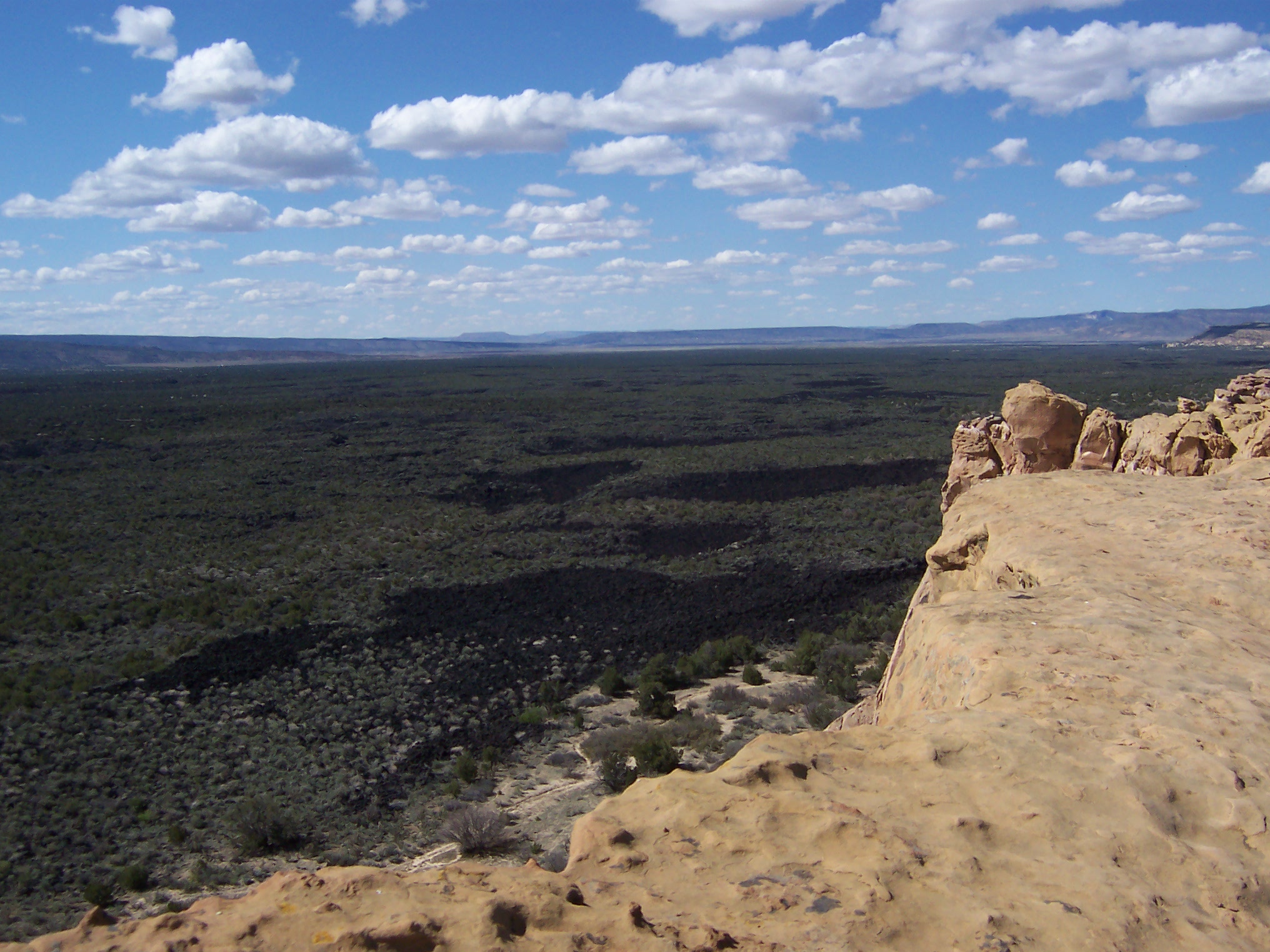
The View from Above
From the air, El Malpais is unmistakable: a dark stain of basalt set against the tawny sandstone and red earth of the surrounding desert. The Sandstone Bluffs overlook marks the boundary where ancient sea-floor sediment meets volcanic flow, a collision of geologic ages visible in a single glance. The landscape has drawn storytellers as well as scientists. Aldous Huxley set the "savage reservation" of his 1932 novel Brave New World on land encompassing the monument. Louis L'Amour placed his 1960 western Flint in the malpais, and Cormac McCarthy set a scene of Blood Meridian on this same black ground. The literary imagination, it seems, keeps returning to a place where the earth looks freshly wounded -- a landscape that refuses to be tamed, or forgotten.
From the Air
Located at 34.88°N, 108.05°W in western New Mexico. The dark lava flows are strikingly visible from altitude, contrasting sharply with surrounding sandstone. Mount Taylor (11,301 ft) is visible to the north. Nearest airports: Grants-Milan Municipal Airport (KGNT) approximately 20 nm northeast, and Albuquerque International Sunport (KABQ) about 75 nm east. Best viewed at 5,000-8,000 ft AGL for full extent of the volcanic field. Clear weather recommended; area sits at approximately 7,000 ft elevation.