Eleuthera
Somewhere on this island, the land narrows to 30 feet. Stand in the right spot and you can see the Atlantic Ocean on one side and the calm turquoise of the Great Bahama Bank on the other, close enough to throw a stone into either. Eleuthera stretches 110 miles through the Bahamas like a drawn-out brushstroke, never more than a few miles wide and sometimes barely wider than the road that runs its length. The Taino people, the island's earliest known inhabitants, called it Cigateo -- "distant rocky land" -- and the name still fits. Eleuthera remains distant in spirit if not in miles, a place 50 miles east of Nassau that feels much farther from everything.
A Failed Utopia, A Lasting Name
In the mid-seventeenth century, a group of English settlers arrived on Eleuthera with an audacious plan: to establish the first European democracy in the Western Hemisphere, nearly 130 years before the American Revolution. They called themselves the Eleutheran Adventurers, taking their name from the Greek word for freedom. The difficulties of island life -- thin soil, hurricane exposure, isolation -- broke the experiment. Most settlers left. But the name stuck, and so did a handful of people who chose rocky independence over whatever they had left behind. A wooden duho, a ceremonial seat carved by the Taino people who lived here centuries before the Adventurers arrived, was found on Eleuthera in the 1800s. It now sits in the British Museum, a quiet reminder that long before Europeans dreamed of freedom here, an indigenous civilization had already built one.
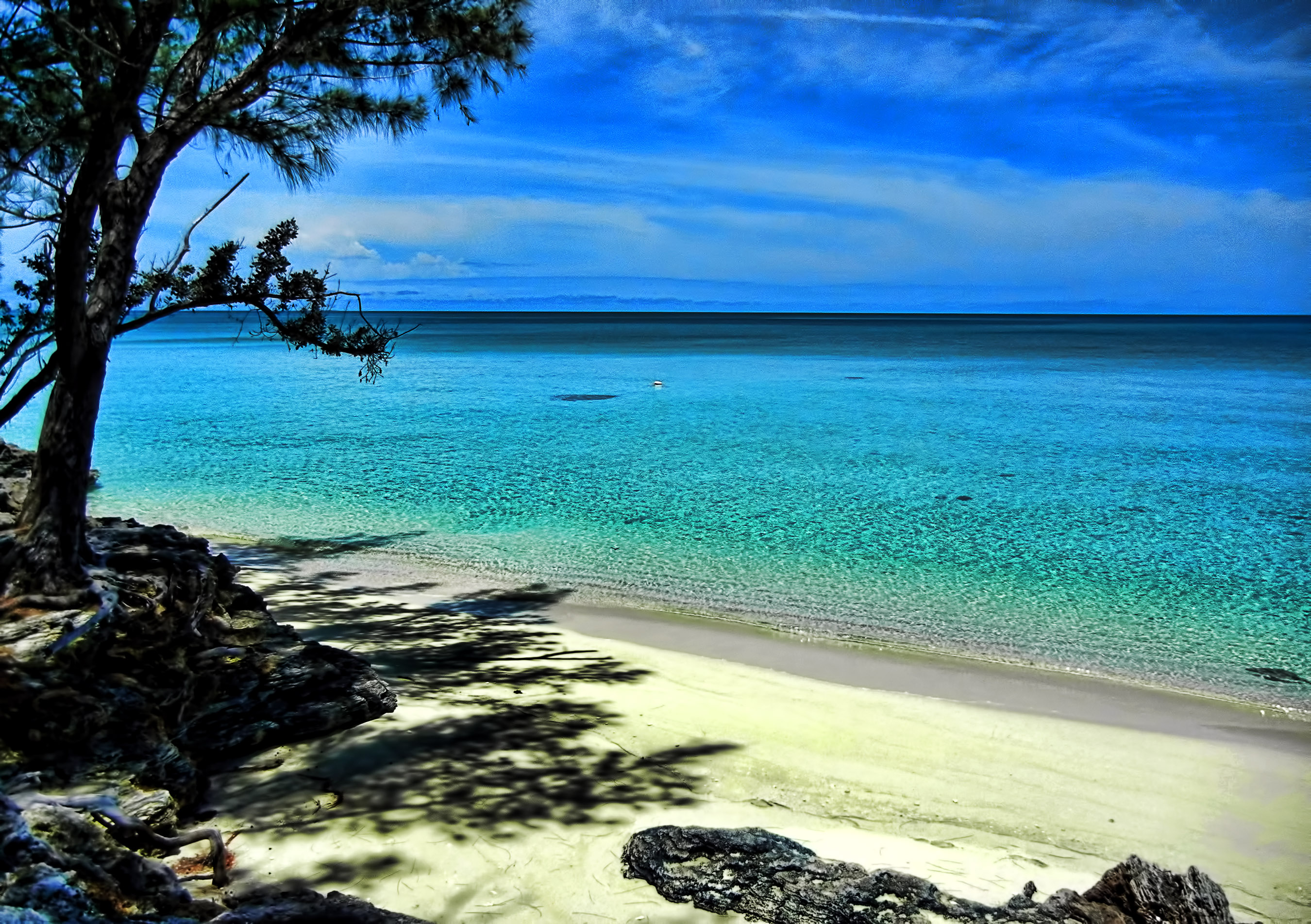
The Glass Window and the Pink Sand
Eleuthera's geography is its defining characteristic. The island rides atop the Great Bahama Bank on its western side, where shallow water barely covers the sand and the sea appears to glow from within. To the east, the Atlantic drops away into deep blue. At the Glass Window Bridge, the island narrows so dramatically that both bodies of water are visible simultaneously -- dark ocean to the left, pale bank to the right, and a thin ribbon of road between them. Plans for a $30 million replacement bridge were announced in 2021 to move the crossing 60 feet west of the existing span. Farther south, Harbour Island's beaches take on a distinctive pink hue from crushed shells of foraminifera, a single-celled marine organism whose red-tinted remains mix with the white sand. The effect is subtle in bright sun and vivid at dawn, when the light is low enough to let the color bloom.
Listening for Submarines
During the Cold War, the U.S. Navy chose Eleuthera for one of the most sensitive installations in the Atlantic. NAVFAC Eleuthera was a shore terminus for SOSUS, the Sound Surveillance System -- a network of underwater hydrophone arrays designed to detect Soviet submarines. In 1951, a six-element test array was placed offshore to prove the concept. After successful trials with a U.S. submarine, a forty-element operational array was installed in 1952, one of nine across the Atlantic. Though it was the first array to go into the water, it was the last to receive its shore terminal; NAVFAC Eleuthera was commissioned on September 1, 1957. The facility employed 150 Navy officers and enlisted personnel, Western Electric and RCA contractors, and 45 Bahamian workers. In 1972, eleven women became the first in the U.S. Navy to serve at a SOSUS facility when they were assigned to NAVFAC Eleuthera. The base was decommissioned on March 31, 1980, after 23 years of silent listening.
Island Time, Island Scale
About 9,100 people live on Eleuthera today, according to the 2022 census, spread across settlements with names like Governor's Harbour, Rock Sound, Tarpum Bay, and Spanish Wells. The Queen's Highway runs the island's full 177-kilometer length, and for most of the drive it feels like the only road in the world. Three airports connect Eleuthera to Nassau and beyond: North Eleuthera, Governor's Harbour, and Rock Sound. Tourism is the dominant economic activity, though six percent of the population still works in fishing, agriculture, or mining. The Cape Eleuthera Institute studies the sharks and rays that thrive in local waters, their abundance attributed to a ban on long-line fishing. In Governor's Harbour, the Haynes Public Library occupies a building constructed in 1897, the oldest government complex on the island. Lenny Kravitz keeps a home on Eleuthera and has said many of his songs were written here -- an island this quiet has a way of making space for whatever you bring to it.
From the Air
Eleuthera lies at approximately 25.13N, 76.14W, stretching roughly 110 miles northwest to southeast through the Bahamas. From cruising altitude, it appears as an impossibly thin ribbon of land separating the pale turquoise of the Great Bahama Bank (west) from the deep blue Atlantic (east). The Glass Window Bridge near the island's midpoint marks the dramatic narrowing. Three airports serve the island: North Eleuthera Airport (MYEH) with a 1,835m runway, Governor's Harbour Airport (MYGH) at mid-island, and Rock Sound Airport (MYRS) in the south. Nassau (MYNN) lies approximately 50 miles to the west. Best viewed at 3,000-6,000 feet AGL, where the full length of the island and its two-toned water contrast are most striking.