Emerald Mound
Only one pre-Columbian earthwork in North America is larger than the one that rises from the Mississippi bluffs near Stanton, Mississippi. That distinction belongs to Monk's Mound at Cahokia, Illinois -- but Emerald Mound is no footnote. Covering eight acres at its base and standing thirty-five feet above the surrounding landscape, this massive platform mound was the ceremonial heart of the Natchez Bluffs region for more than five centuries. The Natchez people gathered here for religious rites and social events from around 1200 CE until well into the era of European contact. What visitors see today along the Natchez Trace Parkway is the surviving core of a complex that once included eight mounds, an encircling ditch, and a community that represented one of the last great expressions of the mound-building tradition along the Mississippi River.
Shaped from the Earth Itself
Emerald Mound was not built from scratch. Its creators, people of the Plaquemine culture during the Mississippian period, recognized a natural hill and transformed it into something monumental. They sculpted the landform into a flat-topped platform measuring roughly 770 feet by 435 feet at its base, then raised two secondary mounds at opposite ends of the summit. Early nineteenth-century travelers recorded six additional smaller mounds flanking the edges of the primary platform, three on each side, but these were flattened by decades of plowing and erosion. A constructed ditch once encircled the entire complex, marking the boundary between sacred and ordinary ground. The National Park Service stabilized the site in 1955, preserving what centuries of agriculture and weather had not yet erased.
Where the Natchez Gathered
The site served as the principal ceremonial center for the Natchez Bluffs Plaquemine culture, and it is the type site for what archaeologists call the Emerald Phase, spanning roughly 1500 to 1680 CE. The Natchez people did not live in dense urban settlements the way their contemporaries at Cahokia once had. Instead, they spread across the landscape in small hamlets and family farms, coming together at places like Emerald Mound for religious ceremonies and communal gatherings. This dispersed settlement pattern made their ceremonial centers all the more important as focal points of identity and tradition. By the time of the La Salle Expedition in 1682, the tribe's primary ceremonial focus had shifted southwest to the Grand Village of the Natchez, also called the Fatherland Site. Emerald Mound was gradually abandoned during the French colonial period, its role supplanted but its physical presence enduring.
The Last of the Mound Builders
Emerald Mound stands at the end of a tradition stretching back thousands of years. Across the Mississippi Valley and the Southeast, Indigenous peoples constructed earthen mounds for burial, ceremony, and political authority. Cahokia, the greatest of these centers, had already declined by the time Emerald Mound entered its most active phase. In this sense, Emerald Mound represents something rare: a living continuation of the mound-building tradition into the period of European contact. The Natchez people maintained their hierarchical society, led by a hereditary chief called the Great Sun, well into the eighteenth century. Their culture survived long enough to be documented by French observers, giving historians and archaeologists an invaluable window into a way of life that elsewhere had faded before Europeans arrived to record it.
A Quiet Monument on the Trace
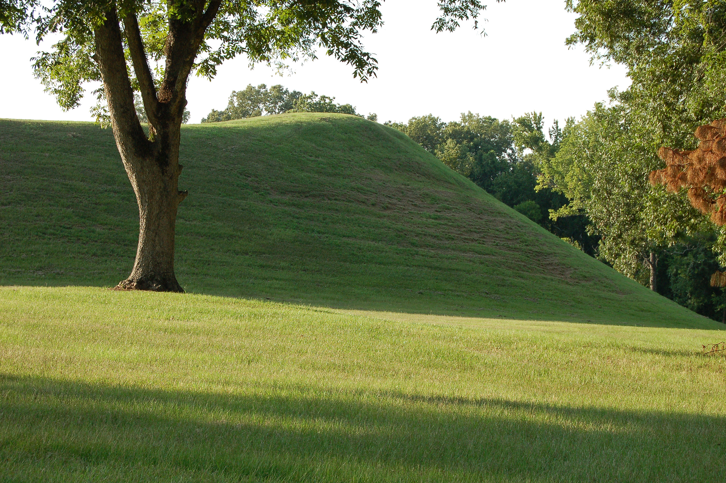
Today, Emerald Mound sits just off the Natchez Trace Parkway at milepost 10.3, a grassy expanse that rewards those who stop and walk its summit. From the top, the scale becomes clear: the flat platform stretches in every direction, the two secondary mounds rising at either end like bookends on a shelf of earth. The surrounding forest presses close, and on a quiet morning the site feels deeply removed from the modern world. There are no reconstructions, no elaborate visitor centers -- just the mound itself, stabilized and maintained, its surfaces mowed to a green that catches the light. From the air, the geometric footprint stands out sharply against the irregular canopy of the Mississippi bluffs, a rectangle of intention carved into a landscape of natural curves. It is a place that rewards both patience and perspective.
From the Air
Located at 31.6361N, 91.2472W along the Natchez Trace Parkway near Stanton, Mississippi. From the air, Emerald Mound appears as a large, flat, rectangular green clearing measuring roughly 770 by 435 feet, standing out against the surrounding forest canopy on the Mississippi bluffs. Best viewed at 1,500-3,000 feet AGL. Two raised secondary mounds are visible at opposite ends of the platform. Nearest airport: Hardy-Anders Field/Natchez-Adams County Airport (KHEZ), approximately 12 nm to the southwest. The Natchez Trace Parkway corridor is a useful navigation reference running northeast-southwest through the area.