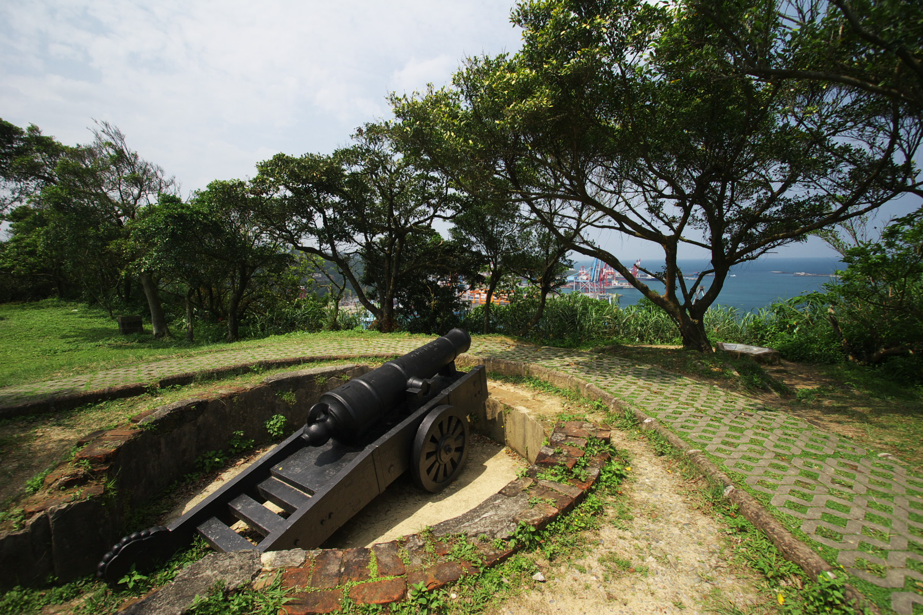
Ershawan Battery
Its Chinese name translates to the Tenable Gate of the Sea, and the battery earned that title the hard way. Built in 1840 to repel British warships during the Opium War, bombarded by French ironclads in 1884, shelled again by the Japanese navy in 1895, Ershawan Battery in Keelung absorbed punishment from three different navies across fifty-five years. What stands today is not the original fortification but a rebuilt version, constructed from the cannibalized remains of the first battery by a Qing general who would become Taiwan's first governor.
Yao Ying's Seventeen Forts
The battery traces its origins to 1840, when Yao Ying, disciplinary officer of the Qing garrison in Taiwan, recognized that the island's coastline was dangerously exposed. The First Opium War had demonstrated that British naval power could project force anywhere along China's coast, and Taiwan's harbors were no exception. Yao composed the Taiwan Seventeen Fortification Plan and presented it to the Qing court, a network of coastal defenses designed to cover the island's most vulnerable approaches. Ershawan was one of those positions, sited at the seaside to command the narrow entrance to Keelung Harbor. For four decades, the battery stood watch without firing a shot in anger.
Under the Guns of La Galissonniere
That changed on August 5, 1884, when three French warships opened fire on the Keelung forts. The Sino-French War had come to Taiwan. Liu Ming-chuan, the Qing official charged with defending Keelung, had already relocated the battery inland from its original seaside position, building a new fortification with materials salvaged from the old one. He made it his command post. The bombardment knocked the battery out of action, and French forces occupied it during the Keelung Campaign from October 1884 to April 1885. They renamed it Fort La Galissonniere, after the ironclad warship that had silenced its guns. The French also established a cemetery nearby, where roughly 500 soldiers and sailors who died during the campaign were buried. Most succumbed not to Chinese fire but to cholera and tropical disease. That cemetery, relocated in the early twentieth century, still exists today.
The Last Bombardment
A decade later, the battery faced Japanese guns. On June 3, 1895, five Japanese warships bombarded Keelung's coastal fortifications during the Battle of Keelung, part of the Japanese invasion of Taiwan following the Treaty of Shimonoseki. The Imperial Guards Division captured Ershawan with little difficulty. Unlike the French, who had fought a grinding eight-month campaign, the Japanese took the position quickly and decisively. Taiwan was ceded to Japan, and the battery that had been built, destroyed, rebuilt, renamed, and captured lost its reason for existence. It fell into disrepair under Japanese rule. The guns that had once challenged European and Asian navies alike rusted in the subtropical air.
Monument to Contested Ground
The Republic of China government, which assumed control of Taiwan after World War II, classified Ershawan Battery as a class one national historical monument. Liu Ming-chuan, who had commanded its defense against the French, went on to become the first governor of Taiwan Province, and the battery stands as a tangible link to that pivotal moment. Walking the rebuilt walls today, visitors look out over the same harbor approach that Yao Ying fortified in 1840. Container ships now pass where French ironclads once anchored. The strategic geography has not changed. Only the nature of the traffic has.
From the Air
Located at 25.1375N, 121.757E on the hillside above Keelung Harbor, northern Taiwan. The battery sits at elevation above the port district and is identifiable by its fortification walls overlooking the harbor entrance. Best viewed at 1,500-2,500 feet. Nearest airport is Taipei Songshan (RCSS), about 18 nm southwest. The French Cemetery is nearby to the northeast. Keelung Harbor itself, with its distinctive basin shape, is the primary visual landmark.