Etowah Indian Mounds
The Muskogee word Italwa means "town," and for five and a half centuries, this was one of the great ones. On the north shore of the Etowah River in what is now Bartow County, Georgia, a civilization built earthen mounds that still rise above the floodplain, engineered fish weirs that still trace the riverbed, and produced artwork so sophisticated that archaeologists needed decades to fully appreciate it. Etowah was occupied from 1000 to 1550 CE by a succession of chiefdoms belonging to the South Appalachian Mississippian culture, ancestors of the Muscogee Creek people. Today, the Muscogee (Creek) Nation and the Poarch Band of Creek Indians both consider Italwa their most important ancestral town. The Cherokee, who arrived centuries later, also hold the site sacred. The mounds have outlasted every people who built on them, every empire that claimed the land around them, every theory that tried to explain them away.
Rivers of Copper and Shell
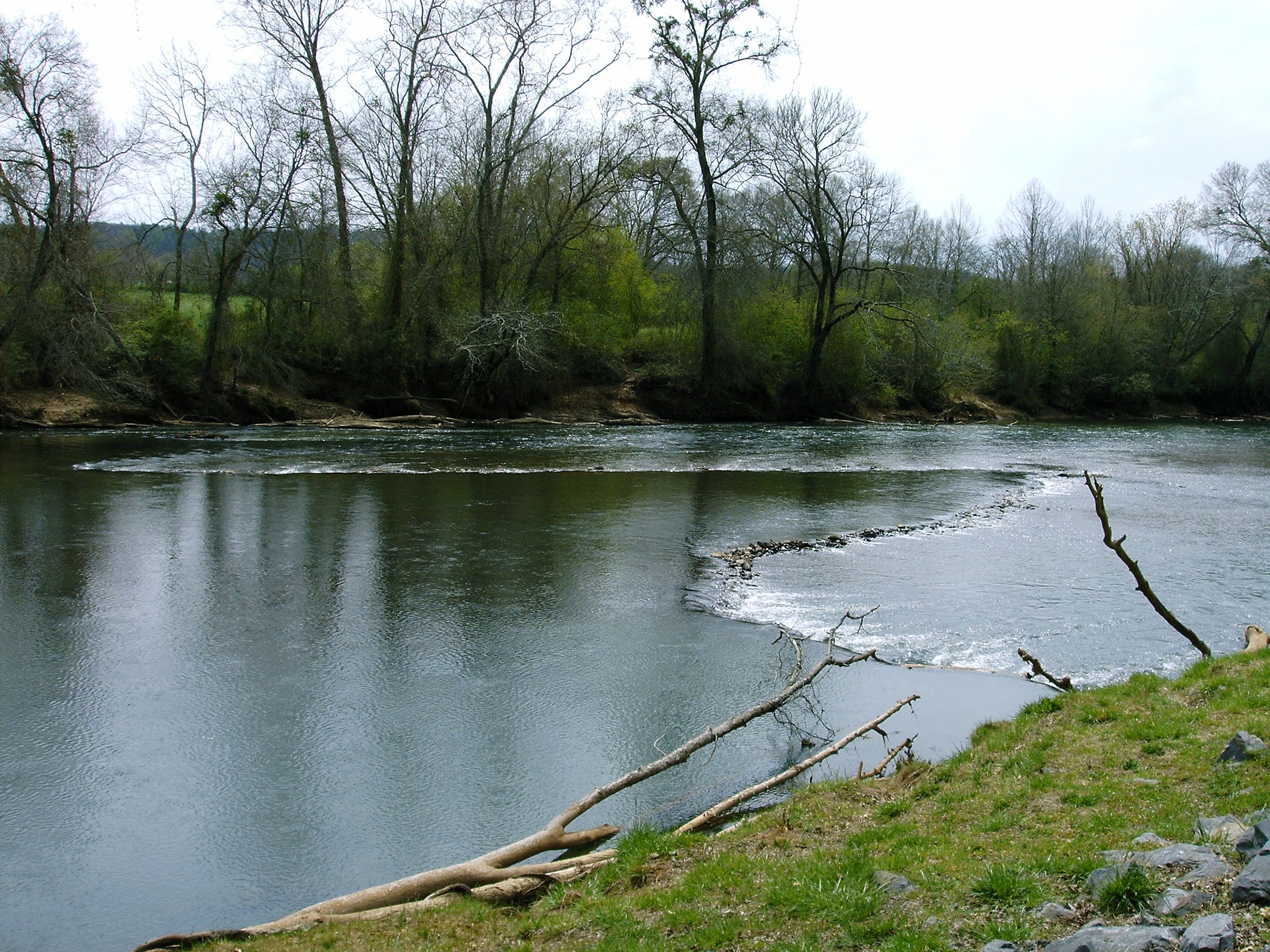
Etowah sat at a crossroads of geography and trade. The Etowah River is a tributary of the Coosa and Alabama rivers, and the site straddles the border between the Ridge and Valley Appalachians and the Piedmont Plateau. That position made it a natural hub. Trade networks brought whelk shells from the Gulf of Mexico, copper, mica, and flint from the Cumberland Plateau, and galena, graphite, and ochers from the Piedmont for painting buildings, bodies, and works of art. Greenstone and marble arrived for tools, weapons, and ritual objects. The loamy riverbed soil, renewed annually by the river's floods and free of frost most of the year, yielded rich harvests of corn, beans, and squash. Chestnut, walnut, hickory, and persimmon trees fed both the people and the white-tailed deer and wild turkey they hunted. The Mississippians built V-shaped rock weirs to channel catfish, drum, and gar into rivercane baskets. Researchers have found remains of more than 100 such weirs along the Etowah River.
Art from the Burial Mounds
The artifacts discovered in burials at Etowah reveal a culture of startling artistic sophistication. Copper tools, weapons, and ornamental copper plates accompanied members of the elite class into death. Where copper's preservative properties protected nearby textile fibers, archaeologists found brightly colored cloth with ornate patterns, the remnants of garments worn by social elites. Ten Mississippian stone statues have been found in the vicinity, many in pairs: a man sitting cross-legged, a woman kneeling, both with elaborate hairstyles. These paired figures are thought to represent lineage ancestors. Individual statues of young women with additional anatomical detail are believed to represent a fertility or Earth Mother goddess. The birdman, hand-in-eye, solar cross, and other symbols of the Southeastern Ceremonial Complex appear throughout the site. Etowah's artifacts, alongside collections from Cahokia, Moundville, Lake Jackson Mounds, and Spiro Mounds, provided the material foundation for defining the entire Southeastern Ceremonial Complex.
Centuries of Misattribution
When European Americans settled in northwest Georgia in the nineteenth century, they assumed the Cherokee had built the mounds, since the Cherokee occupied the region at the time. This was wrong by centuries. The Cherokee, an Iroquoian-speaking people, did not arrive in this part of Georgia until the late eighteenth century, long after the mounds were constructed. Spanish conquistador Hernando de Soto may have visited a settlement called Itaba here in 1540, though his chroniclers made no mention of large mounds, perhaps because they were already overgrown. Missionary Elias Cornelius described the site in 1817, noting that trees growing on the mounds proved they were at least two centuries old, but he had little idea of their true history. Cyrus Thomas and John P. Rogan tested the site in 1883 for the Smithsonian Institution. The first thorough excavation did not begin until the winter of 1925, when Warren K. Moorehead opened Mound C and revealed the rich burial goods that would reshape understanding of Mississippian culture.
What the Earth Remembers
Arthur R. Kelly, founding chairman of the Department of Anthropology at the University of Georgia, conducted further professional excavations before the government built Allatoona Dam upstream for flood control in 1947. The site was designated a National Historic Landmark in 1964, managed by the Georgia Department of Natural Resources. Today, the Etowah Indian Mounds museum displays Mississippian culture pottery, monolithic stone axes, stone statuary, copper jewelry, and shell gorgets found at the site. A restored rock fishing weir stands within the grounds, a working reminder of the engineering that sustained a civilization. The mounds themselves remain the most powerful artifact. Mound A, the largest, still dominates the landscape from its position on the riverbank. Standing on top of it, you look out across the same floodplain the Mississippians farmed, the same river they fished with stone weirs and rivercane baskets, and it becomes clear that this was not a primitive settlement but an organized, sophisticated, and enduring civilization.
From the Air
Located at 34.125N, 84.808W on the north shore of the Etowah River, south of Cartersville, Georgia. The mound complex is visible from lower altitudes as distinct elevated earthworks in the river floodplain. Look for the Etowah River winding through the landscape with the mounds on its north bank. Lake Allatoona is visible upstream to the east. Cartersville-Bartow County Airport (KVPC) is approximately 5nm northeast. Cobb County International Airport-McCollum Field (KRYY) is about 20nm southeast. Hartsfield-Jackson Atlanta International (KATL) is approximately 40nm south-southeast. The terrain is gently rolling Piedmont transitioning to Ridge and Valley Appalachians, with good VFR visibility typical of northwest Georgia.