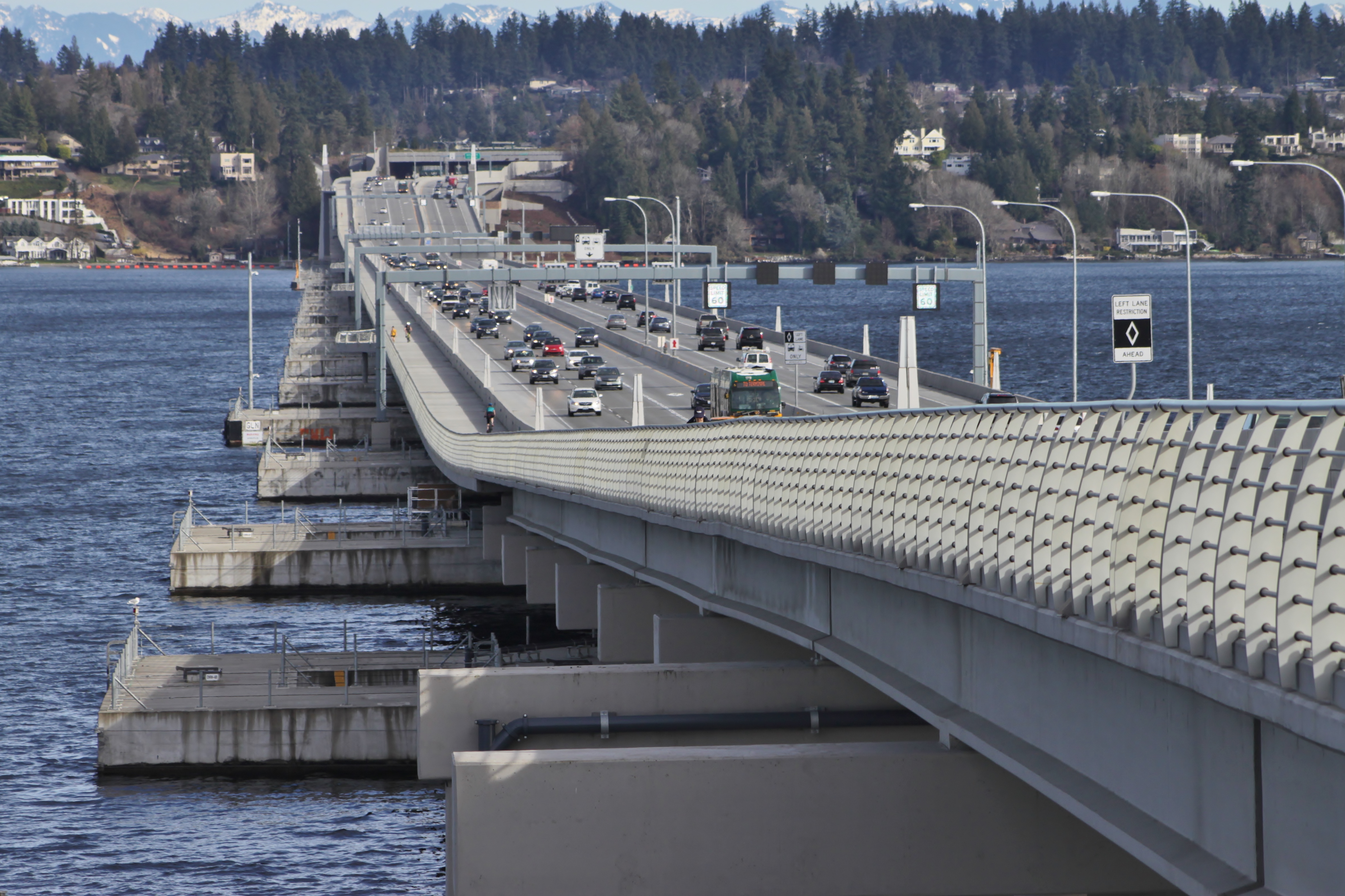
Evergreen Point Floating Bridge
Seventy-seven concrete pontoons hold six lanes of traffic above the dark waters of Lake Washington, and the whole arrangement floats. The Evergreen Point Floating Bridge, known to Seattle commuters simply as the 520 Bridge, stretches 7,710 feet from the city's Montlake neighborhood to the eastern suburbs of Kirkland and Bellevue, making it the longest floating bridge in the world. Guinness certified the record on opening day, April 2, 2016, in front of an estimated 40,000 to 50,000 people who walked, ran, and cycled across the deck before the first car was allowed to cross. What they were celebrating was not just a bridge but the resolution of a decades-long engineering and political struggle to replace a structure that wind, earthquakes, and age had rendered dangerously fragile.
The Bridge That Closed in the Wind
The original Evergreen Point Floating Bridge opened on August 28, 1963, carrying four lanes of State Route 520 across 7,578 feet of lake on 33 pontoons. It cost $24.7 million and included a drawspan at its center for large vessels. But the design predated modern earthquake engineering standards, and its hollow support structures harbored vulnerabilities that worsened with age. When sustained wind gusts exceeded 50 miles per hour for more than fifteen minutes, the bridge closed entirely, stranding commuters on both sides of the lake. Storm surges and vibrations compromised the aging drawspan, anchor cables, and pontoons. By the late twentieth century, studies to replace the bridge were piling up, but every proposal ran into fierce opposition from communities at both ends. Planning for a replacement finally began in earnest in 1997; approval came in 2011, more than a decade later.
Pontoons and Problems
Construction began with the casting of 77 concrete pontoons at purpose-built facilities in Aberdeen and Tacoma. The massive sections were floated to Lake Washington through the Lake Washington Ship Canal, a procession of gray monoliths that drew onlookers along the route. Assembly on the lake started in 2014. But the project hit a crisis in 2012 when inspectors discovered cracks in the first batch of completed pontoons, flaws that threatened to cut the bridge's intended 75-year lifespan short. An investigation led by concrete expert John Reilly blamed the state's Bridge and Structures Office for design errors made during an attempt to accelerate the bidding process. Repairs required a floating, 660-ton cofferdam that functioned as a portable drydock, wrapping around damaged pontoons for months of remediation. The fix cost approximately $208 million, consumed most of the program's reserve funds, and pushed the opening from late 2014 into 2016. The state's top bridge engineer was removed from his position over the debacle.
A Bridge Designed to Breathe
Where the old bridge laid its pontoons end to end with the road surface directly on top, the replacement took a fundamentally different approach. The new pontoons sit perpendicular to the direction of traffic, oriented north-south beneath a platform raised twenty feet above the waterline. This elevated design improves stability in high winds and creates room for shoulders, a protected multi-use trail for cyclists and pedestrians, and future light rail tracks. At its widest, the bridge measures 116 feet across. Fifty-eight anchors hold the structure in place, connected by three-inch, thousand-foot steel cables to fluke anchors, gravity anchors, and drilled shafts embedded in the lakebed. Each pontoon contains a leak detection system with a float switch set three inches off the floor. If water breaches a compartment, an alarm sounds in the three-story maintenance building hidden beneath the bridge, and crews can lower a pump into the flooded chamber from the deck above.
Two Bridges Become One
Opening day was a civic celebration. Governor Jay Inslee presided over the dedication, while the Cascade Bicycle Club organized rides across the deck and onto the Interstate 5 express lanes. Traffic shifted in two stages: westbound lanes opened April 11, eastbound lanes on April 25. Then came the question of what to do with the old bridge. A plan to tow its 33 pontoons to Kenmore for recycling was rejected when the city raised concerns about toxins in the aging concrete. The pontoons were eventually sold to a recycling company in Gig Harbor for reuse as floating decks. A public contest had solicited creative ideas, from a floating version of New York's High Line to submerged walking paths. As of 2020, several of the old pontoons rest anchored in the Pitt River in British Columbia, quietly outlasting the bridge they once formed. The broader SR 520 megaproject, including replacement of the Portage Bay bridge and Montlake Boulevard interchange, is scheduled for completion in 2031.
From the Air
The Evergreen Point Floating Bridge crosses Lake Washington at approximately 47.641N, 122.259W, running roughly east-west between Seattle's Montlake neighborhood and the Eastside suburbs. From the air, the bridge is unmistakable: a straight ribbon of roadway floating on the lake surface, noticeably wider and higher than the parallel I-90 floating bridges to the south. The perpendicular pontoon arrangement and raised deck give it a distinctive profile. Four sentinel towers at the approaches rise 43 feet above the bridge deck. Nearest airports: Boeing Field (KBFI) 8nm south, Renton Municipal (KRNT) 7nm southeast, Kenmore Air Harbor (S60) 6nm north. Best viewed at 2,000-4,000 feet to appreciate the full span across the lake.