Exmoor National Park
Something large and dark has been moving through the bracken on Exmoor since the 1960s. Farmers blame it for dead sheep. Hikers catch glimpses -- a shadow too big for a fox, too fluid for a dog, vanishing into the heather before anyone can be certain of what they saw. The Beast of Exmoor, as the press named it, is probably a cougar or black leopard released after a 1976 law made it illegal to keep such animals in private captivity. Probably. The moor has always had a talent for keeping its secrets, and this latest mystery is just one thread in a landscape woven from 3,000 years of human habitation and considerably longer geological time.
The Shape of the Moor
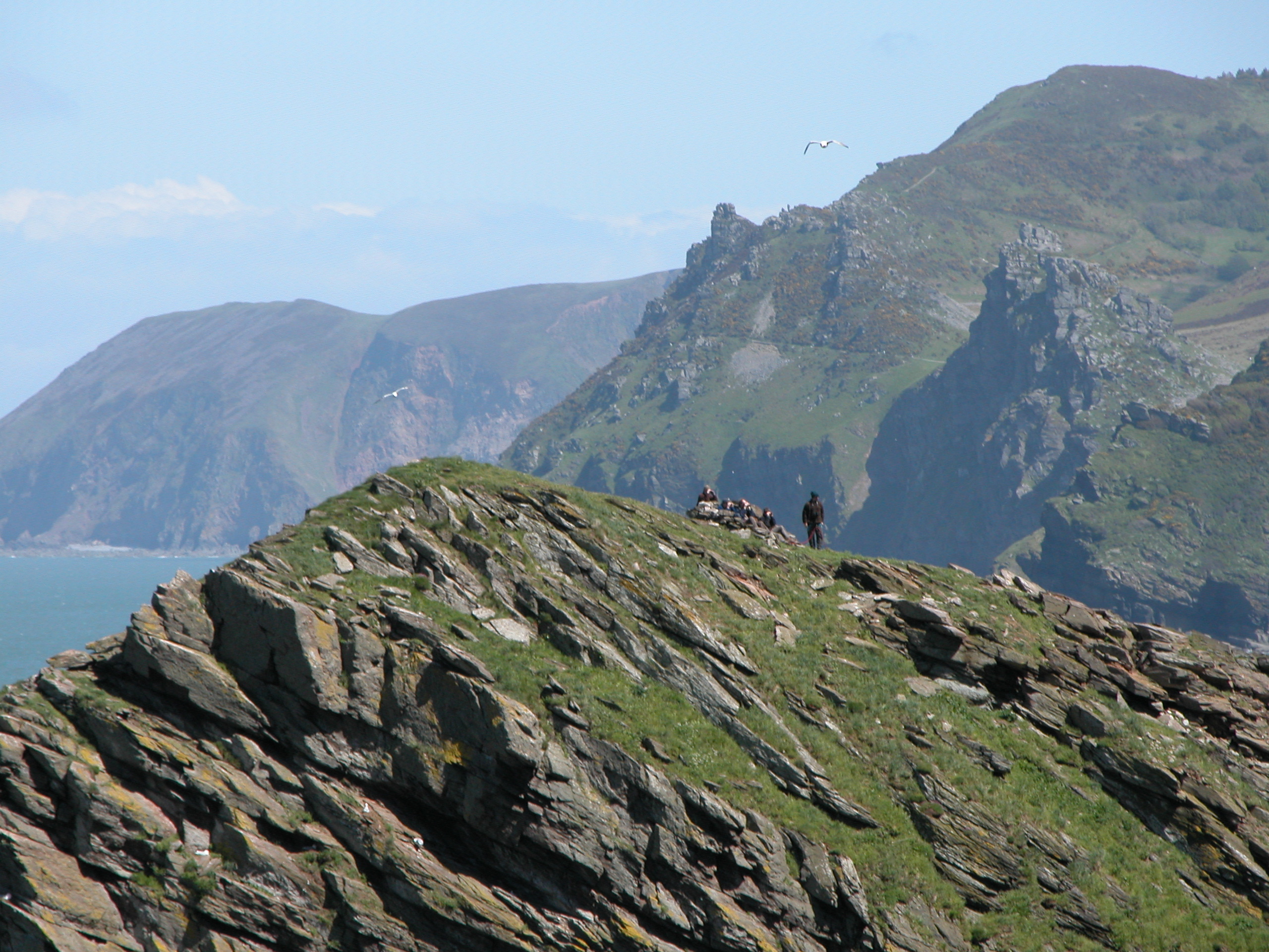
Exmoor earned National Park status in 1954 and takes its name from the River Exe, whose source rises near the village of Simonsbath in Somerset. The park covers 267 square miles of open heath and moorland, stretching across the north coast of Devon and into west Somerset. Most visitors are unprepared for the drama of its coastline: 34 miles of cliffs that include the highest sea cliffs in England, plunging into the Bristol Channel with a ferocity that seems at odds with the gentle rolling moor behind them. The South West Coast Path traces these clifftops and was voted Britain's favourite trail in 2006. Inland, the moor rises to Dunkery Beacon at 1,704 feet, the highest point in Somerset, from which views stretch across the Bristol Channel to Wales on clear days.
The Oldest Grazers
Sheep have worked these moors for more than 3,000 years. Traditional breeds including Exmoor Horn, Cheviot, and Whiteface Dartmoor still graze the open land, alongside Devon Red cattle. But the moor's most distinctive inhabitants are the Exmoor ponies -- not a breed in the conventional sense but a race, the closest surviving relatives of wild horses in Europe. Small, hardy, and supremely adapted to wet moorland, they roam freely across the park and are rounded up once a year to be marked and checked. Red deer hold their own territory on quieter hillsides, best spotted in the early morning when the mist still clings to the valleys. The bird life is equally rich: Merlins hunt across the heather, peregrine falcons patrol the cliffs, and the rare Dartford warbler has found a foothold in the gorse.
Lorna Doone Country
R. D. Blackmore's 1869 novel Lorna Doone gave Exmoor its most famous story -- a tale of outlaws, romance, and revenge set around the villages of Brendon in Devon and Oare in Somerset. The Doone Valley remains a draw for visitors who want to walk the landscape Blackmore described, even if the Doone family itself was largely his invention. More verifiable is the connection to Samuel Taylor Coleridge, who lived in the area and drew inspiration from its isolated valleys and sudden weather changes. The Valley of Rocks, a short walk from the town of Lynton, offers a landscape so geologically dramatic -- twisted formations of sandstone rising above the sea, inhabited by herds of feral goats -- that it seems designed to produce poets.
Fudge, Clotted Cream, and the Long Walk
Exmoor is not a wilderness in the conventional sense. It is a working landscape, shaped by farming, managed for grazing, and threaded with villages that have supplied provisions to travellers for centuries. The Brendon Hills to the south are cultivated; the Somerset towns of Dulverton and Minehead mark the park's eastern edges; and the coast path connects to trails that reach all the way to Ilfracombe in the west. Local food -- clotted cream, fudge, cider -- is part of the experience, as is the particular quality of light on the moor, which changes character with the weather and the season. For walkers, the Two Moors Way links Exmoor to Dartmoor to the south, crossing some of the most sparsely populated country in England. No great fitness is required to enjoy short walks on the moor, but those who tackle the long-distance routes discover an Exmoor that reveals itself slowly, one valley at a time.
From the Air
Located at 51.167N, 3.750W, Exmoor National Park stretches across the north Devon and west Somerset coast. Dunkery Beacon (1,704 ft) is the highest point. The dramatic coastal cliffs along the Bristol Channel are a distinctive visual feature. Exeter Airport (EGTE) is approximately 30 nm south; Barnstaple is on the western edge. Best appreciated from the north at 3,000-4,000 ft, where the transition from moorland plateau to sea cliffs is most visible.