Extreme Points of Europe
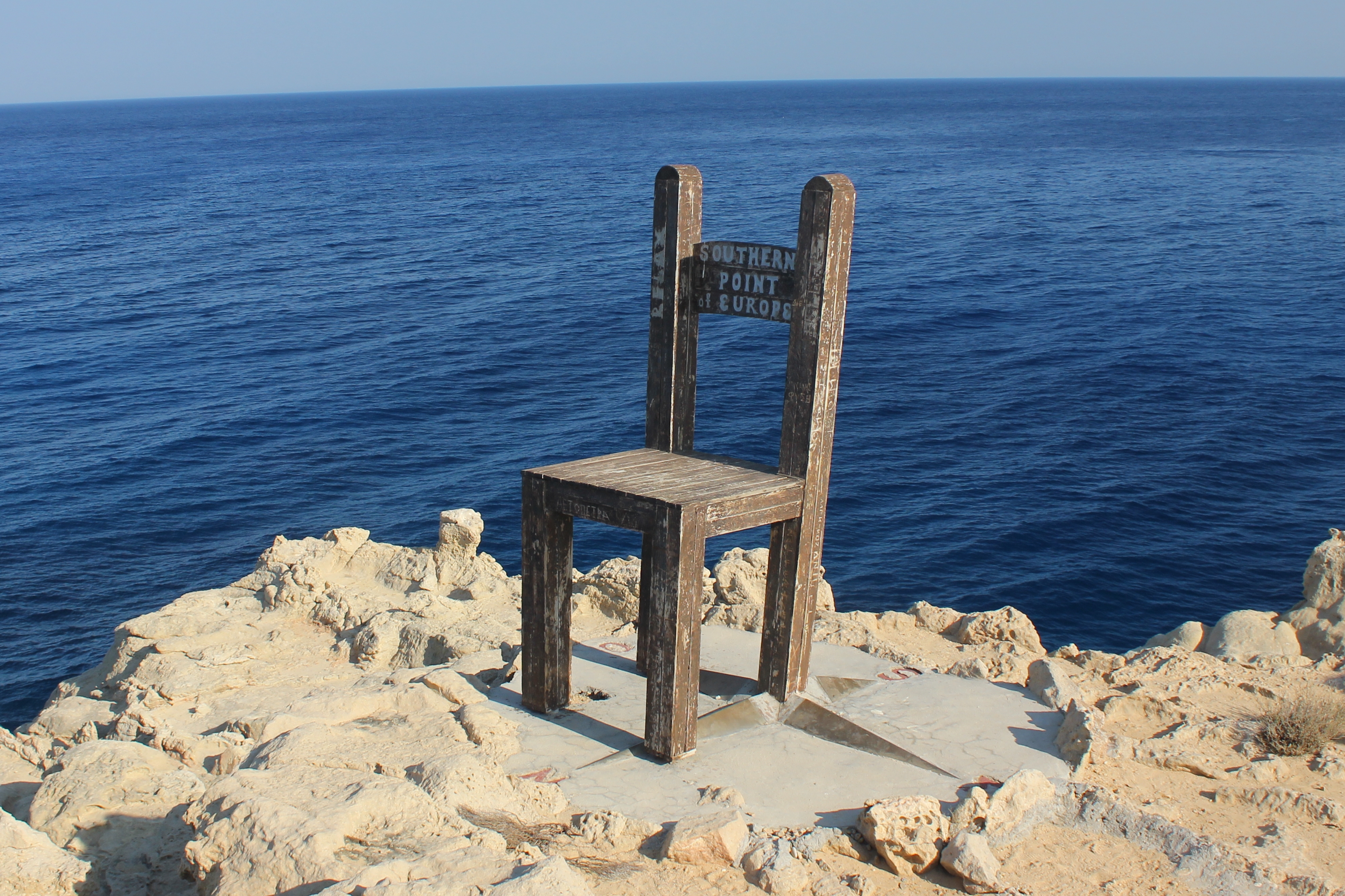
Where does Europe end? The question has no clean answer, and that uncertainty defines the continent's extreme points. Depending on whether you count certain archipelagos as European, whether you draw the eastern border along the Ural watershed or somewhere else, and whether tectonic plates or political affiliation should determine membership, the answers shift by hundreds of kilometers. Cape Fligely on Rudolf Island in Franz Josef Land, at 81 degrees 48 minutes north, claims the northernmost position -- but Franz Josef Land sits near the ambiguous border between Europe and Asia. If you exclude it, Norway's Rossoya takes the crown. The southernmost point depends on whether Cyprus, geographically in Asia but politically in the European Union, counts as European. Even the highest point is contested: Mount Elbrus at 5,642 meters if the Caucasus belongs to Europe, Mont Blanc at 4,810 meters if it does not.
The Compass Points
Mainland Europe's cardinal extremes are more settled, if less dramatic. Cape Nordkinn in Norway, at 71 degrees 08 minutes north, is the northernmost point of the continental mainland -- a windswept headland on the Barents Sea. Punta de Tarifa in Spain, at precisely 36 degrees north, marks the southern tip, where Europe nearly touches Africa across the Strait of Gibraltar. The western edge is Cabo da Roca in Portugal, a cliff that the poet Camoes described as the place 'where the land ends and the sea begins.' To the east, the mainland boundary follows the Ural watershed to an unnamed 545-meter peak in the Russian Arctic, 60 kilometers southwest of the Kara Sea. If you include islands, the extremes stretch much further: Monchique Islet in the Azores pushes Europe's western boundary to 31 degrees west, though the islet sits on the North American Plate -- making it geologically not European at all.
Vertical Extremes
Europe's vertical range is staggering. At the top, Mount Elbrus stands at 5,642 meters, its twin volcanic peaks perpetually ice-capped, located 11 kilometers on the European side of the Caucasus watershed divide. Below sea level, the extremes multiply depending on category. The Caspian Sea shore in Russia sits 28 meters below sea level -- the lowest natural point under open sky. Beneath the waves, the Calypso Deep in the Ionian Sea plunges 5,267 meters. Underground, Krubera Cave in Georgia's Abkhazia region descends 2,196 meters, making it the deepest cave on Earth. And then there is humanity's own contribution: the Kola Superdeep Borehole in Russia, drilled to 12,262 meters below the surface during a Soviet-era scientific project that ran from 1970 to 1994. It remains the deepest artificial point anywhere on the planet -- a pencil-thin shaft reaching temperatures of 180 degrees Celsius at its bottom.
How High Can You Ride
Europe has a particular obsession with building transport infrastructure to improbable altitudes. The highest point reachable by cable car is Klein Matterhorn in Switzerland, at 3,883 meters -- a station perched near the peak of a mountain whose larger neighbor is among the most famous silhouettes in the world. The highest railway station is Jungfraujoch, also in Switzerland, at 3,454 meters, accessible by a train that bores through the inside of the Eiger. The highest paved mountain pass open to traffic is the Col de l'Iseran in the French Alps at 2,770 meters. Meanwhile, the lowest public tunnel -- the Ryfast in Norway -- descends 292 meters beneath the sea, connecting the city of Stavanger to the island of Hundvag through 14.4 kilometers of rock. Switzerland claims five of the seven highest transport records, a concentration that reflects both the country's topography and its conviction that any mountain can be civilized with sufficient engineering.
The Edge of Definition
What makes Europe's extreme points genuinely interesting is not the geography but the arguments. Every list of continental extremes is also a list of contested definitions. Is the Canary Islands' La Restinga, at 27 degrees 45 minutes north, the true southern extent of Europe? Politically, perhaps. Physiographically, the Canaries are African. Is the Capelinhos Volcano on Faial Island the westernmost point? It is the westernmost point of the Eurasian Plate above sea level, but Monchique Islet extends further west on the North American Plate. The eastern boundary has generated the most scholarly disagreement, since the Ural Mountains do not form a sharp line but a broad zone of foothills and river basins. These debates are not pedantic. They reflect the deeper truth that Europe is less a geographic entity than a cultural and political idea -- one whose boundaries have always been drawn by humans rather than discovered in the landscape.
From the Air
The article's geotag at 68.31N, 66.62E places it near the Polar Urals, close to the watershed divide that defines Europe's eastern boundary. From cruising altitude, the Ural range is visible as a low, rolling chain running north-south, far less dramatic than its outsized role as a continental boundary would suggest. The extreme points themselves span from the high Arctic (Franz Josef Land, accessible only by expedition) to the Mediterranean (Gavdos, south of Crete). No single flight path captures all extremes, but a north-south route from Murmansk (ULMM) to Crete (LGIR) covers the mainland range. Nearby airports to this geotag include Vorkuta (UUYW) to the west and Salekhard (USDD) to the east.