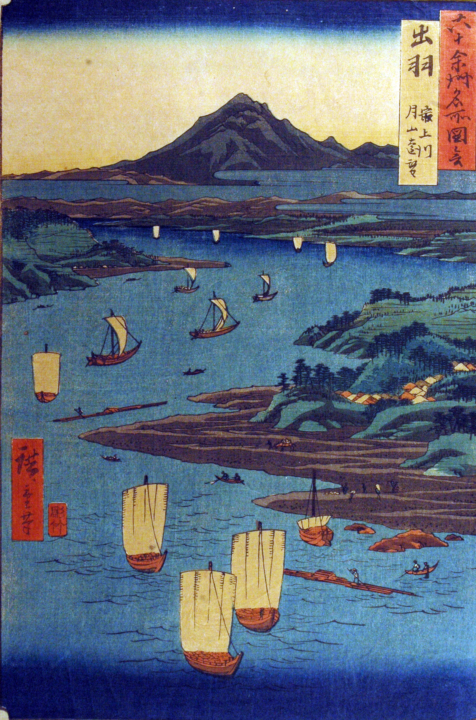
Famous Views of the Sixty-odd Provinces
The timing was almost too perfect for fiction. In September 1853, Hiroshige published the first prints of his grand survey of Japan's provinces -- 68 landscapes, each capturing a famous view from a different corner of the archipelago. That same year, Commodore Perry's Black Ships steamed into Edo Bay and cracked open the closed world those prints depicted. By the time Hiroshige finished the series in May 1856, the provincial boundaries he had so carefully illustrated were a decade away from being erased entirely by the Meiji Restoration. The Famous Views of the Sixty-odd Provinces became, without anyone intending it, a portrait of a Japan that was about to disappear.
Seventy Prints, Three Years, One Vanishing World
Hiroshige (1797-1858) began the series with characteristic ambition, completing 42 of the 70 prints in 1853 alone. Then the pace slowed. The 61st print, depicting Buzen Province, appeared in 1854. Seventeen more followed in September 1855, and the final nine trickled out between the third and fifth months of 1856. A contents page, published last, reorganized the prints according to the eight historical travel routes of old Japan -- a final act of cartographic nostalgia. The publisher was Koshimuraya Heisuke, who released the prints in serialized form, building anticipation for each new province the way a modern streaming service drops episodes. A deluxe initial run featured bokashi, additional overprinting that enriched the colors and shadows, but the technique was expensive and later print runs scaled it back or eliminated it entirely.
Borrowed Landscapes, Original Vision
Hiroshige did not travel to all 68 provinces. Instead, he worked from meisho zue -- illustrated guidebooks that catalogued famous places across Japan. At least 26 of his designs drew directly from Sansui Kikan (Exceptional Mountain and Water Landscapes), an eight-volume series written and illustrated by Baisao Shunko, published between 1800 and 1802. This was common practice in the ukiyo-e tradition, where artistic transformation mattered more than firsthand observation. What Hiroshige brought was his extraordinary eye for atmosphere: the way fog sits in a mountain valley, the quality of light on water at different hours, the tension between human figures and the landscapes that dwarf them. Each print chose the vantage point of a local -- not the grand panorama a tourist might seek, but the intimate view a resident knows best.
A Vertical Revolution
The series broke with convention in a fundamental way: it used a vertical format. Previous major Japanese landscape print series had been horizontal, matching the natural sweep of a panoramic view. Hiroshige's choice of the vertical oban size -- 35.6 by 24.8 centimeters -- was partly practical. The guidebooks he worked from used vertical layouts, making vertical compositions a natural fit. But scholars also suspect a marketing calculation: a vertical format would have stood out sharply on the shelves of Edo print shops, and it allowed for better binding of such a large number of prints into collected volumes. The result was a series that emphasized depth over breadth, drawing the eye from foreground detail up through layered distances to sky and cloud -- a format that would become standard for the landscape prints that followed.
The Last Map of Old Japan
Each print corresponded to one of the 68 provinces that had defined Japan's political geography since 824 CE, plus a single view of Asakusa Fair in Edo, the capital. That Edo print proved prophetic: it became a harbinger of Hiroshige's next and most celebrated work, One Hundred Famous Views of Edo, which he began while still completing the final provinces of this series. But the real significance of the Sixty-odd Provinces lies in what happened next. The Meiji Restoration of 1868 redrew every provincial boundary Hiroshige had documented. The feudal domains were dissolved, replaced by modern prefectures. The old travel routes were superseded by railways. The famous views remained, but the world that gave them meaning had been fundamentally transformed. Hiroshige died in 1858, two years after finishing the series, never seeing the full scope of the upheaval his prints had unknowingly memorialized.
From the Air
The series is associated with Kyoto (coordinates 35.013N, 135.678E), where the first print depicts Arashiyama in Yamashiro Province. The actual prints span locations across all of Japan's 68 historical provinces. From the air over Kyoto, the Arashiyama hills along the Oi River correspond to Print No. 1. Nearest airports: Osaka International (Itami, RJOO) approximately 20nm south-southeast; Kansai International (RJBB) approximately 55nm south. The Sagano district of western Kyoto, where the coordinates place this article, offers views of the same Arashiyama landscape Hiroshige depicted in his opening print.