Where Batavia Governed
Every city has a square where its history pools like rainwater, collecting in layers too deep to see from the surface. In Jakarta, that square is Fatahillah - or Stadhuisplein, or Nieuwe Markt, depending on which century's map you consult. First recorded around 1627 as a riverfront marketplace beside the meandering Ciliwung, the square has been redesigned, expanded, traversed by trams, stripped of its Dutch name, and finally emptied of cars altogether. The city hall that anchored its southern edge for centuries now houses a history museum. The canal that once bordered it has been filled in and paved over. Even its name is borrowed: Fatahillah was a 16th-century military commander from the Sultanate of Demak who took the port from the Portuguese decades before the Dutch ever arrived. The square remembers everyone who shaped it, which is to say it remembers almost too much.
A River Runs Through It
Before there was a proper square, there was a river and a market. The Ciliwung - the Dutch called it Groote Rivier, the Big River - wandered toward the western edge of the young settlement, giving the marketplace a waterfront character. Shophouses crowded the northern and eastern sides. To the south, the first City Hall of Batavia announced the colonial government's presence, positioned with careful deliberation at the head of Prinsenstraat, the street that led straight to the gates of Batavia Castle. The name Stadhuisplein followed the city hall's construction, and the square settled into its role as the administrative heart of a forted Dutch city in the tropics. It was only half the size of what it would become - the eastern half was still packed with commercial buildings, the kind of organic urban density that colonial planners would soon find inconvenient.
The Grid Takes Over
In 1632, Governor-General Jacques Specx undertook a major restructuring of Batavia's defenses. New outer walls went up. A system of inner and outer moats was dug. And the Groote Rivier, that meandering waterway that gave the square its character, was straightened into a rigid north-south canal to accommodate a grid-like street plan. The shophouses on the eastern side of the square were demolished. What had been a half-enclosed marketplace became a fully defined civic space, surrounded on all sides by buildings of consequence: the City Hall to the south, a church to the west, the Tijgersgracht canal to the east, and remaining shophouses to the north. Prinsenstraat now formed a dramatic axis connecting the Castle's south gate to the City Hall, creating the kind of visual authority that colonial governments prized. A Chinese clothing bazaar occupied the northwest corner from 1635 until the early 18th century - roughly where Cafe Batavia stands today, serving coffee to tourists in a building that sits on centuries of commercial continuity.
Trams, Teardowns, and Architects' Protests
The late 19th century brought the technologies and debates of modernization. A tramline cut diagonally across the square, connecting Binnen Nieuwpoortstraat to Prinsenstraat in a way that would have horrified the 17th-century planners who designed the square for symmetry. Around 1870, the Tijgersgracht canal was filled in, and the Palais van Justitie - now the Fine Arts and Ceramics Museum - was completed on the eastern edge, expanding the square slightly. At the turn of the 20th century, the northeast shophouses came down to make room for a new post and telegraph office. This demolition triggered something remarkable: two of the most prominent Dutch architects of the era, Hendrik Petrus Berlage and Thomas Karsten, publicly criticized the project for destroying the traditional urban fabric of the Old Town. It was an early instance of heritage advocacy in colonial Indonesia - European architects arguing that European colonial structures deserved protection from European colonial development.
A Commander's Name, a Governor's Vision
After Indonesian independence, the Dutch names that had governed Jakarta's streetscape for three centuries were systematically replaced. Stadhuisplein became Taman Fatahillah, honoring the Muslim commander who had captured the port of Sunda Kelapa from the Portuguese in 1527 - an event that predated Dutch colonization by nearly a century and that Indonesians regard as the founding moment of Jakarta itself. The square's transformation from colonial administrative center to national heritage site accelerated under Governor Ali Sadikin in 1970, when restoration work began on the square and its surrounding landmarks. The former City Hall became the Jakarta History Museum in 1974. Workers restored an 18th-century artesian water pump that still stands in the middle of the square, a functioning artifact surrounded by tourists taking photographs of each other. The pump draws water from the same aquifer that sustained the Dutch garrison centuries ago.
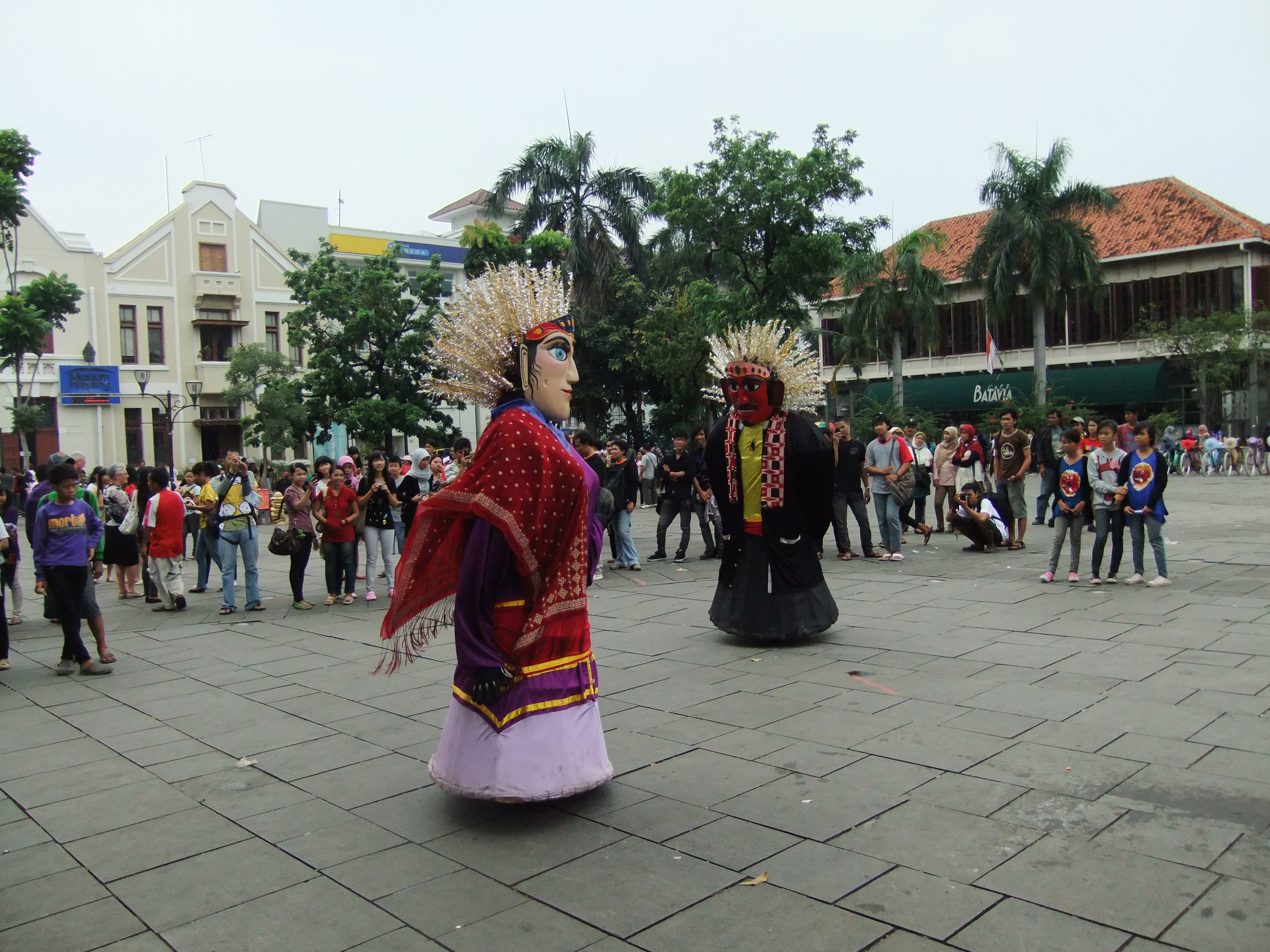
The Square Today
Fatahillah Square is now a car-free zone within the broader Kota Tua Jakarta historic district. On weekends, the open paving fills with families, street performers, and vendors selling colorful bicycles for rent. The Jakarta History Museum occupies the grand building to the south - the same position where Batavia's City Hall has stood since the 1620s. The Wayang Museum, dedicated to Indonesia's tradition of shadow puppetry, sits nearby. The Fine Arts and Ceramics Museum fills the old Palace of Justice. What strikes a visitor is how the square's proportions still work after four centuries. Despite the tramlines, the canal filling, the demolitions and reconstructions, the basic rectangle of open space surrounded by institutional buildings retains the civic gravity that Jacques Specx's planners intended. The river is gone. The castle is gone. The names have changed three times. But the square keeps doing what squares do: holding the city's public life in place.
From the Air
Located at 6.135°S, 106.813°E in the Kota Tua (Old Town) district of North Jakarta. The square is identifiable from the air by its open rectangular space amid dense low-rise colonial-era buildings, contrasting with modern high-rises to the south. The Jakarta History Museum's distinctive colonial facade anchors the southern edge. Nearest airport is Soekarno-Hatta International (WIII), about 20 km northwest. From 2,000-3,000 feet, the Old Town's grid pattern and wider streets are distinguishable from the surrounding informal urban fabric. Jakarta Bay and the port of Tanjung Priok are visible to the north and northeast.