Finnmarksvidda
On New Year's Day 1886, the mercury at Karasjok plunged to the coldest temperature ever recorded in Norway. The reading has never been matched anywhere else in the country, and it came from the heart of Finnmarksvidda, a plateau so immense and so exposed that it generates its own extremes. Covering more than 22,000 square kilometers of Arctic interior, this tableland accounts for roughly 36 percent of Finnmark county. It sits between 300 and 500 meters above sea level, low enough to support birch woodland and high enough to punish anyone who underestimates the wind.
A Land Measured in Horizons
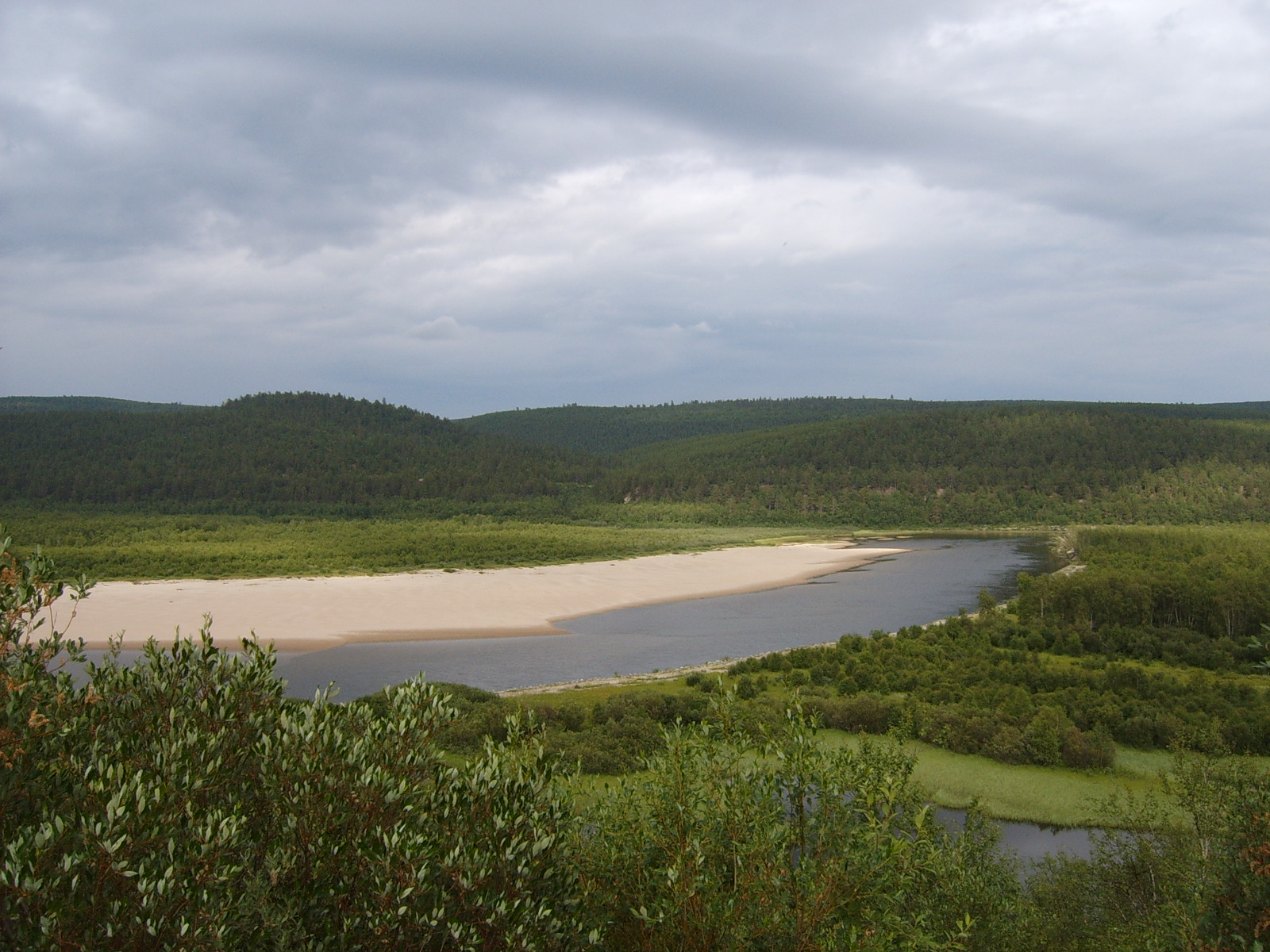
Finnmarksvidda stretches approximately 300 kilometers from Alta Municipality in the west to the Varanger Peninsula in the east, and at least as far from north to south, with its southern reaches extending into Finland. The scale is difficult to grasp from the ground, where the terrain rolls in long, gentle undulations that dissolve into a sky so wide it seems to press down on everything beneath it. Birch woods thin into pine barrens, which give way to bogs and the still surfaces of glacial lakes. Some of those lakes are nearly circular, remnants of collapsed pingos that formed during cold periods of the last deglaciation, when mounds of ice pushed up through the permafrost and then caved in on themselves. The southeastern corner of the plateau is protected within Anarjohka National Park, a 1,409-square-kilometer reserve established in 1976 that preserves some of the most remote wilderness in Scandinavia.
The Reindeer People
Finnmarksvidda lies entirely north of the Arctic Circle, and it is inseparable from the Sami, the indigenous people who have shaped its landscape for millennia. The Sami relationship with the plateau centers on reindeer herding, a practice that once required constant migration across the tundra following the animals' seasonal patterns. Herds still move between inland winter pastures and coastal summer grazing grounds, though snowmobiles have largely replaced the long foot marches of earlier generations. Traditional shelters, known as lavvu, still dot the winter landscape, their conical silhouettes a reminder that the plateau has been home to people far longer than it has belonged to any nation-state. For the Sami, Finnmarksvidda is not empty space to be crossed but a cultural heartland, a place where language, livelihood, and identity remain tied to the land and the animals that walk it.
Cold Beyond Comparison
The plateau's subarctic climate produces the harshest winters in Norway. Kautokeino, at 307 meters elevation, serves as a representative gauge for conditions across Finnmarksvidda: long months of darkness, deep snow, and temperatures that routinely fall well below minus thirty degrees Celsius. Higher on the plateau, the weather station at Sihccajavri, perched at 382 meters beside the lake of the same name and roughly 13 kilometers from the E45 border crossing with Finland, records some of the region's most extreme readings. The interior location, far from the moderating influence of the Norwegian Sea, means that cold air pools in the valleys and sits. Summer brings the midnight sun and a brief explosion of green, when the birch forests leaf out and the bogs bloom with cotton grass and cloudberry. But the warmth is fleeting, and by September the plateau is already bracing for the return of the dark.
An Arctic Flyover
From the air, Finnmarksvidda reveals a pattern invisible at ground level: the interlocking mosaic of forest, wetland, and open tundra that makes this one of Europe's last great wildernesses. Rivers carve silver threads through the dark landscape, draining into the Tana and Alta watersheds. The plateau's flatness is deceptive; beneath the surface lies a geological story of glacial advance and retreat that sculpted every lake basin and gravel ridge visible today. In winter, the plateau becomes an unbroken field of white, the birch trees stripped to black skeletons and the lakes sealed under ice thick enough to support a snowmobile. In summer, when the snow melts and the water bodies catch the light, the plateau glitters as if scattered with fragments of mirror. Either way, the impression from altitude is the same: space on a scale that northern Europe rarely offers, interrupted by nothing taller than a stunted birch.
From the Air
Coordinates: 69.32°N, 23.82°E. The plateau sits at 300-500 meters elevation across a vast area of interior Finnmark. Best viewed from medium altitude (FL100-FL200) for a sense of scale. The nearest significant airports are Alta (ENAT) and Lakselv/Banak (ENNA). In winter, the landscape is uniformly white; in summer, look for the mosaic of dark birch forest, bright green bogs, and reflective lakes. The E6 highway and Altaelva river provide visual navigation references along the western edge.