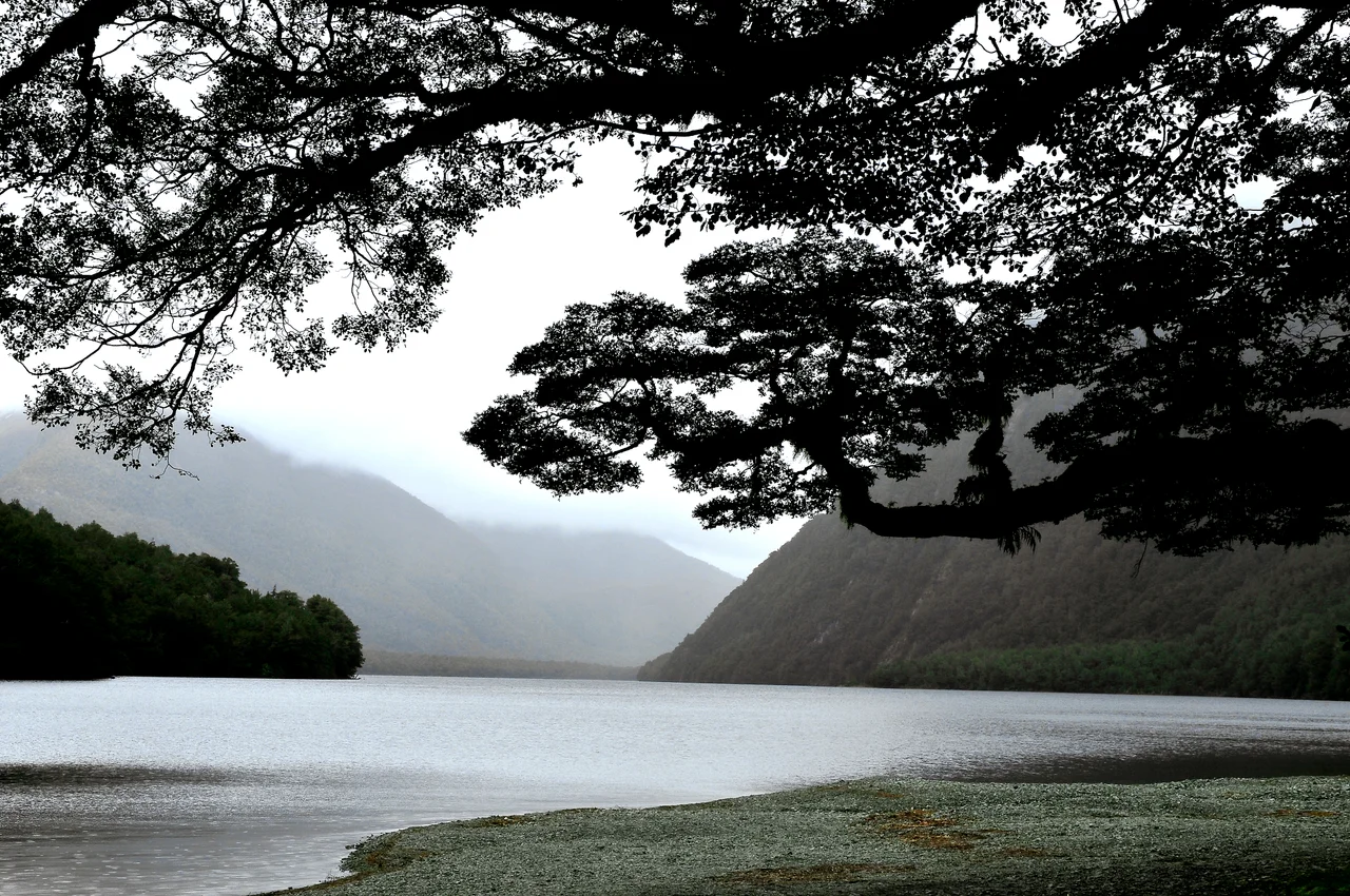
Fiordland National Park
In 1948, a doctor named Geoffrey Orbell walked into a remote valley in Fiordland and found the takahe, a flightless bird the scientific community had declared extinct fifty years earlier. The bird was simply living where no one had bothered to look. That discovery says everything about this place. Fiordland National Park occupies the entire southwest corner of New Zealand's South Island, covering more area than any other national park in the country, and much of it remains so inaccessible that the Department of Conservation relies on aircraft to carry out even basic maintenance. There are no roads except one. Supplies to backcountry lodges fly in. Toilet waste flies out. If you are injured in the interior, a helicopter is the only practical rescue. The park, together with adjoining Mount Aspiring National Park, forms part of the Te Wahipounamu UNESCO World Heritage Site, and it served as a filming location for the Lord of the Rings trilogy. But its real drama requires no set dressing.
Drowned Valleys
The fiords are the signature. During the last ice age, glaciers ground their way through the bedrock and carved steep-sided valleys that plunged well below sea level. When the ice retreated, the ocean flooded in, creating long, narrow inlets walled by near-vertical rock. Milford Sound is the most famous, but Doubtful Sound - named because Captain Cook doubted his ship could sail back out against the wind - remains inaccessible by road and substantially less crowded. The scale of these inlets defies casual comprehension. Mitre Peak at Milford Sound rises 1,692 meters directly from the water's edge, one of the highest sea cliffs on Earth. Rain feeds waterfalls that cascade down the rock faces, some of them permanent, many appearing only during downpours and vanishing hours later. The park receives over 200 rain days per year, and at Milford Sound the annual rainfall reaches 8,000 millimeters - more than six times what falls on the gateway town of Te Anau, barely 120 kilometers away.
The Last Refuge
Fiordland's inaccessibility has made it a final stronghold for species that vanished elsewhere. The takahe, with its brilliant blue-green plumage and red bill, survived in the Murchison Mountains above Lake Te Anau because the terrain was simply too punishing for people to reach. The kakapo, the world's only flightless parrot, held on in Fiordland longer than anywhere else on New Zealand's two main islands, though even here it eventually succumbed to introduced predators by the 1980s. A recovery program has since relocated surviving kakapo to offshore islands free of rats and stoats. Speculation persists that other species thought extinct may still inhabit the park's unexplored interior. The remoteness that frustrates searchers is the same remoteness that protects whatever lives there. What thrives without question are the sandflies - clouds of biting insects that greet visitors at every landing point and have driven many a tramper to reconsider their itinerary.
Tracks Through the Wild
The park contains roughly 500 kilometers of formed walking tracks, though most are concentrated in the eastern and northern areas. Three of New Zealand's Great Walks pass through Fiordland. The Milford Track, a 53.5-kilometer route from the head of Lake Te Anau to Milford Sound, is widely considered one of the finest multi-day walks on Earth. It takes four days and three nights, and bookings are essential during the October-to-April season. The Kepler Track loops through beech forest and alpine tundra above Lake Te Anau. The Routeburn Track crosses into neighboring Mount Aspiring National Park, linking two national parks across a high alpine pass. For those seeking solitude, the Dusky Track offers a harder, longer route connecting Lake Hauroko to Lake Manapouri through genuinely wild country. Before the 1950s, tramping was the only way to reach the fiords at all. The construction of the Milford Road, threading through the Homer Tunnel and along winding mountain passes, finally connected Te Anau to Milford Sound by car - a two-hour drive that remains the park's only road.
Power Carved from Stone
Lake Manapouri, on Fiordland's eastern edge, holds a secret beneath its surface. The Manapouri Power Station, one of New Zealand's largest hydroelectric facilities, has been carved entirely out of solid rock below the lake. Two tailrace tunnels carry water 10 kilometers through the mountains to Deep Cove in Doubtful Sound. From the surface, the only evidence of the station's existence is power lines that disappear into the ground. The road over Wilmot Pass connecting the station to Deep Cove is one of the few in the country not connected to the national highway network. Visitors can take a bus trip over the pass and descend to the cove, where the combination of fiord, rainforest, and engineered infrastructure creates a landscape that feels both ancient and industrial. The power station was controversial when proposed in the 1960s, sparking one of New Zealand's earliest environmental campaigns. Lake Manapouri's water levels are now managed under strict conditions.
Weather as Character
In Fiordland, weather is not a backdrop. It is an active participant. Storms sweep in from the Tasman Sea with little warning, transforming sunny valleys into mist-draped channels within hours. The temperature can swing dramatically across short distances, and a few kilometers of walking can move you from sheltered calm to exposed ridge. Te Anau, the park's gateway on the eastern shore, receives 1,200 millimeters of rain annually - dry by west coast standards. Cross the mountains to Milford Sound, and the rainfall multiplies nearly sevenfold. This gradient creates extraordinary ecological variety: the western valleys support dense temperate rainforest while the eastern margins feel almost pastoral. Visitors heading into the backcountry are advised to inform park rangers of their plans and report back on return. The Department of Conservation staffs ranger outposts at major visitor locations, and in a park this size, those intentions may be the starting point for any search and rescue operation.
From the Air
Located at 45.39S, 167.35E in the southwest corner of New Zealand's South Island. The park is enormous and unmistakable from cruising altitude: a wall of heavily forested mountain ranges slashed by narrow fiords reaching inland from the Tasman Sea coast. Milford Sound (Piopiotahi) is the most prominent fiord, identifiable by the iconic Mitre Peak (1,692 m). Queenstown Airport (NZQN) is the nearest major airport, approximately 170 km northeast. Te Anau Manapouri Airport (NZMO) is a small regional strip closer to the park's eastern edge. The Homer Tunnel on the Milford Road is visible as a narrow cut through the Darran Mountains. Frequent cloud cover, heavy rain, and rapidly changing weather are characteristic - the west coast fiords can be obscured even when inland areas are clear. Best aerial visibility is typically in early morning. Look for waterfalls cascading from sheer rock faces after rain, and the dark surface of the fiords contrasting sharply with surrounding green.
Nearby Stories
- 2003 Fiordland Earthquake 7 km away
- Lake Hauroko 33 km away
- Greenstone and Caples Tracks 36 km away
- Sutherland Falls 45 km away
- Lake Wakatipu 56 km away
- Invercargill 84 km away
- Chatham Islands 1320 km away
- West Antarctica 5107 km away