First Battle of Fort Wagner
The men of General George C. Strong's brigade waded ashore on the southern tip of Morris Island on July 10, 1863, covered by the thunder of four ironclad warships and shore batteries on Folly Island. They advanced three miles up the narrow sand spit, sweeping Confederate batteries before them, until they reached the northern end of the island and stopped. Fort Wagner blocked their path entirely. The earthen redoubt, packed with sand and reinforced with palmetto logs, stretched from the marsh on one side to the ocean on the other. There was no way around it. There was only through it - and through it, on the morning of July 11, Strong's men tried to go.
A New Commander's Gamble
Brigadier General Quincy Adams Gillmore arrived to command the Department of the South in early June 1863 with a reputation and a plan. The Army engineer had cracked what many considered an impossible target the year before, capturing Fort Pulaski near Savannah by using rifled artillery at long range to breach its masonry walls. Now Gillmore intended to apply the same methodical approach to Charleston. His strategy was sound in concept: seize Morris Island, plant heavy guns within range of Fort Sumter, and reduce the famous fortress to rubble. With Sumter silenced, the Navy could enter the harbor. The key obstacle was Fort Wagner, also known as Battery Wagner, a heavily armed earthwork that commanded Morris Island's northern reaches. Unlike the brick-and-mortar Fort Pulaski, Wagner was built of sand - a material that absorbed artillery fire rather than crumbling under it.
Dawn in the Fog
The morning assault on July 11 began in thick fog. Strong's brigade moved forward at dawn, visibility dropping to yards. The men of the 7th Connecticut Infantry pushed ahead aggressively, overrunning a line of Confederate rifle pits in front of the main works. But Fort Wagner itself was another matter entirely. Colonel Robert F. Graham commanded a garrison of 1,770 Confederates behind the earthen walls, and they had been waiting. When the Connecticut troops and their supports reached the fort's defenses, they ran into a storm of artillery and musket fire. The sand walls that frustrated Union gunners also protected the defenders perfectly - shells buried themselves harmlessly while the garrison fired from protected positions. Heavy guns from the fort poured canister and grape into the advancing Federal lines, and the attack stalled. Other Union units could not push through the killing ground to reinforce the assault. Strong's brigade fell back, bloodied and frustrated.
Prelude to Glory
The repulse at Fort Wagner on July 11 did not discourage Gillmore. He spent the next week preparing a more deliberate assault, combining a massive naval and artillery bombardment with a concentrated infantry charge. That second attempt, launched on July 18, would become one of the most famous engagements of the entire Civil War - not because it succeeded (it did not), but because of who led the charge. The 54th Massachusetts Volunteer Infantry, one of the first African American regiments in the Union Army, spearheaded the attack on Fort Wagner's walls. Their colonel, Robert Gould Shaw, was killed on the parapet. The regiment suffered devastating casualties but fought with a courage that silenced doubters across the North who had questioned whether Black soldiers would stand in combat. The assault failed, as the first had, but the 54th Massachusetts transformed the national debate about race and military service.
The Island Preserved
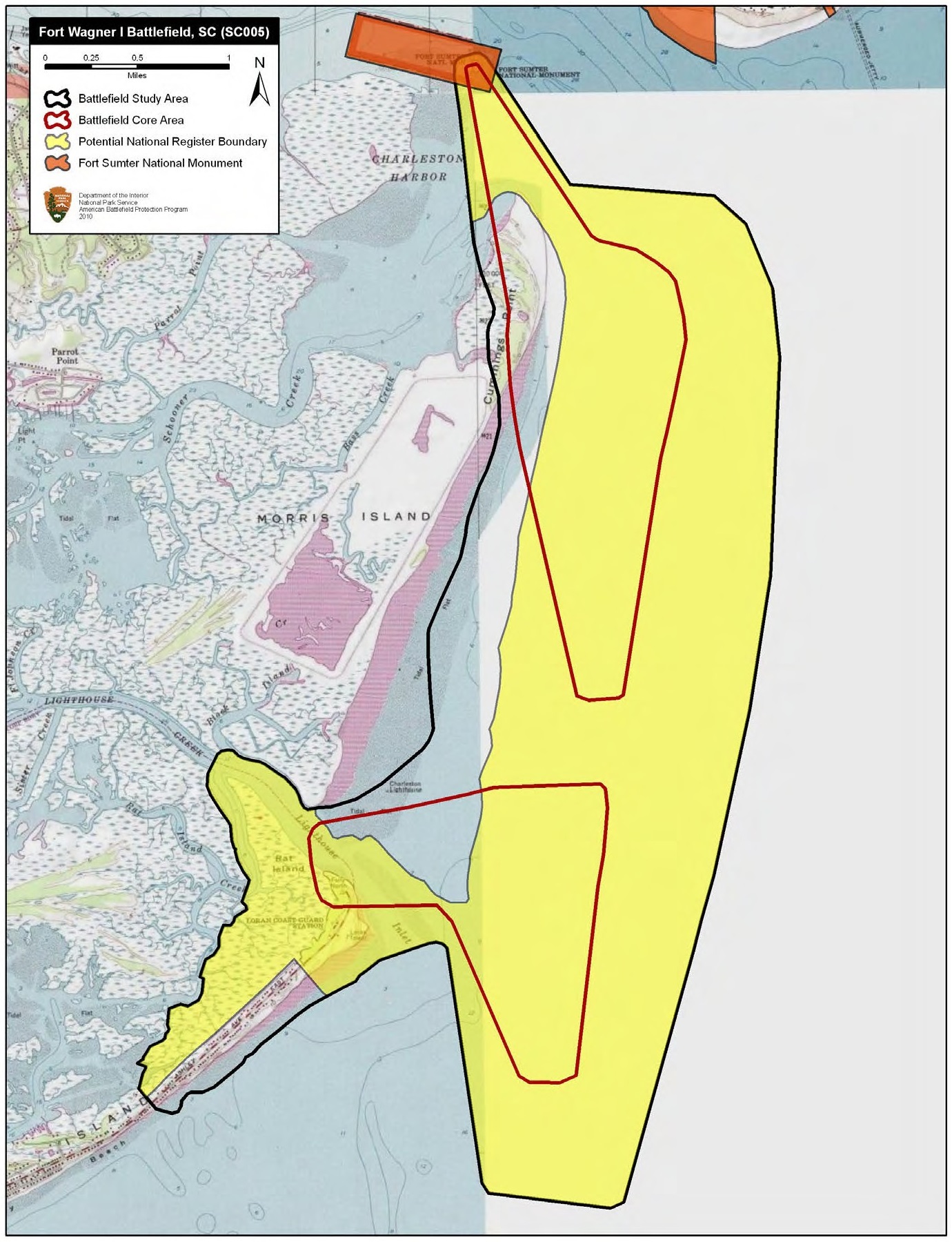
Morris Island itself nearly vanished from memory before it vanished beneath development. By the early 2000s, a developer had plans to build houses on the historic battlefield. Local preservationist Blake Hallman and others formed the Morris Island Coalition, generating media attention and public pressure that defeated the proposal. When Ginn Resorts later acquired the property with similar intentions, the American Battlefield Trust, the South Carolina Conservation Bank, the Trust for Public Land, and private donors purchased the island in May 2008 for $3 million on behalf of the City of Charleston. Today the sands where Strong's men charged and the 54th Massachusetts made its stand are protected, a landscape of dunes and salt marsh that looks much as it did in 1863. The battlefield that witnessed two of the Civil War's most significant assaults on fortified positions is preserved for those willing to make the journey across the water to walk where the soldiers walked.
From the Air
Located at 32.73°N, 79.87°W on Morris Island at the southern entrance to Charleston Harbor. The narrow sand spit of Morris Island is clearly visible from altitude, stretching north toward Fort Sumter. The island's geography makes the tactical problem obvious from the air - Fort Wagner blocked the entire width of the island between marsh and ocean. Folly Island lies immediately to the south across Lighthouse Inlet. Fort Sumter is visible to the north in the harbor. Charleston International Airport (KCHS) is approximately 14 miles northwest.