Five Islands, Nova Scotia
Mi'kmaq legend says the god Glooscap, furious at a giant beaver that had dammed his medicine garden across the bay at Advocate, scooped up handfuls of mud, sticks, and stones and hurled them at the creature. The debris became five islands -- Moose, Diamond, Long, Egg, and Pinnacle -- strung along the north shore of the Minas Basin like the aftermath of a divine tantrum. Geology offers a more measured explanation: these are exposed fragments of the North Mountain Basalt, ancient lava flows resting on Triassic sandstone. But standing on the shore at low tide, looking across miles of exposed seafloor toward those basalt pillars rising from red-brown mud, the Mi'kmaq version feels more adequate to the scale of the place.
Five Stones in a Giant's Wake
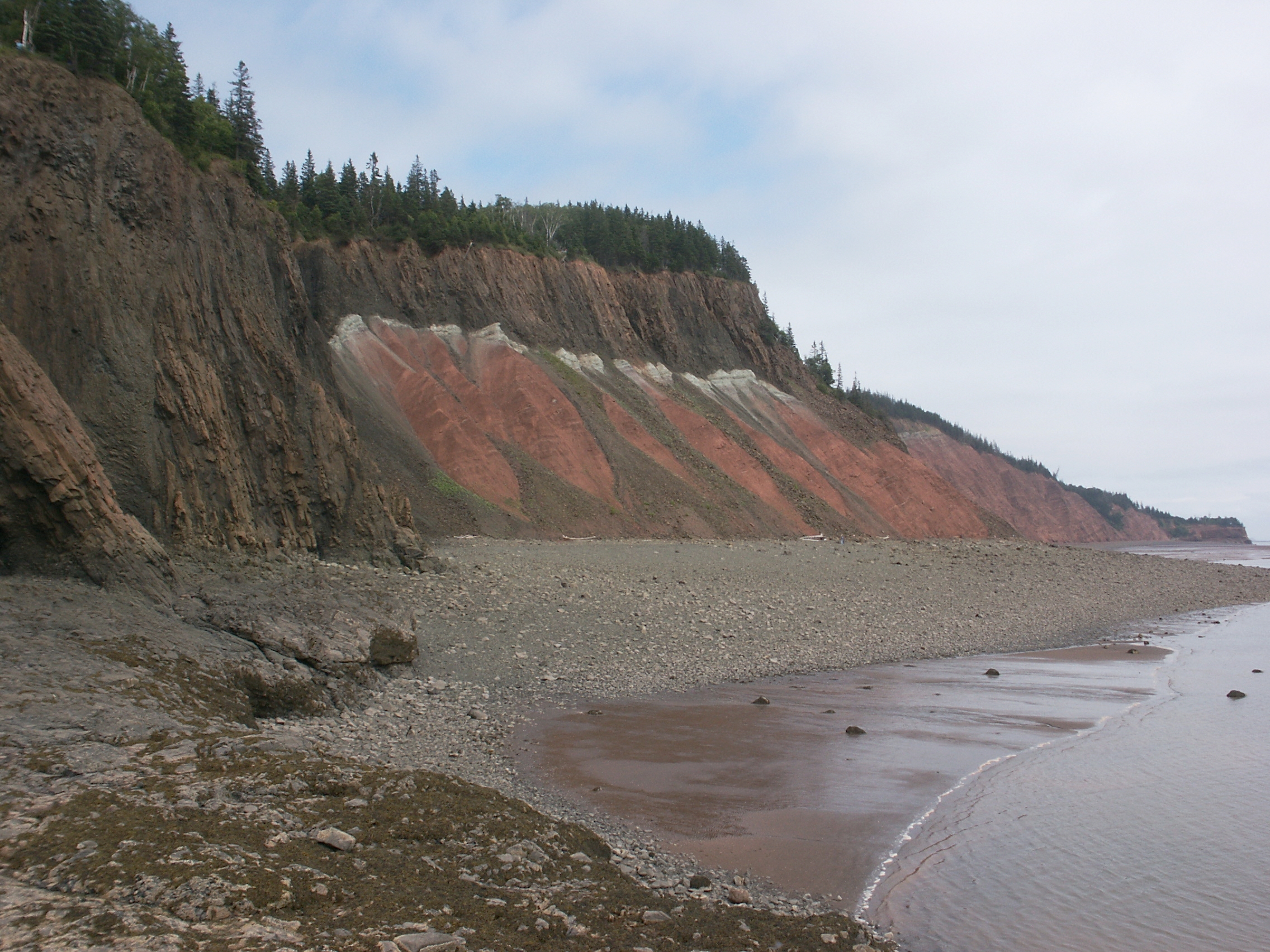
The five islands sit just offshore from the rural community of Five Islands, population 316, in Colchester County. Each island has its own geological character. Moose and Pinnacle show both sandstone and basalt. Diamond and Long are pure basalt. Egg is entirely sandstone. Beyond Pinnacle, a sea stack called Pinnacle Rock stands sentinel. The basalts contain minerals that draw rockhounds from across the Maritimes: agate, stilbite, gmelinite, and calcite crystallize in the volcanic rock, while the Cobequid Fault running just inland yields barite in the ravines. In the late 1800s, the Duncan/Eureka Mine on the Bass River extracted large quantities of barite, which fed the Henderson and Potts paint factory in Lower Five Islands before being shipped to Halifax and the United States. The Five Islands Provincial Park encompasses Moose and Diamond Islands, offering access to a landscape where the world's highest tides reshape the shore twice daily.
The Ghost of Moose Island
Moose Island is the only one of the five ever to be inhabited, and it carries the darkest story. Early in the 1800s, a Scotsman named John Ruff settled the island with his family, clearing forest and establishing a mixed farm that supplied the coastal village with produce, wood, and charcoal. Ruff was reputed to be a hard, cruel man, and rumors circulated that he abused his wife and children. When he died violently, suspicion fell on his son. A controversial trial ended in acquittal, and the family moved to the mainland, taking the unresolved mystery with them. Locals say that on misty, moonless nights, Ruff's spirit stalks the overgrown fields searching for vengeance. Some claim to have seen a light walking the island's shore in the darkness. The island's name, according to community elders, comes from a moose herd that lived there until settlers arrived in the surrounding area -- one more thing the island lost.
Running on the Ocean Floor
Long Island found a second life in 2003 when Dick Lemon purchased it and envisioned an artists' retreat on its clifftop. Access was the challenge: boat landing was limited to a four-hour window around high tide, and the cliffs allowed only a rope-assisted scramble up a muddy draw. Beginning in 2004, workers hung from the cliff faces to pound in supports for 194 steps rising from the sea to the island's summit. A helicopter carried heavy equipment in, and a locally built lift hauled 25 tons of gravel and 20 tons of furnishings to the top. Dennis Ross, a retired corrections officer from nearby Springhill, oversaw the construction of a main house, four sleeping cabins -- including one shaped like a riverboat edged over a cliff -- and a solar power system. In 2007, Lemon launched the Not Since Moses race, a charity 5K and 10K run from Long and Moose Islands across the exposed seafloor to shore, only possible because the Fundy tides drain the basin so completely that runners can cross miles of ocean bed. Artists from the Nova Scotia College of Art and Design and performers from the Ships Company Theatre have used the retreat since.
Where the Tide Is the Clock
Five Islands is a place governed by the tide rather than the hour. At high water, the islands stand surrounded by the Minas Basin's dense, reddish-brown current. At low water, the seafloor spreads out in every direction, and you can walk to the islands across mud and rock. A lighthouse has stood watch here since 1914, though erosion forced it to be moved in 1952 and again in 1957. By the 1990s it was deteriorating badly, but the Five Islands Lighthouse Preservation Society saved it from demolition and relocated it to a municipal park in 2008. The community sustains itself on blueberries, fishing, clam harvesting, and the tourists who come to experience what the tides reveal. The economy is modest. The landscape is not. From the shore, the basalt headlands of the Minas Basin stretch in both directions, and twice a day the ocean performs its most extravagant disappearing act -- draining away to leave a world that, for a few hours, belongs entirely to those willing to walk it.
From the Air
Located at 45.41N, 64.04W on the north shore of the Minas Basin. The five islands -- Moose, Diamond, Long, Egg, and Pinnacle -- are clearly visible from the air, especially at low tide when the exposed seafloor connects them to the mainland. Nearest airport is Halifax Stanfield International (CYHZ) approximately 120 km east. Five Islands Provincial Park is visible along the shoreline. Best viewed at 2,000-4,000 feet. The dramatic tidal flats and basalt headlands extending along the northern Minas Basin shore are a striking sight.