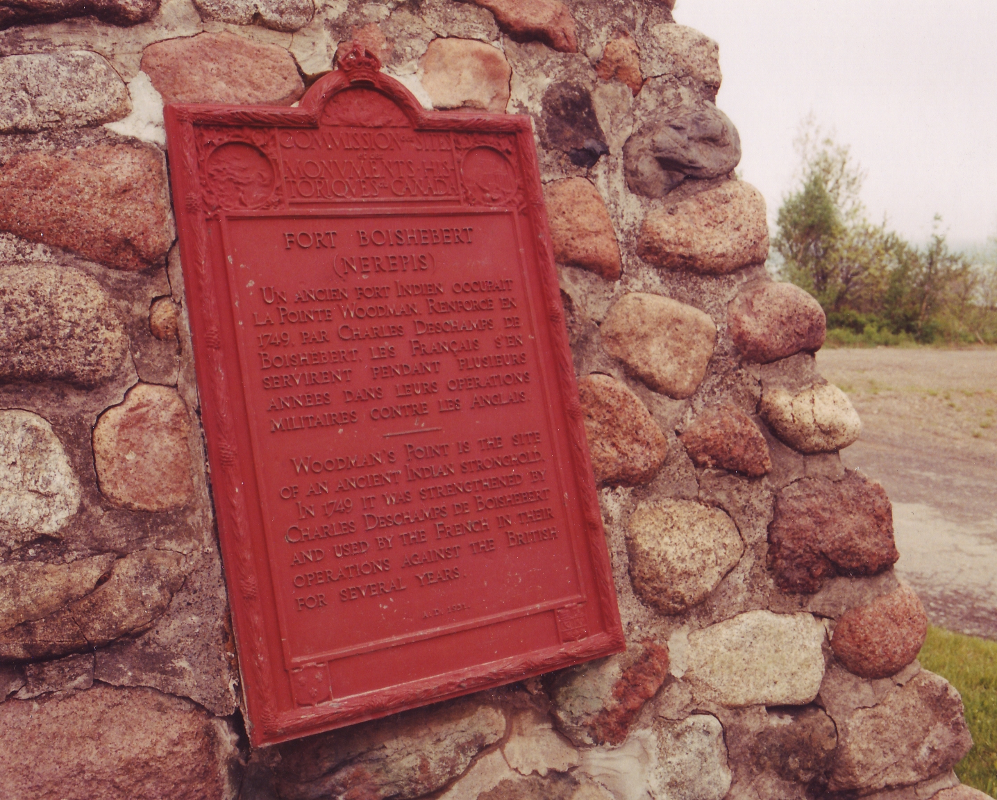
Fort Boishebert
The spot where the Nerepis River empties into the Saint John has been fortified for longer than any European document can confirm. When Governor Villebon wrote about the site in October 1696, he referred to it as "the fort of the Nerepis Indians" -- a name that suggests the defensive works predated French arrival by an unknown span of years. What began as an Indigenous stronghold at the confluence of two rivers became, over the next half-century, a contested French outpost that changed hands and names as colonial wars swept through Acadia. Today it is a quiet National Historic Site at Woodmans Point, outside Grand Bay-Westfield in Kings County, New Brunswick.
Where Two Rivers Meet
The site's strategic value is written in the landscape. The Saint John River, the longest in the Maritimes, was the main artery of travel and trade through the interior of New Brunswick. The Nerepis River joins it from the west at Woodmans Point, creating a natural junction that could be fortified to control movement in multiple directions. The Nerepis people understood this geography long before European surveyors mapped it. Their fortified village commanded the confluence, and when French colonial forces needed a fallback position during English raids, they retreated to exactly the same spot. In October 1696, French soldiers rescued by Nerepis warriors fell back to Fort Nerepis after a small English fleet entered Saint John Harbour and attacked downriver positions.
A Fort Reborn in Wartime
The fort's second life came during Father Le Loutre's War, the bitter conflict between French and British forces that tore through Nova Scotia and New Brunswick in the late 1740s and early 1750s. In 1749, Charles Deschamps de Boishébert et de Raffetot -- the officer whose name the fort would carry into the historical record -- rebuilt the fortification after withdrawing from the mouth of the Saint John River. That withdrawal came under terms negotiated by Captain John Rous and Edward How, a pragmatic arrangement that traded one defensive position for another further inland. Boishébert's rebuilt fort served as a French anchor on the Saint John River, though not for long.
Abandoned and Remembered
By 1751, the strategic picture had shifted again. The French reestablished control at the mouth of the Saint John River and fortified it with Fort Menagoueche, making the inland position at the Nerepis confluence less critical. Sieur de Gaspe abandoned Fort Boishébert, and the site returned to the quiet that rivers eventually impose on places built for war. The wooden fortifications decayed, the clearings grew over, and the confluence resumed its older role as a meeting point of waterways rather than armies. In 1930, the site was designated a National Historic Site of Canada, recognizing both its role in the French colonial defense network and its deeper Indigenous origins as a fortified Nerepis village.
Layers Beneath the Surface
What makes Fort Boishébert significant is not any single battle or commander but the layering of human purpose on one piece of ground. The Nerepis chose this confluence for the same reasons the French did -- water access, defensive terrain, control of movement -- and the archaeological remains beneath the surface at Woodmans Point reflect that continuity. A federal plaque from the Historic Sites and Monuments Board marks the location, though the physical traces of the fort itself have long since disappeared into the earth. From above, the confluence of the Nerepis and Saint John rivers is still legible as a natural crossroads, the kind of place that draws settlement regardless of who holds the territory.
From the Air
Located at 45.37N, 66.23W at Woodmans Point, outside Grand Bay-Westfield, New Brunswick. The site sits at the confluence of the Nerepis and Saint John rivers, a junction clearly visible from the air. Best viewed at 2,000-3,000 feet AGL. Nearest airport: Saint John Airport (CYSJ), approximately 12 nm south-southeast. The Saint John River valley is wide and well-defined here, making the river junction an easy landmark to identify.