Fort Canning Hill
The Malays called it Bukit Larangan -- Forbidden Hill -- and for centuries, no one climbed it without purpose. Ancient kings were said to be buried on its summit. A sacred spring on its western slope was reserved for the women of the royal household. When the Chinese traveller Wang Dayuan visited around 1330, he described the hilltop settlement of Ban Zu as a place of honest people who wore turbans of gold-brocaded satin and red-colored clothes. Nearly five hundred years later, when Stamford Raffles arrived in 1819, the ruins of that settlement were still visible among the trees. What Raffles saw as an ideal site for a hilltop residence had been, for centuries before him, a seat of power.
Gold in the Dirt
In 1928, workers digging the foundation for the Fort Canning Reservoir struck something unexpected: a cache of Javanese-style gold ornaments dating to the mid-14th century. The discovery confirmed what the old Malay chronicles had long suggested -- that this hill was no ordinary elevation. Archaeological excavations beginning in 1984 have since uncovered evidence of glass and gold workshops from the 15th century, along with a ceremonial or religious area near the summit. Resident John Crawfurd, exploring the hill in the early 1800s, had found shards of pottery, Chinese coins dating to the 10th-century Song dynasty, and the ruins of a square stone terrace 40 feet across that may have been a temple. On the northern slope, another terrace was said to hold the tomb of Iskandar Shah, a Malay king, though no burial has been confirmed. The hill tells a story of layered civilizations, each building atop what the last left behind.
The Flag on the Forbidden Hill
On 6 February 1819, after Temenggong Abdul Rahman and Sultan Hussein Shah signed the Singapore Treaty with Raffles, Major William Farquhar climbed Bukit Larangan with a handful of Malaccan Malays, hauled up a gun, and hoisted the Union Jack. That act -- a flag on a forbidden hill -- marked the birth of British Singapore. Raffles built his residence on the summit, a wood-and-atap bungalow 100 feet long and 50 feet wide. The architect George Drumgold Coleman later redesigned it in brick and tile, and the hill became Government Hill, home to successive Residents and Governors. In 1861, a military fort gave the hill its current name, after Viscount Charles John Canning, the first Viceroy of India. The fort bristled with 68-pounders facing the sea, later supplemented by 8-inch and 13-inch shell guns. A Gothic-gated Christian cemetery spread across the slopes, serving as the burial ground for early Europeans until it was declared full in 1865.
The Bunker Where Singapore Fell
Deep inside Fort Canning Hill, the British built an underground command center -- the Far East Command Centre, known today as the Battle Box. It was from these bunkers that Lieutenant-General Arthur Ernest Percival directed the final, desperate defense of Singapore. On 15 February 1942, Percival surrendered here to the Japanese, marking the fall of what Churchill called the worst disaster in British military history. The Japanese occupied the hill's buildings, above and below ground, until 1945. The underground bunker was then sealed and abandoned for decades. It reopened on 31 January 1992 as a museum, its corridors preserved much as they were in those last hours -- maps on tables, telephones on desks, the claustrophobic reality of command in a collapsing defense. Visitors descend into the same tunnels where the decision to surrender was made, a physical reminder of how quickly a fortress can become a trap.
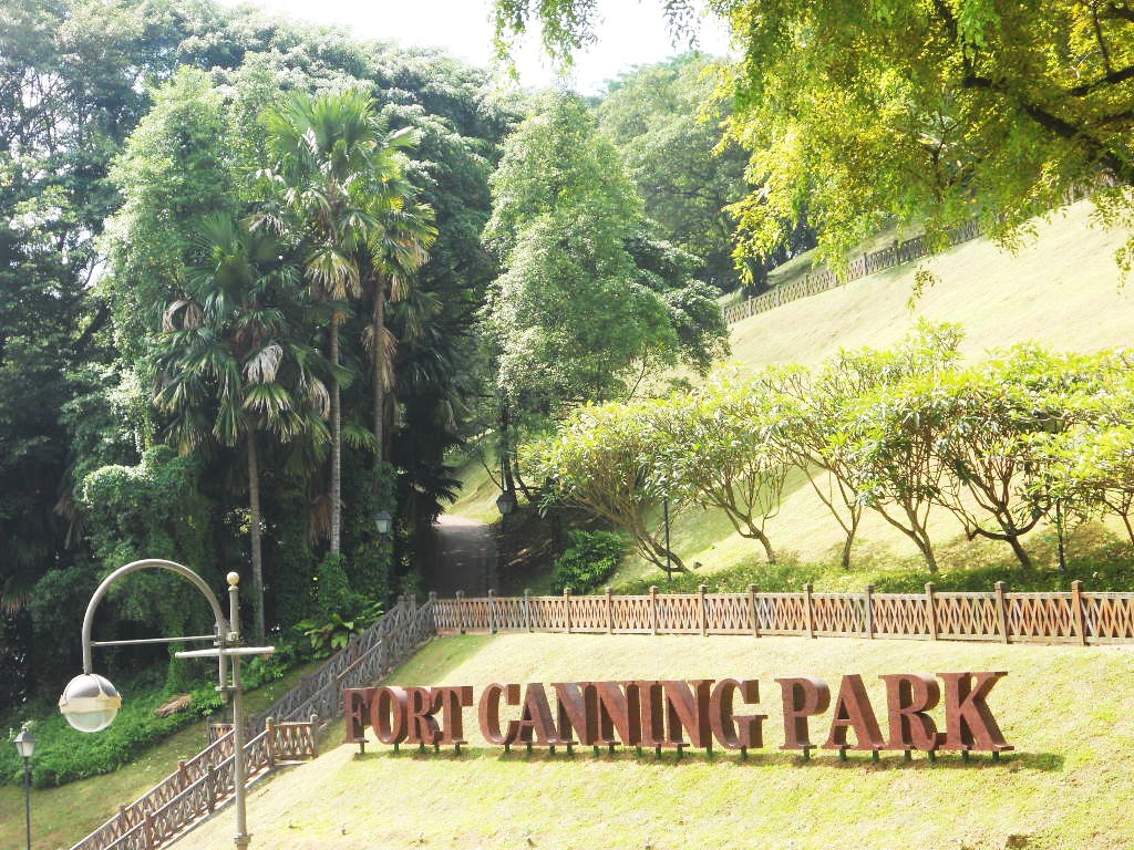
A Park Built on Ruins
After independence, the British handed the fort to Singapore's military in 1963. The Singapore Armed Forces built their Command and Staff College on the site, which opened in 1970. But the hill's destiny was shifting from military to cultural. In 1972, the former military grounds merged with King George V Jubilee Park to form Central Park, renamed Fort Canning Park by Lee Kuan Yew in 1981. Today the park is Singapore's most layered public space. A replica of Raffles' experimental spice garden grows where he once planted clove and nutmeg from Bencoolen. The Fort Canning Lighthouse, built in 1903 to guide ships through the Strait of Malacca and decommissioned in 1958 when high-rises blocked its beam, stands as a replica on the hilltop. Shakespeare in the Park and Ballet Under the Stars fill the green spaces where soldiers once drilled. The 9-pound cannon that once announced the hours -- fired at 5 a.m., 1 p.m., and 9 p.m. -- sits silent beside South Battery, decorative now rather than defensive.
Seven Centuries in 48 Meters
What makes Fort Canning remarkable is compression. Within 48 meters of elevation and a few hectares of parkland, you can trace Singapore's history from the 14th-century kingdom of Singapura through Portuguese-era conflicts, British colonization, Japanese occupation, and independence. The Gothic gates of the old cemetery stand within walking distance of the sally port -- the hidden escape door that every fort needed and Fort Canning still has. Wang Dayuan's honest people of Ban Zu, Raffles' imperial ambitions, Percival's surrender, and the families who now picnic on Jubilee Park's playground slides all share the same ground. In 2019, the park hosted Singapore's bicentennial celebrations, recreating three historical gardens -- the Royal Garden, the First Botanical Garden, and Jubilee Park -- to honor the layers beneath. The Forbidden Hill is no longer forbidden. But it remembers everything.
From the Air
Located at 1.294N, 103.847E in central Singapore, a prominent green hill rising 48 meters in the downtown core. Visible as a distinctive green area amid high-rises. Adjacent to the Singapore River, near Clarke Quay and the National Museum. Singapore Changi Airport (WSSS) is approximately 16 km to the east. The Fort Canning Tunnel passes directly under the hill. Best viewed at 1,500-3,000 ft.