Fort Charlotte, Saint Vincent
Every cannon at Fort Charlotte points inland. This is the detail visitors notice first and remember longest, because it violates every expectation of what a coastal fort should be. The British did not build it this way out of confusion. They built it this way because the French invaded Saint Vincent at Calliaqua in 1779, arriving not from the harbor but from an unexpected stretch of coast, and the lesson was absorbed permanently. When construction began after the British retook the island in 1763, the engineers designed Fort Charlotte as a redoubt -- a last defensive position accessed by a viaduct, with its guns trained on the land approaches that had proven so dangerous.
A Queen's Name on a Hilltop
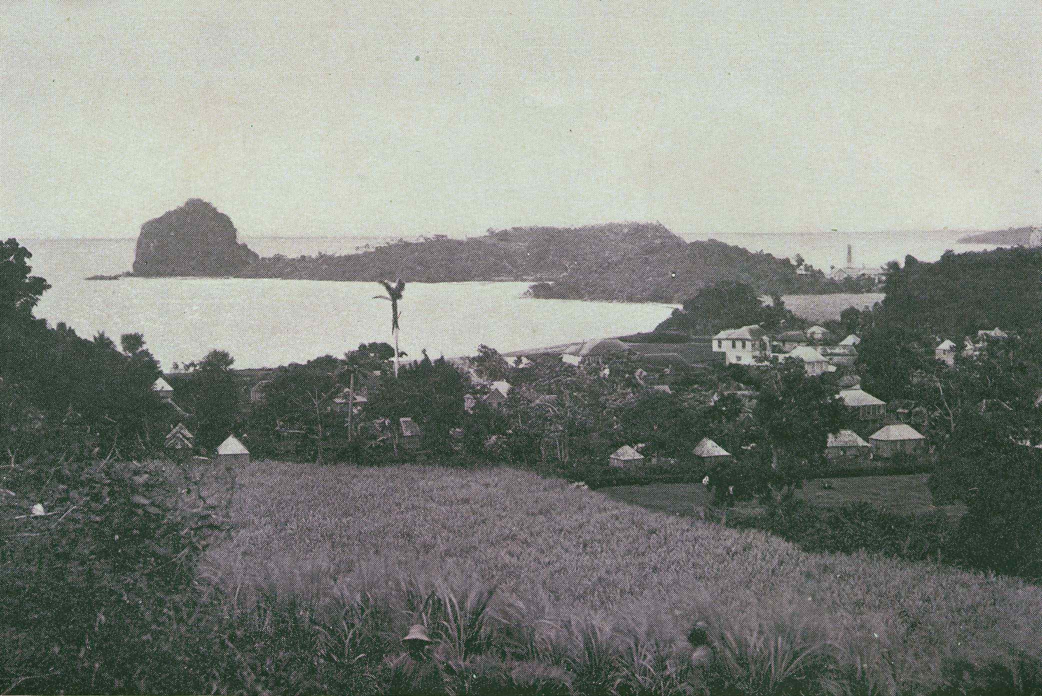
The fort sits 601 feet above sea level on Berkshire Hill, just west of Kingstown, and commands a panoramic view of the island's leeward side. On a clear day, you can see Grenada ninety miles to the south. Closer at hand, Young Island, Bequia, and the Grenadines chain stretch across the water like stepping stones. The fort was named after Charlotte of Mecklenburg-Strelitz, wife of King George III, and construction stretched from 1763 to 1806 -- more than forty years of building during which the garrison had to defend against three distinct threats simultaneously: French invasion, Kalinago resistance, and rebellion by enslaved people. The completed fortification could support 600 troops and mount 34 guns, some of whose cannons bear dates as late as 1811. It was designed to hold out long enough for the Royal Navy to bring reinforcements from neighboring islands.
From Garrison to Asylum
After its military purpose faded, Fort Charlotte became a warehouse for human suffering. At various times the barracks housed a poorhouse, a leper colony, and a mental hospital -- institutions for people the colonial administration preferred to keep out of sight, placed conveniently on a hilltop that most citizens of Kingstown had no reason to climb. The main barracks building later served as a women's prison, with capacity for 50 inmates though it typically held around 15. The dry moat that once defended against assault became the prisoners' exercise yard. The prison closed in mid-2015, and the ruined barracks facing Kingstown harbour stand as monuments to the fort's grim second career. There is a particular irony in a fortification built to protect a colony being repurposed to confine its most vulnerable citizens.
The Garifuna Murals
The officers' quarters now house a small museum with a treasure that most visitors do not expect: a series of colorful painted murals telling the history of the Black Caribs, or Garifuna. The Garifuna emerged from the mixing of escaped and shipwrecked enslaved Africans with the indigenous Kalinago people, creating a distinct culture and identity that the British colonial authorities viewed as a serious threat. The Second Carib War of 1795-1797 ended with the British deporting thousands of Garifuna to the island of Roatan off Honduras, one of the largest forced relocations in Caribbean history. That the fort which helped enforce British control now houses a memorial to the people it was built to suppress is the kind of historical reversal that Fort Charlotte embodies at every turn -- a place where the stones tell one story and the murals tell another.
The Light That Still Burns
Fort Charlotte remains a working piece of infrastructure. The Fort Charlotte Light sends three white flashes every twenty seconds, guiding vessels into Kingstown Bay just as the fort's original garrison once watched for hostile sails on the horizon. The Coastguard radio station and harbour signal station operate from the hilltop, their antennas rising alongside the old cannon emplacements. Below the fort, the ruins of its sister fortifications tell a parallel story. Fort Duvernette, perched on a volcanic plug rising 195 feet from the sea, and Wilkie's Battery were both built by the French before 1763. They fell into disrepair once Fort Charlotte's construction began, their strategic purpose absorbed by the larger fortification on the hill. Wilkie's Battery was eventually converted into a cotton drying house, then a private residence, and finally the Grand View Beach Hotel in 1964 -- a trajectory from warfare to hospitality that captures the Caribbean's talent for reinvention.
From the Air
Fort Charlotte is located at 13.16N, 61.24W on Berkshire Hill, 601 feet above sea level, immediately west of Kingstown on Saint Vincent's leeward coast. The fort and its ramparts are visible from the air as a distinct hilltop structure overlooking the harbor. Approach from the west or south for the best view of the fort's relationship to Kingstown and the harbor below. Young Island and Fort Duvernette's volcanic plug are visible to the south. E.T. Joshua Airport (TVSA) is approximately 3 nautical miles to the southeast. On clear days, the view from altitude mirrors the fort's own panorama: Bequia, the Grenadines, and Grenada stretching south.