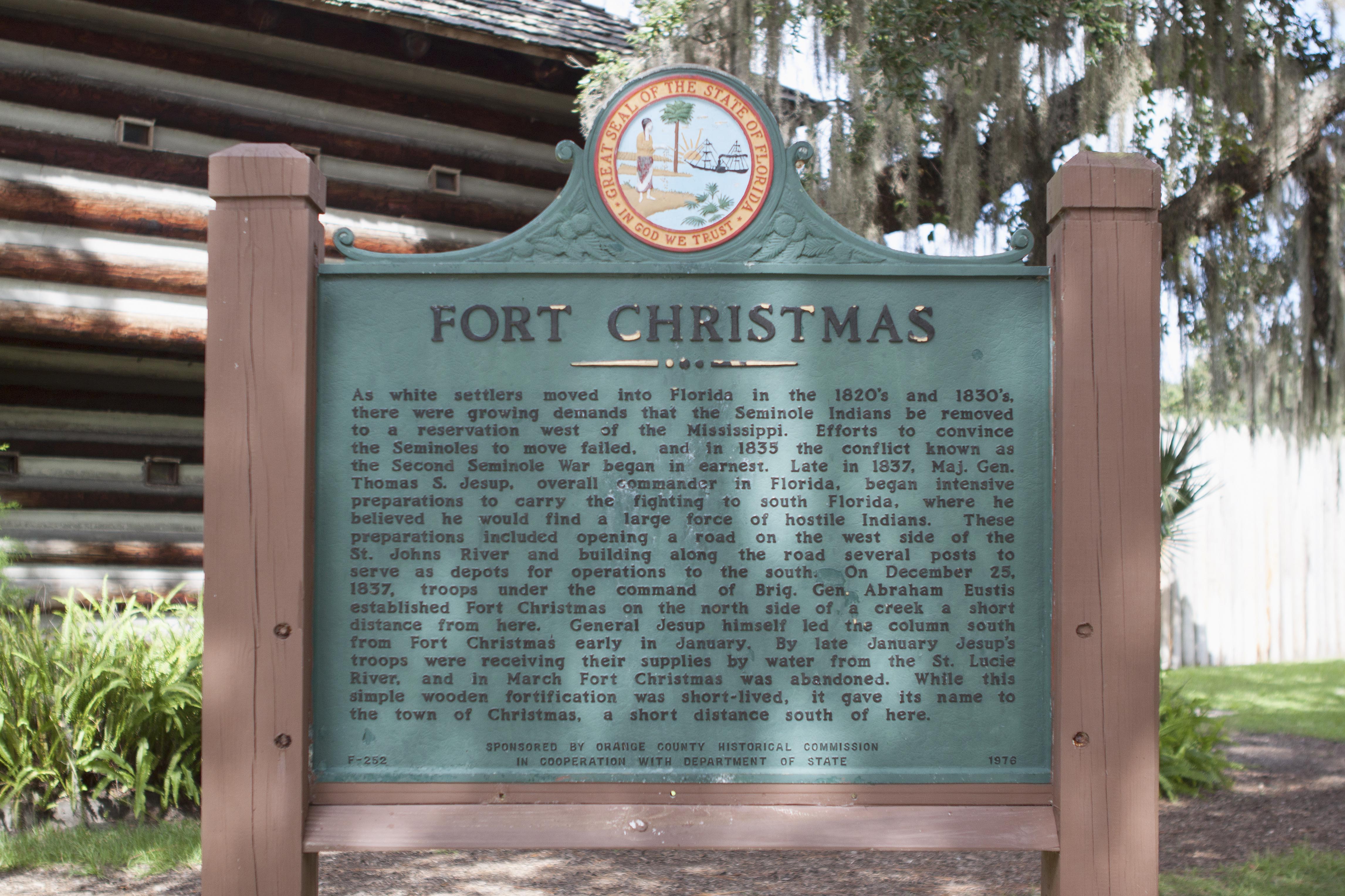
Fort Christmas
On Christmas morning 1837, there was no celebration. Brigadier General Abraham Eustis and a column of 2,000 U.S. Army soldiers and Alabama militiamen arrived at a marshy clearing near the headwaters of the St. Johns River in east Orange County, Florida. They brought 1,000 horses and 70 wagons. Their orders: build a fortification as part of a chain of more than 200 installations meant to force the Seminole people from their homeland during the Second Seminole War. The troops raised the palmetto-log fort in just over a week. Someone noted the date of their arrival, and the name stuck: Fort Christmas.
A War in the Swamps
The Second Seminole War, fought between 1835 and 1842, was the longest and most expensive of the Indian Wars waged by the United States. It began when the federal government tried to enforce the Treaty of Payne's Landing, which required the Seminole to relocate west of the Mississippi. Many Seminole refused, and guerrilla warfare erupted across Florida's swamps and hammocks. Fort Christmas was one link in a vast chain of forts stretching across the territory, designed to restrict Seminole movement and protect supply lines. A fixed garrison of two companies held the post, though the fort's military significance faded as the conflict wore on. By the war's end in 1842, the fort had served its purpose and was abandoned. Nothing of the original structure survived.
Palmetto Logs and Living Memory
For more than a century, the site of Fort Christmas was little more than a name on a map and a crossroads in rural Orange County. The community that grew up around it remained small and agricultural. Then in the late 1970s, Orange County Parks and Recreation partnered with the Fort Christmas Historical Society to build a full-scale replica of the original fort. Dedicated in 1977, the reconstructed fort sits just south of Christmas Creek, probably less than a mile from where the original stood. Built of logs in the style of the 1837 structure, the replica houses a small museum displaying U.S. military artifacts, Seminole and Ais Indian items, and pioneer tools and household goods from the war era. Weapons, clothing, and personal effects fill the interior rooms, offering a tangible connection to the conflict that shaped this stretch of Florida.
Cracker Country
Beyond the replica fort, the park preserves something equally valuable: the vernacular architecture of rural Florida. A growing collection of restored "Florida Cracker" houses and farm buildings has been relocated to the site, furnished with original and reproduction period pieces that document daily life from the 1870s through the 1930s. These modest wood-frame structures, with their steep metal roofs and wide porches designed to shed Florida's punishing rain and heat, represent a way of life that has largely vanished from the Orlando metropolitan area. A 1906 schoolhouse and its lunch room round out the collection, giving visitors a full picture of a frontier community's institutions. The buildings breathe with the kind of authenticity that planned exhibits cannot replicate.
Christmas Every Day
The community of Christmas, Florida, has long embraced its seasonal name. The fort's park hosts an annual "Cracker Christmas" celebration each December, drawing crowds for pioneer-era demonstrations, bluegrass music, and holiday festivities. A bluegrass festival in late March extends the calendar of events. The park itself offers baseball diamonds, basketball courts, tennis facilities, a playground, and picnic areas, making it a living community space rather than a static museum. Operated jointly by the Fort Christmas Historical Society and Orange County Parks and Recreation, the park sits in a stretch of east Orange County that still feels rural, with cattle ranches and citrus groves framing the road. It is a place where a Christmas Day military operation from nearly two centuries ago has been transformed into something its builders never intended: a gathering place for the community that grew from the ground they once fortified.
From the Air
Fort Christmas Historical Park is located at 28.56°N, 81.02°W in east Orange County, Florida, along State Road 420 (Fort Christmas Road). From the air, look for the cleared park grounds and replica fort structure amid flat agricultural land east of Orlando. The St. Johns River marshes are visible to the east. Nearest airports: Orlando Executive Airport (KORL) approximately 18nm west-southwest; Orlando International Airport (KMCO) approximately 20nm southwest; Space Coast Regional Airport (KTIX) approximately 25nm east. Recommended viewing altitude: 2,000-3,000 ft AGL to see the park layout and surrounding rural landscape.