Fort Clinch
Almost five million bricks went into Fort Clinch, and not one of them could stop a rifled cannon. That is the central irony of this pentagonal fortress perched on a peninsula at the northern tip of Amelia Island, guarding the entrance to Cumberland Sound and the St. Marys River. Construction began in 1847 as part of the United States Third System of coastal defenses, a grand national project conceived after the War of 1812 to ring the American coastline with masonry strongholds. By the time the Civil War arrived, the very technology the fort was meant to resist had leapfrogged its thick walls. Fort Clinch was never completed, yet it changed hands between Confederates and Union forces, served in two more wars, fell to ruin, and was brought back to life by Depression-era workers who turned it into one of Florida's first state parks.
Before the Bricks
The Spanish first fortified this site in 1736, recognizing what every subsequent power also understood: whoever controlled this peninsula controlled access to the St. Marys River and Cumberland Sound. For more than a century, various nations garrisoned the position as colonial boundaries shifted across northeast Florida. After the Second Seminole War ended in 1842, the United States began building a permanent fortification here in 1847. The design followed the Third System template: a pentagonal compound with inner and outer walls, corner bastions, embrasures for artillery, and interior courtyards containing a two-story barracks and support buildings. The fort was named for General Duncan Lamont Clinch, a veteran of the War of 1812 and a key figure in both the First and Second Seminole Wars, who died in 1849.
A War That Changed Everything
Confederate forces seized the unfinished fort in early January 1861, two days before Florida formally seceded from the Union. For the first year of the Civil War, Fort Clinch served as a haven for Confederate blockade runners slipping through the coastal waterways. But the development of rifled cannon had fundamentally changed warfare. Smoothbore guns fired round shot that battered masonry; rifled barrels launched elongated projectiles that punched through it. The fort's thick brick walls, state of the art a decade earlier, were now dangerously vulnerable. General Robert E. Lee visited Fort Clinch in November 1861 and again in January 1862 as he surveyed Confederate coastal defenses. His conclusion was practical: abandon the fort and redeploy the scarce troops elsewhere. In March 1862, Lee ordered the withdrawal. Federal forces moved in immediately, and the fort became the base of Union operations on the adjacent Georgia and Florida coasts for the remainder of the war.
Abandoned, Revived, Abandoned Again
Peace brought neglect. The Army placed Fort Clinch on caretaker status in 1869, and it sat quietly deteriorating for nearly three decades. The Spanish-American War of 1898 prompted a brief regarrisoning, but by September of that year the Army walked away again. The fort crumbled. Salt air and subtropical rain worked at the mortar between those five million bricks. Vegetation crept over the walls. It seemed destined to become another ruin absorbed by the Florida landscape. Then the Great Depression, of all things, saved it. Workers from the Civilian Conservation Corps arrived in the 1930s and began a meticulous restoration, returning the fort to its Civil War-era appearance. In 1935, the State of Florida purchased the fort and surrounding land, and Fort Clinch State Park opened to the public in 1938. World War II closed the gates once more, as the military repurposed the fort as a communications and security post. After the war, it reopened for visitors and has remained accessible ever since.
Five Million Bricks Standing
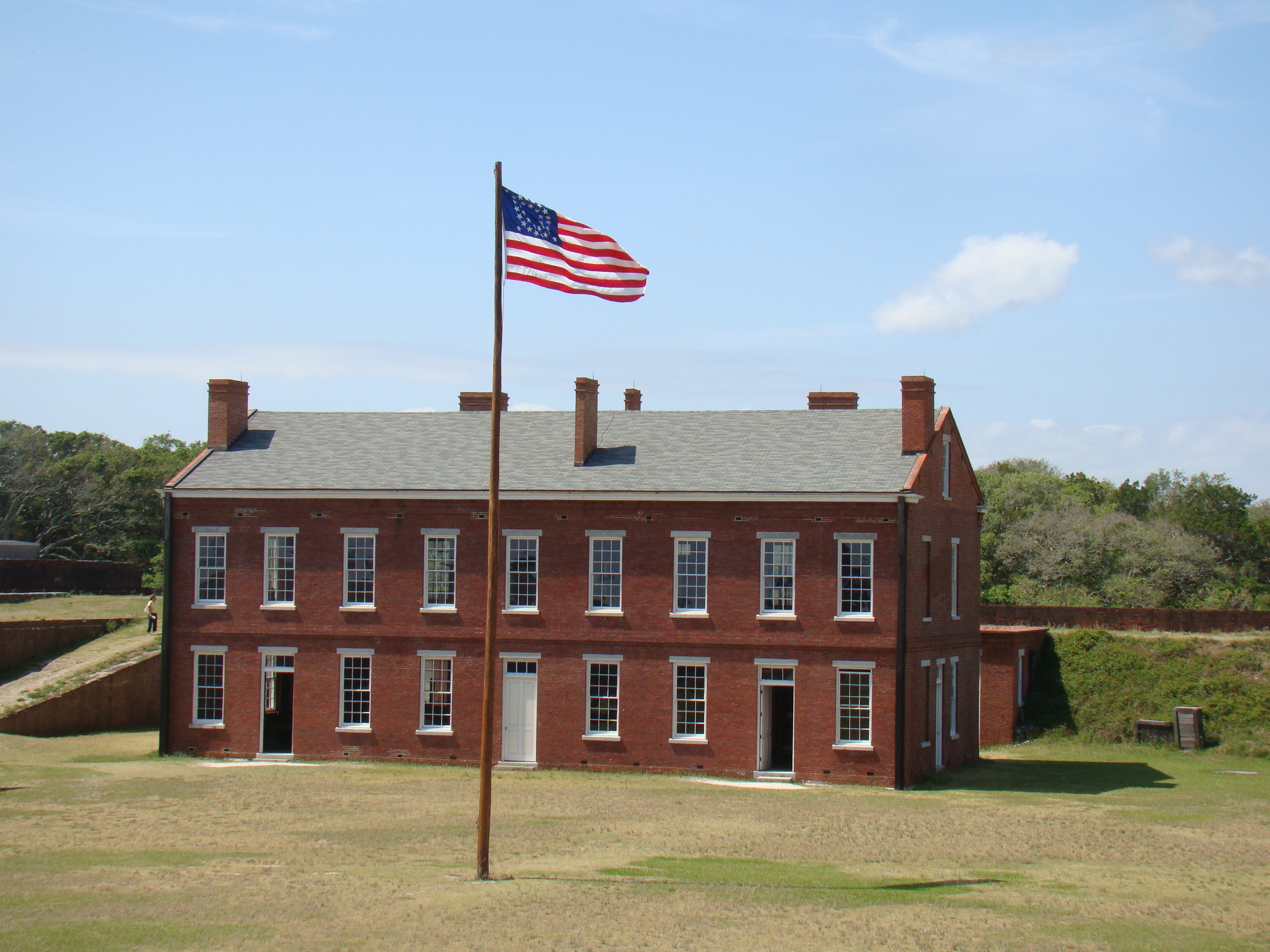
Fort Clinch was added to the National Register of Historic Places in 1972, interpreted primarily through its role as a Union base during the Civil War. Today the fort sits within Fort Clinch State Park on Amelia Island in Nassau County, Florida, northeast of Fernandina Beach. Visitors walk through the arched entrance into courtyards where costumed interpreters re-enact garrison life. The corner bastions still jut outward at precise angles designed to eliminate blind spots for defending riflemen. Embrasures in the outer walls frame views of Cumberland Sound, the same waterway the fort was built to protect. The two-story barracks stands restored, its rooms furnished as they would have been when Union soldiers occupied them. The pentagonal footprint remains intact, a geometry lesson in military architecture from an era that ended almost as soon as it began.
From the Air
Fort Clinch is located at 30.70N, 81.45W on the northern tip of Amelia Island, at the entrance to Cumberland Sound where the St. Marys River meets the Atlantic. The pentagonal fort is visible from low altitude as a distinct geometric shape against the tree canopy. Fernandina Beach Municipal Airport (KFHB) is approximately 3 nm to the south on the same island. Jacksonville International Airport (KJAX) lies about 28 nm south-southwest. Best viewed at 1,500-3,000 ft AGL. The fort sits on a small peninsula jutting into Cumberland Sound; approach from the northeast for the clearest view of the fortification walls and the sound beyond.