Fort Concho
On June 20, 1889, the men of K Company, 19th Infantry, lowered the flag over Fort Concho for the final time and left the next morning. By then, barbed-wire fences had enclosed the surrounding plains, and the soldiers -- barred by law from cutting the wire -- had been reduced to patrolling roads. The frontier they had been built to defend no longer existed. For 22 years, this post at the confluence of the North and South Concho Rivers had anchored the US Army's presence in West Texas, launching campaigns against the Comanche and Apache across the Staked Plains. Its story is the story of the Texas frontier itself: violent, contested, and ultimately transformed beyond recognition.
Rivers and Routes
Fort Concho owes its existence to water and geography. The Concho River valley had drawn human settlement for centuries -- the Jumano people traded with the Spanish here until the Apache drove them out in the 1690s, and the Comanche in turn displaced the Apache by the mid-1700s. When the California Gold Rush of 1849 sent thousands of migrants across West Texas, the US Army built a string of frontier forts to protect the routes of travel. Fort Chadbourne, established in 1852 along the Butterfield Overland Mail route, was the first attempt. But Chadbourne had poor water. After the Civil War, when cattle herders driving the Goodnight-Loving Trail brought heavy traffic through the Concho Valley, the Army identified the junction of the rivers as the ideal replacement site -- abundant water, ample grazing land, and proximity to the routes it was meant to guard. Captain Michael J. Kelly and 50 troopers established the first camp on the North Concho in the summer of 1867. Kelly died of typhoid fever on August 13 of that year; the camp was named in his honor before being rechristened Fort Concho by Secretary of War Edward M. Stanton in March 1868.
Mackenzie's War
Colonel Ranald S. Mackenzie took command of the 4th Cavalry in February 1871 and turned Fort Concho into a launching pad for some of the most consequential campaigns of the Texas Indian Wars. In March 1872, Sergeant William Wilson led a patrol that discovered water in the Staked Plains and a large Comanche settlement at Mushaway Peak -- intelligence that changed the Army's understanding of where and how the Comanche lived. That September, Mackenzie's forces fought the Comanche at the Battle of the North Fork, capturing 124 women and children. One hundred sixteen captives were marched back to Fort Concho and interned in the quartermaster's corral for six months before the Department of Texas ordered their release. When the Red River War erupted in June 1874 after more than 200 warriors attacked buffalo hunters at Adobe Walls, Mackenzie left Fort Concho on August 23 with eight companies of the 4th Cavalry. He chased the Comanche to their stronghold in Palo Duro Canyon and destroyed it on September 28, breaking their capacity to resist.
The Buffalo Soldiers' Stand
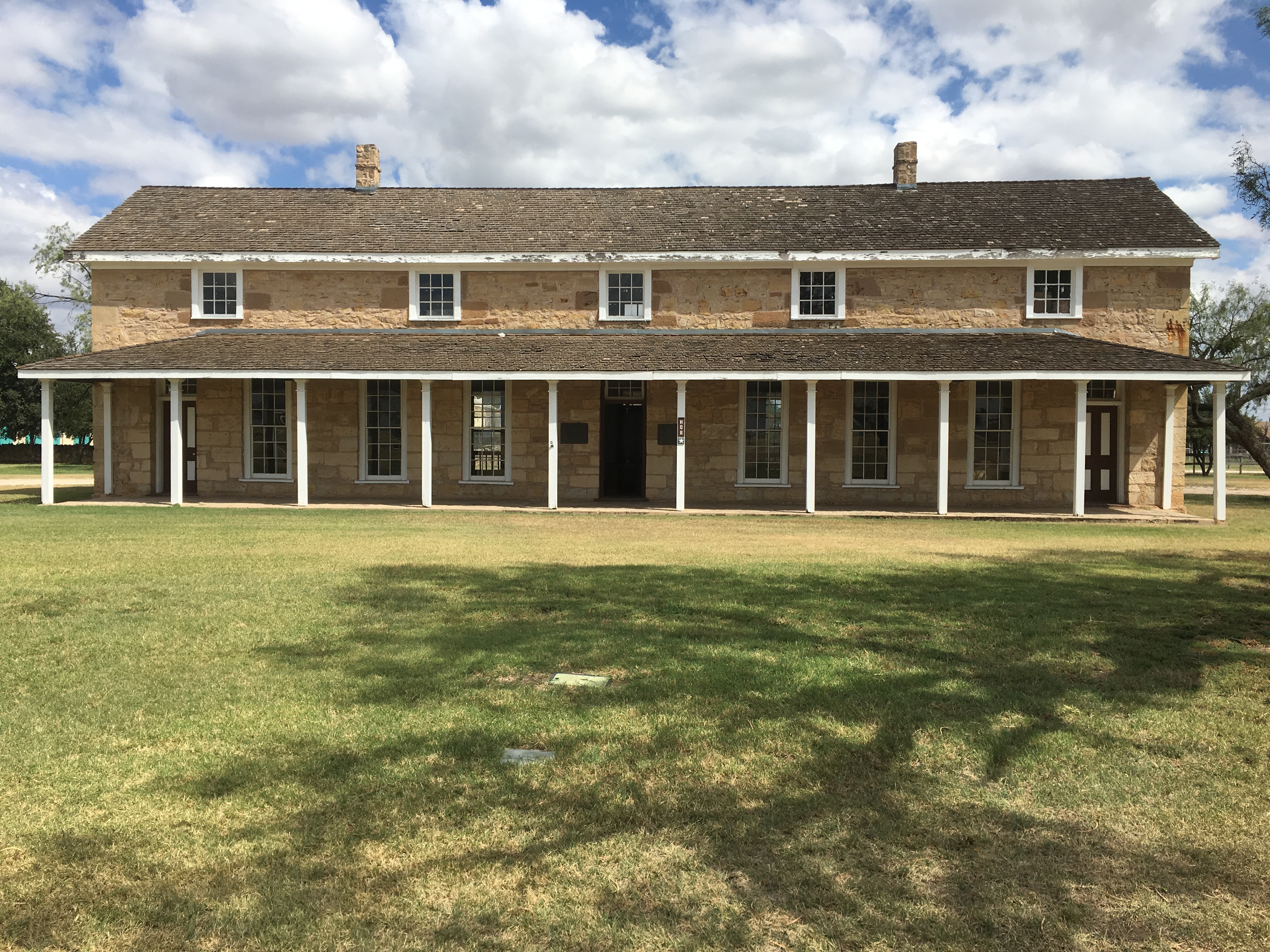
In 1875, the 4th Cavalry transferred to Fort Sill, and the 10th Cavalry -- the famed Buffalo Soldiers, an all-Black regiment -- took their place under Colonel Benjamin Grierson. The 10th established its regimental headquarters at Fort Concho and spread across a network of posts from Fort Clark to Fort Quitman. Their most dramatic chapter came during the Victorio Campaign. In March 1880, Grierson led five companies against the Mescalero Apache chief Victorio, whose war parties had entered the Trans-Pecos. The campaign stretched from Fort Stanton to Rattlesnake Springs, where Grierson's forces finally defeated Victorio and drove his band into Mexico. The Mexican Army destroyed what remained on October 15, 1880. Meanwhile, violence between the fort's Black servicemen and the townspeople of San Angelo was persistent and bitter, ending only when the 10th Cavalry transferred to Fort Davis in July 1882. Humanitarian aid during a devastating 1882 flood -- which destroyed the nearby town of Ben Ficklin -- helped ease the lingering animosity between the garrison and the community.
Ginevra Carson's Crusade
After the Army left in 1889, the fort was carved into commercial and residential lots. Barracks were demolished, officers' quarters became private homes, and a school was built on the parade ground in 1907. But a handful of locals refused to let the fort disappear. Merchant J. L. Millspaugh urged the city to buy it as early as 1905. In 1927, a woman named Ginevra Wood Carson acquired a room in the Tom Green County Courthouse for a local history exhibit -- the seed of what became the Fort Concho Museum. She moved the collection into the fort's headquarters building in 1930 and spent years scraping together funds. The building's owner wanted $6,000; Carson could raise only $3,000. In 1935, the owner relented. Carson ran the museum through the Depression, World War II, and the 1950s Texas drought, never controlling more than a quarter of the fort's grounds. She retired in 1953, but her work set in motion the preservation that continues today.
Stone and Memory
Fort Concho was named a National Historic Landmark on July 4, 1961, and placed on the National Register of Historic Places in 1966. Today the Fort Concho Historic District encompasses 25 buildings on the fort's original grounds, with a museum collection of 40,000 items. It is one of the best-preserved examples of the frontier military installations built by the US Army in Texas. About 55,000 people visit annually. An anonymous $2 million donation in 2015 funded plans to rebuild Barracks 3 and 4 -- structures that had been demolished over a century earlier. The fort also played an unexpected role in modern headlines: in April 2008, following a raid on the polygamist YFZ Ranch, Texas authorities temporarily sheltered children at Fort Concho before the Texas Supreme Court ruled the seizure unlawful. Even decommissioned, the old post keeps finding ways to serve.
From the Air
Located at 31.454°N, 100.428°W in San Angelo, Texas, at the confluence of the North and South Concho Rivers. The fort's original grounds and 25 historic buildings are visible from low altitude as a distinct cluster of stone structures set apart from the surrounding city grid. Best viewed at 2,000-4,000 ft AGL. Nearest airports: KSJT (San Angelo Regional/Mathis Field, 5 nm SW), KGFK (Goodfellow AFB, adjacent to the east). The parade ground and Officer's Row are the most recognizable features from the air.