Fort Frederica National Monument
They feminized the name so people wouldn't confuse it with Fort Frederick in South Carolina. The town became Frederica, after Frederick, Prince of Wales, son of King George II. But there was nothing delicate about the place. Built in 1736 on a bend of the Frederica River on St. Simons Island, Georgia, it was a military outpost on the front line of an imperial contest between Britain and Spain - a fortified settlement where 630 British troops and up to 1,000 colonists lived in the strip of contested coast that Europeans bluntly called the "Debatable Land."
Debtors, Highlanders, and Refugees
James Oglethorpe founded Georgia in 1733 with an unusual mission: to give England's imprisoned debtors a second chance in the New World. But he also needed to defend his colony. The land between British South Carolina and Spanish Florida had been contested for centuries, and Spain had no intention of ceding it peacefully. With two Native American guides, Oglethorpe scouted St. Simons Island and chose a site where the Frederica River bent sharply - a natural defensive position that let the garrison watch approaches from both directions. The colonists who arrived in 1736 came from across Europe: English settlers, Scottish Highlanders recruited from Inverness who formed the Highland Independent Company, and refugees from the German Electorate of the Palatinate. Together they built a fort and a planned town following the Oglethorpe Plan, a grid layout that Oglethorpe applied to towns across the Georgia Colony.
The Spanish Come Calling
In July 1742, Spanish Governor Manuel de Montiano landed nearly 1,900 troops from 36 ships on St. Simons Island. Oglethorpe's force of fewer than 1,000 was badly outnumbered. He abandoned the southern Fort St. Simons, spiking its guns, and fell back to Frederica. What followed were two engagements that changed the course of Georgia history. At the Battle of Gully Hole Creek, British soldiers routed a Spanish reconnaissance column. Hours later, at the Battle of Bloody Marsh, outnumbered defenders firing from behind palmettos and live oaks repulsed a larger Spanish force in a confused, rain-soaked skirmish. Oglethorpe then sealed the victory with a brilliant deception - a forged letter that tricked the Spanish into executing a deserter and believing British reinforcements were on the way. By July 25, the Spanish had withdrawn. They never attempted to invade Georgia again.
A Town That Vanished
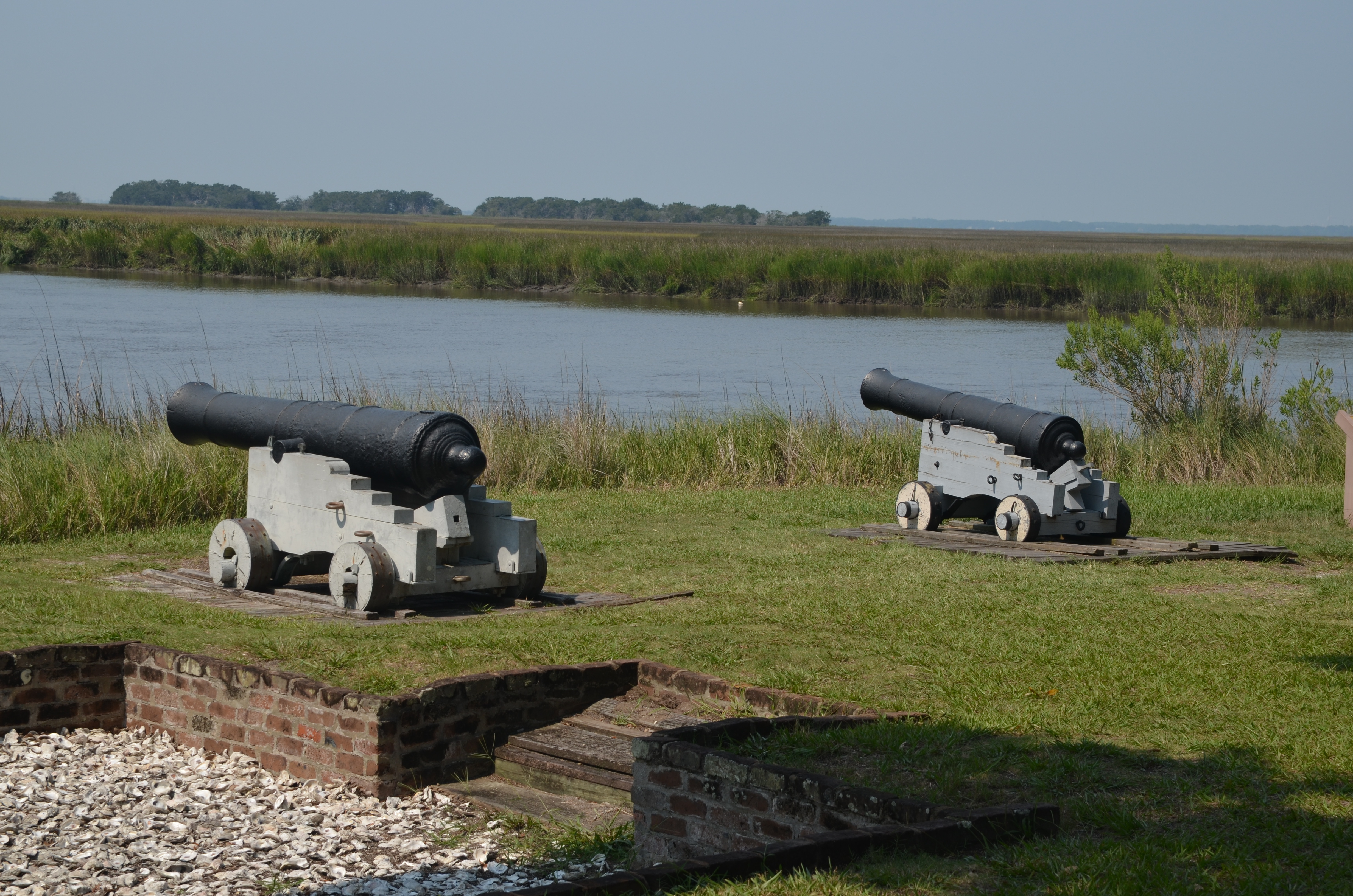
Victory made Frederica obsolete. With Spain no longer threatening the colony, the British government disbanded the garrison in 1749. Without soldiers spending their pay, the town's economy collapsed. By 1755, most residents had left. A fire swept through in 1758, and within a few more years the settlement was fully abandoned. When the naturalist William Bartram visited in March 1774, he found only ruins, though he noted a small garrison still lingered. The fort and town that had once anchored British power on the southern colonial frontier had lasted barely two decades. The tabby walls - a coastal building material made from oyster shells, lime, sand, and water - slowly crumbled under the live oaks and Spanish moss.
Digging Up Frederica
Fort Frederica was authorized as a National Monument on May 26, 1936, during the Great Depression. The Works Progress Administration documented the site as part of its nationwide effort to survey historic places and provide employment. Starting in 1947, the National Park Service and the Ft. Frederica Association sponsored a series of archaeological excavations. Using 18th-century maps and journals as guides, archaeologists uncovered sections of the fort and the town's foundations. The digs revealed details about daily colonial life that no written record captured - the layout of homes, the placement of the magazine, the footprint of barracks. The monument was listed on the National Register of Historic Places on October 15, 1966. Today, visitors walk among tabby ruins along the riverfront, tracing the outline of a town that once held the line between two empires.
From the Air
Located at 31.224N, 81.393W on the western shore of St. Simons Island, Georgia, along the Frederica River. The fort ruins and surrounding National Monument grounds are visible as a cleared area amid the island's dense live oak canopy, situated on a prominent bend in the river. St. Simons Island is one of Georgia's Golden Isles barrier islands, easily identified from altitude. McKinnon St. Simons Island Airport (KSSI) is approximately 4 nm to the south on the island's southern tip. Brunswick Golden Isles Airport (KBQK) is 7 nm to the northwest across the marshes and Mackay River. The Sidney Lanier Bridge is visible to the west connecting the island to Brunswick. Jekyll Island lies to the south across St. Simons Sound. Best viewed at 1,500-3,000 ft AGL to see the fort outline and river bend. Expect coastal weather with sea breezes and possible morning fog over the marshes.