Fort Frederick (Saint John, New Brunswick)
Every fort at the mouth of the Saint John River was built on the bones of the one before it. The French built Fort Menagoueche here. The British burned it. The British built Fort Frederick on the same ground. The Americans burned that. Then the British built Fort Howe across the river. Three nations, three forts, one strategic chokepoint -- the place where the Saint John River empties into the Bay of Fundy, and whoever holds it controls the water highway into the interior of what would become New Brunswick.
Monckton's Arrival
On September 13, 1758, Colonel Robert Monckton departed Halifax with a formidable force: regular soldiers alongside Gorham's Rangers, Danks' Rangers, and the legendary Rogers' Rangers. A week later, they reached the mouth of the Saint John River. The French fort that had once guarded this position -- Fort Menagoueche -- had been destroyed three years earlier, burned by its own garrison as British forces closed in after the fall of Fort Beausjour. Monckton ordered it reconstructed and renamed Fort Frederick. The move was part of a broader British strategy during the French and Indian War. Fort Frederick was one of three major forts the British planted on northeastern rivers to sever Indigenous and French supply lines to the coast. Fort Halifax in Maine and Fort Pownall on the Penobscot served the same purpose further south. Together, they formed a chain that strangled French communications along the entire seaboard.
Cutting the Lifeline
The Saint John River was not just a waterway -- it was the central artery of Acadian and Indigenous life in the region. For the Maliseet people, it connected interior villages to the sea. For the Acadians who had migrated upriver after the British conquest of peninsular Nova Scotia, it was their last corridor of independence. Fort Frederick plugged the mouth of that corridor like a cork. With British guns commanding the river's entrance, supplies and communications to villages upstream were virtually severed. The fort's strategic importance was less about the structure itself -- a modest frontier fortification -- than about its position. Whoever held this spot controlled whether anyone could travel between the Bay of Fundy and the vast interior. The French had understood this when they built Fort Menagoueche. The British understood it when they built Fort Frederick on the same ground.
The Raid of 1775
Fort Frederick stood for less than two decades before the American Revolution brought new enemies. In 1775, American privateers sailed from Machias, Maine, and fell upon the fort. They pillaged it and set it ablaze -- a raid that demonstrated just how exposed British positions in the Maritime provinces remained, even decades after the French threat had receded. The burning of Fort Frederick was part of a broader pattern of American raids along the coast of what was then still Nova Scotia. After the St. John River expedition, Major Gilfred Studholme recognized that the site's defensive value had not diminished, but the location needed rethinking. In 1777, he oversaw the construction of Fort Howe on higher ground to the north, across the Saint John River. Fort Frederick was never rebuilt. Its site became one more layer in the archaeological record of a place that had been fortified, destroyed, and fortified again for over a century.
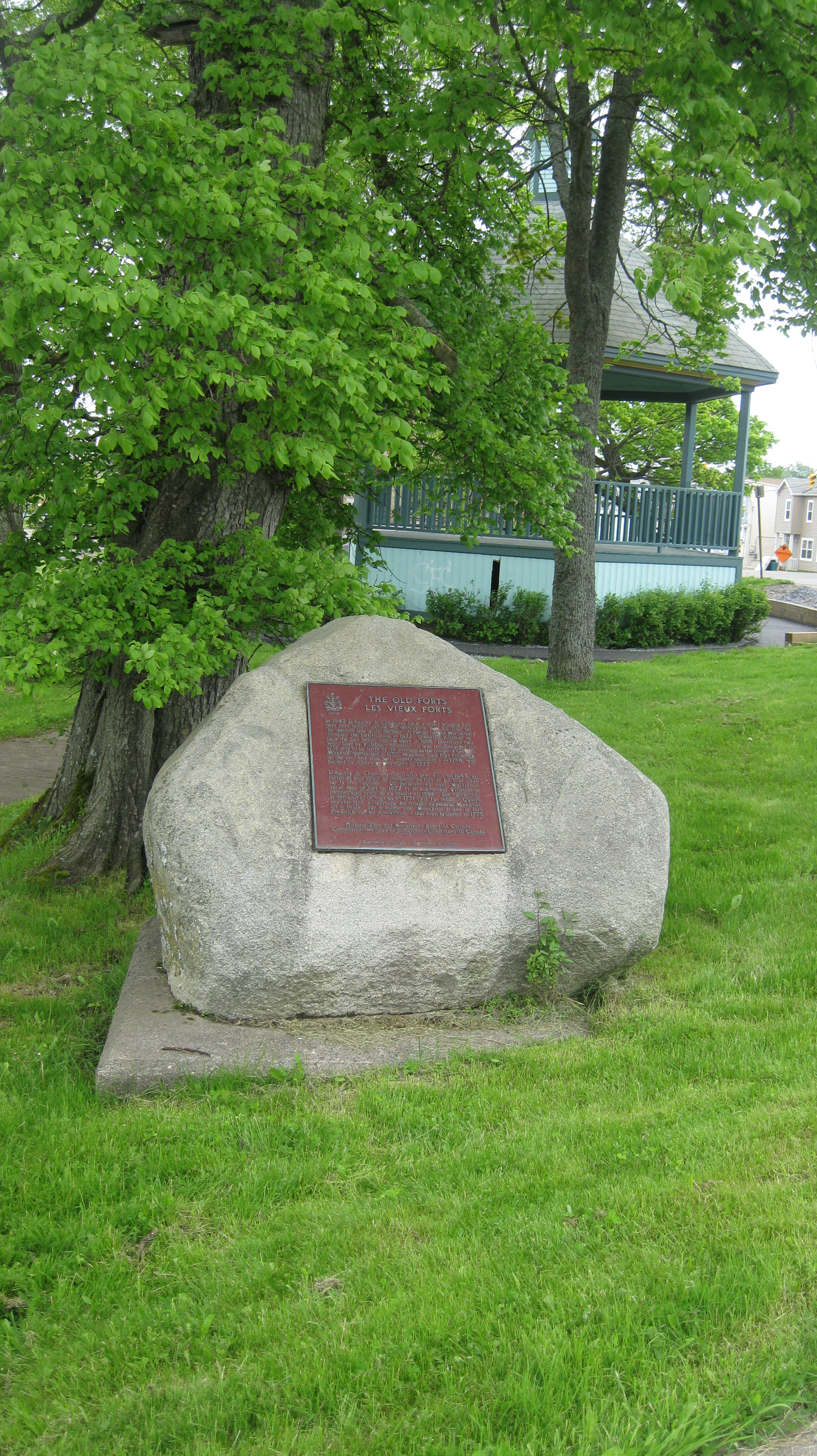
A Monument to Succession
Today a monument at the site commemorates not just Fort Frederick but the succession of fortifications that occupied this ground. Fort La Tour stood here in the 1630s. Fort Menagoueche replaced it in 1751. Fort Frederick rose from those ashes in 1758. Each represented a different empire's attempt to control the same strategic point. The monument acknowledges what the landscape itself makes obvious: some places are too important to leave undefended, regardless of who holds the territory. A painting by Lieutenant Thomas Davies, made during the fort's construction in 1758, survives in the National Gallery of Canada. It shows a modest but purposeful structure on a commanding point of land, the river spreading wide behind it. The scene is peaceful, almost pastoral -- a quality that belies the violence of its making and the violence that would follow.
From the Air
Located at 45.262N, 66.073W at the mouth of the Saint John River where it enters the Bay of Fundy. The original fort site is on the western (Carleton) side of the harbour. No standing structure remains, but a monument marks the location. Best viewed at low altitude approaching from the Bay of Fundy. Nearest airport: Saint John Airport (CYSJ), approximately 15 km east. The river mouth, Partridge Island, and the harbour narrows are key visual landmarks.