Fort Gaspareaux
Twelve soldiers. That was the entire garrison of Fort Gaspareaux in 1753 -- twelve or fourteen men stationed at a palisaded square of earth and timber overlooking Baie Verte on the Northumberland Strait. The fort was less a military stronghold than a fortified supply depot, a waypoint on the only overland route connecting France's great Atlantic fortress at Louisbourg with the capital of New France at Quebec. But in the tangled geography of mid-eighteenth-century colonial warfare, even a warehouse with a dozen soldiers could be a linchpin. Fort Gaspareaux was exactly that.
The Road Between Two Worlds
The only land route between Louisbourg and Quebec ran through the Isthmus of Chignecto, crossing from the Northumberland Strait at Baie Verte to the Bay of Fundy at Chignecto, then following the coast and the Saint John River northward. When the British established Halifax in 1749, the French immediately recognized the threat. If the British controlled the isthmus, they could cut the supply line between Louisbourg and Quebec, severing French North America in two. Within eighteen months, France built three forts along the corridor: Fort Gaspareaux at Baie Verte, Fort Beausejour at Chignecto, and Fort Menagoueche at the mouth of the Saint John River. The chain was meant to hold even if one link failed. In practice, they were all desperately undermanned.
Square Walls in Soft Earth
Built in 1751 by order of the Marquis de la Jonquiere, Fort Gaspareaux was a palisaded earthwork measuring 180 feet square, surrounded by a ditch. Blockhouses stood at each corner, equipped with small-bore cannon. Communication with Fort Beausejour, roughly seventeen miles to the southwest across the isthmus, initially relied on an ancient Mi'kmaq portage route. In 1754, a proper road was finally cut between the two forts. During the summer months, ships could reach the fort from Quebec, Louisbourg, or France itself, making it a seasonal hub for supplies and dispatches. But the garrison remained tiny. The fort's purpose was logistical, not defensive, and France could spare few soldiers for what amounted to a fortified warehouse on the edge of the known world.
Surrender Without a Shot
When a British fleet of 31 transports and three warships descended on the isthmus in June 1755, the outcome at Gaspareaux was never really in doubt. On June 17, the day after the fall of Fort Beausejour, Colonel John Winslow marched 300 men to the far side of the isthmus. Captain Benjamin Rouer de Villeray, commanding Gaspareaux's small garrison, had no realistic hope of resistance. The fort surrendered without a battle. The British renamed it Fort Monckton, after Lieutenant-Colonel Robert Monckton who had directed the campaign. The fall of both forts settled the boundary dispute between France and Britain in the latter's favor and set in motion the Expulsion of the Acadians, a mass deportation that would scatter French-speaking communities across the Atlantic world.
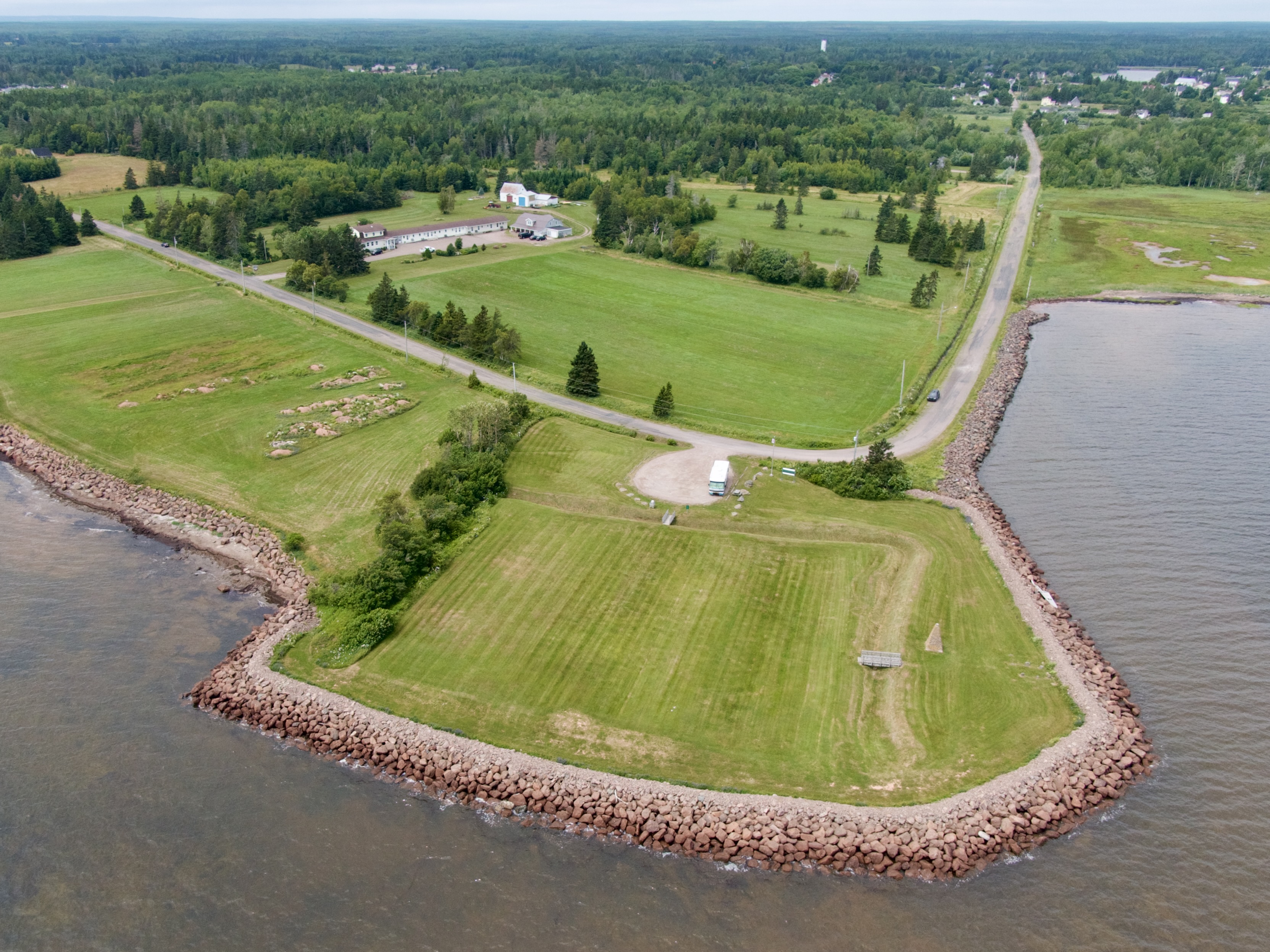
The Gravestones on the Hill
The British did not hold Fort Monckton long, but their brief occupation left a permanent mark. In the spring of 1756, Mi'kmaw militia ambushed a wood-gathering party from the fort, killing and scalping nine soldiers. Their remains were buried in a small military graveyard on the site, the oldest known military gravestones in Canada. The headstones are now illegible, weathered past reading by more than two and a half centuries of Atlantic wind and rain. The British abandoned the fort later that same year. The site returned to quiet -- the ditched enclosure slowly filling with grass, the palisade posts rotting back into the soil. A stone cairn was erected in the 1930s by the National Historic Sites and Monuments Board. Today, the fort is a National Historic Site where visitors can walk the outline of the ditch, visit the small cemetery, and look out across the Northumberland Strait toward Prince Edward Island. An unmanned light structure, added in 1972, stands where blockhouses once guarded a supply line that held an empire together.
From the Air
Located at 46.04N, 64.07W near Port Elgin, New Brunswick, overlooking Baie Verte and the Northumberland Strait. The fort site is visible as a ditched enclosure near the coastline. Recommended viewing altitude 1,500-3,000 feet. Nearest airports: CYQM (Greater Moncton, 45 km NW), CYSJ (Saint John, 200 km SW). From altitude, you can see the full width of the Isthmus of Chignecto and trace the route between Fort Gaspareaux and the site of Fort Beausejour near the Bay of Fundy coast.