Fort Guijarros
The name means 'pebbles' in Spanish — Fort Pebbles, named for the cobblestone beach at Ballast Point on which it was built. Fort Guijarros was the Spanish empire's answer to the vulnerability of San Diego Bay's western entrance, constructed in 1797 from stone and lime mortar on the narrow tip of the Point Loma peninsula. It was a late and modest gesture: the Californias had been colonized for nearly three decades by the time anyone got around to fortifying the harbor. The fort's guns fired in anger exactly twice, both times against American vessels. Then it was abandoned. What replaced it has been replaced in turn, each generation building over the last.
A Fort Arrives Late
The Spanish missions along Alta California's coast had been operating since 1769, but the sea approaches to San Diego Bay remained undefended for most of that time. The viceroy in Mexico City ordered a fortification in 1793; it took until 1797 to complete. Fort Guijarros — formally the Batería de San Joaquín — was built on Ballast Point at the entrance to the bay, where any ship entering or leaving would pass within range of its guns. The cobblestone beach gave the fort its common name. The structure was not impressive by Old World standards: an earthwork and masonry battery with a small garrison, far from resupply and not notably well-armed. But it was there, and its presence was a statement about who controlled these waters.
The Two Engagements
Fort Guijarros fired its guns in battle twice in its entire history, and both incidents involved American trading ships engaged in the lucrative hide-and-tallow trade. The first engagement came in 1803, when the American brig Lelia Byrd — carrying sea otter pelts obtained in violation of Spanish trading regulations — attempted to leave San Diego Bay without authorization. The fort opened fire; the Lelia Byrd returned fire and escaped. The second engagement occurred in 1828, after Mexican independence had transferred ownership of the fort, when a smuggler similarly attracted official displeasure. In both cases, the Americans got away. These were also the first naval engagements fought in what is now California — a distinction that says more about California's peaceful colonial history than about any military prowess on either side.
Abandonment and Succession
By the time of Mexican independence in 1821, Fort Guijarros was already deteriorating. The new Mexican government had neither the resources nor the strategic motivation to maintain it, and the guns were removed and the garrison withdrawn. The site lay largely empty until 1858, when a whaling station was established there by Portuguese-American families from the East Coast, processing California gray whales through the site that had once served as a military battery. When whaling declined, the U.S. government acquired Ballast Point in 1869. Fort Rosecrans was established in 1873, named for a Civil War general, and through both World Wars the point bristled with gun batteries defending the bay entrance. Today it is Naval Base Point Loma, home to the Pacific Fleet's attack submarines. California Historical Landmark No. 69 marks the original fort's location.
The Museum and What It Preserves
The Fort Guijarros Museum Foundation maintains a small museum and replica gun emplacement near the original fort site, accessible to civilians on special event days when the naval base opens its gates. The interpretation of the fort focuses on the Spanish colonial period and the Lelia Byrd engagement — the clearest historical hook for a site that has been so thoroughly built over. Archaeologists have located traces of the original structure beneath the accumulated layers of nineteenth and twentieth-century construction. The point itself, its narrow silhouette guarding the bay entrance, remains exactly what it was in 1797: the place where the ocean meets the harbor, where anything entering or leaving must pass. The Spanish chose the location with good strategic sense. Every subsequent occupant agreed.
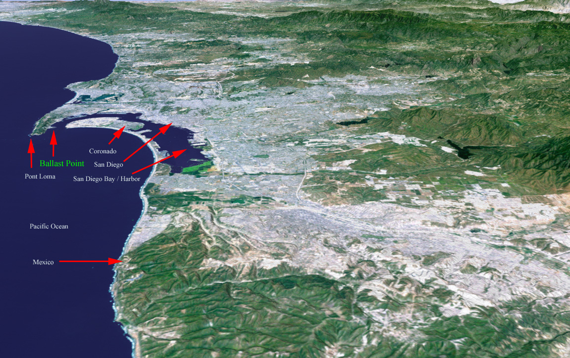
From the Air
Fort Guijarros (now Naval Base Point Loma) is located at approximately 32.67°N, 117.24°W at the tip of the Point Loma peninsula at the entrance to San Diego Bay. The area is within restricted airspace (R-2503). The Old Point Loma Lighthouse is visible on the peninsula's spine. San Diego International Airport (KSAN) is approximately 12 km northeast. The distinctive peninsula and bay entrance configuration make this an excellent visual landmark from altitude.