Fort Howe
Canada's national park system began, in a sense, with an embarrassment. Fort Howe was designated a National Historic Park on March 30, 1914, making it the first historic site in the country's park system. Within a few years, officials admitted the fort was 'not a very important historic site' and had been used to acquire 'undistinguished property.' By 1930, the park was abolished and the land handed to the city of Saint John. Yet the fort's actual history -- spanning the American Revolution, the War of 1812, both World Wars, and the founding of New Brunswick itself -- is anything but undistinguished.
Highland Emigrants in the Woods
Fort Howe exists because Fort Frederick burned. In 1775, American privateers torched the British fort at the mouth of the Saint John River, leaving the harbour exposed. Two years later, during the Siege of Saint John in 1777, ninety Americans under Colonel John Allan arrived at the river mouth to establish an advance base. Major Gilfred Studholme responded with the 84th Regiment of Foot -- the Royal Highland Emigrants, Scottish soldiers transplanted to the colonies. On June 30, 1777, the regiment landed at Saint John and the Americans melted into the forest. The 84th pursued, marching into dense woods where Allan's men had prepared an ambush. Twelve Americans and one Highland Emigrant died in the fighting. Studholme's men eventually overcame Allan's force upriver near present-day Fredericton, though only three Americans were captured. When more privateers attacked on July 13, the 84th repulsed them again. Studholme then built Fort Howe on the rocky hill above the river, garrisoning it with fifty men.
Cannons for Celebrations
The fort that rose on that hill was built from fascines, sticks, sod, and eventually timber palisades -- rough but effective. Eight cannons, barracks for 100 men, two blockhouses, and an abatis gave it teeth. A third blockhouse crowned the eastern end of the ridge, an extension of the Appalachian Mountains that runs along the Bay of Fundy's north shore. The fort was named for Sir William Howe, Commander-in-Chief of the British Army in America. After the Treaty of Paris in 1783, Loyalist refugees settled around the fort's protective shadow, founding the communities of Parrtown and Carleton. Fort Howe became military headquarters for the lower Saint John River valley. Its cannons, rarely fired in anger, found a different calling: a 17-gun salute welcomed Governor Thomas Carleton on November 21, 1784, when New Brunswick was carved from Nova Scotia as a new colony. They boomed again for Nelson's victory at Trafalgar in 1805, and once more when Wellington defeated Napoleon at Waterloo in 1815.
The Linchpin
During the War of 1812, Fort Howe became the central node in Saint John's defensive system. It protected the river narrows while the Carleton Martello Tower guarded the harbour from the west side and Fort Dufferin watched the entrance near Partridge Island. The fort's barracks housed both British Army troops and Royal Navy sailors who launched raids along the Maine coast -- then part of Massachusetts -- striking at targets in present-day Washington and Penobscot counties. It also supported a frontier blockhouse on the St. Croix River at St. Andrews. But peace eroded the fort's purpose. The Martello Tower and newer facilities could better defend the harbour. After Confederation in 1867, British troops withdrew and the remaining defences were left to deteriorate. Nature reclaimed the blockhouses, the palisades rotted, and the hill returned to scrub and wildflowers.
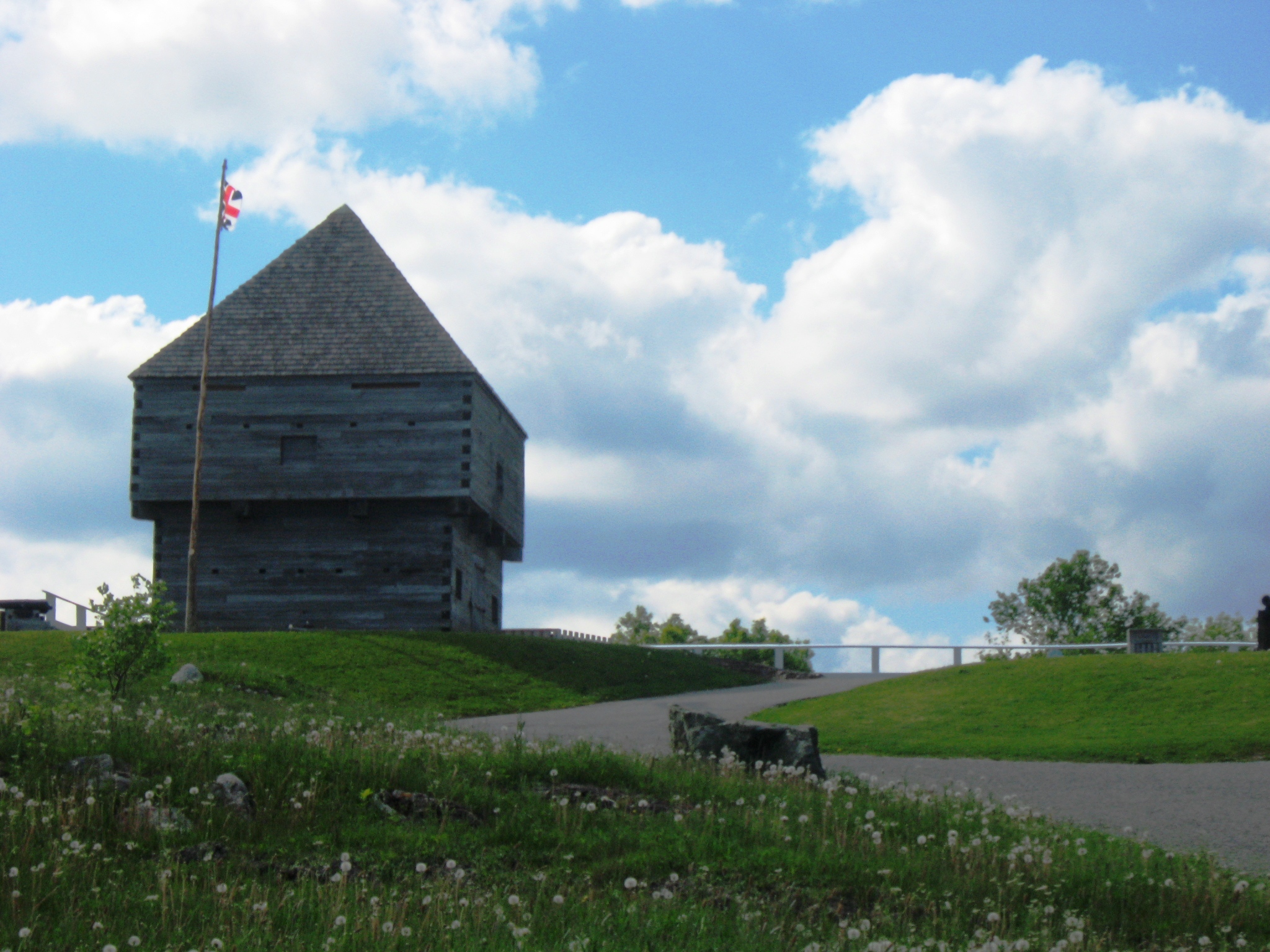
A Park That Failed, a Place That Endured
The Second World War brought one final military chapter: the Canadian 8th Anti-Aircraft Battery placed a 3.7-inch gun atop the hill as part of coastal defense. An Ordnance Corps instrument repair shop went up nearby. After the war, fire claimed the last original blockhouse and the repair shop, and the site was levelled. Fort Howe's life as a national park had been brief and awkward. James B. Harkin, the first Commissioner of National Parks, had championed its designation in 1914, partly to introduce eastern Canadians to the national park concept. But the Parks Branch had no experience managing historic sites and treated the property as an urban recreational park. When the site was given back to Saint John in 1930, its story helped spur the creation of the Historic Sites and Monuments Board of Canada in 1919 -- a more rigorous system for evaluating heritage. In 1966, Fort Howe was redesignated as a National Historic Site. In 1967, a replica blockhouse was erected on the hill for Canada's centennial. Today, original and replica cannons share the hilltop with a World War II anti-aircraft battery, and the park remains one of the finest lookout points in the city.
From the Air
Located at 45.2767N, 66.0731W on a prominent rocky hill overlooking the Saint John River mouth and Bay of Fundy. The replica blockhouse is visible from the air at lower altitudes. The hilltop park sits on an extension of the Appalachian ridge along the Bay of Fundy's north shore. Nearest airport: Saint John Airport (CYSJ), approximately 15 km east. Key visual landmarks include the river narrows below the fort, Partridge Island at the harbour mouth, and the Carleton Martello Tower on the opposite (west) side of the harbour.