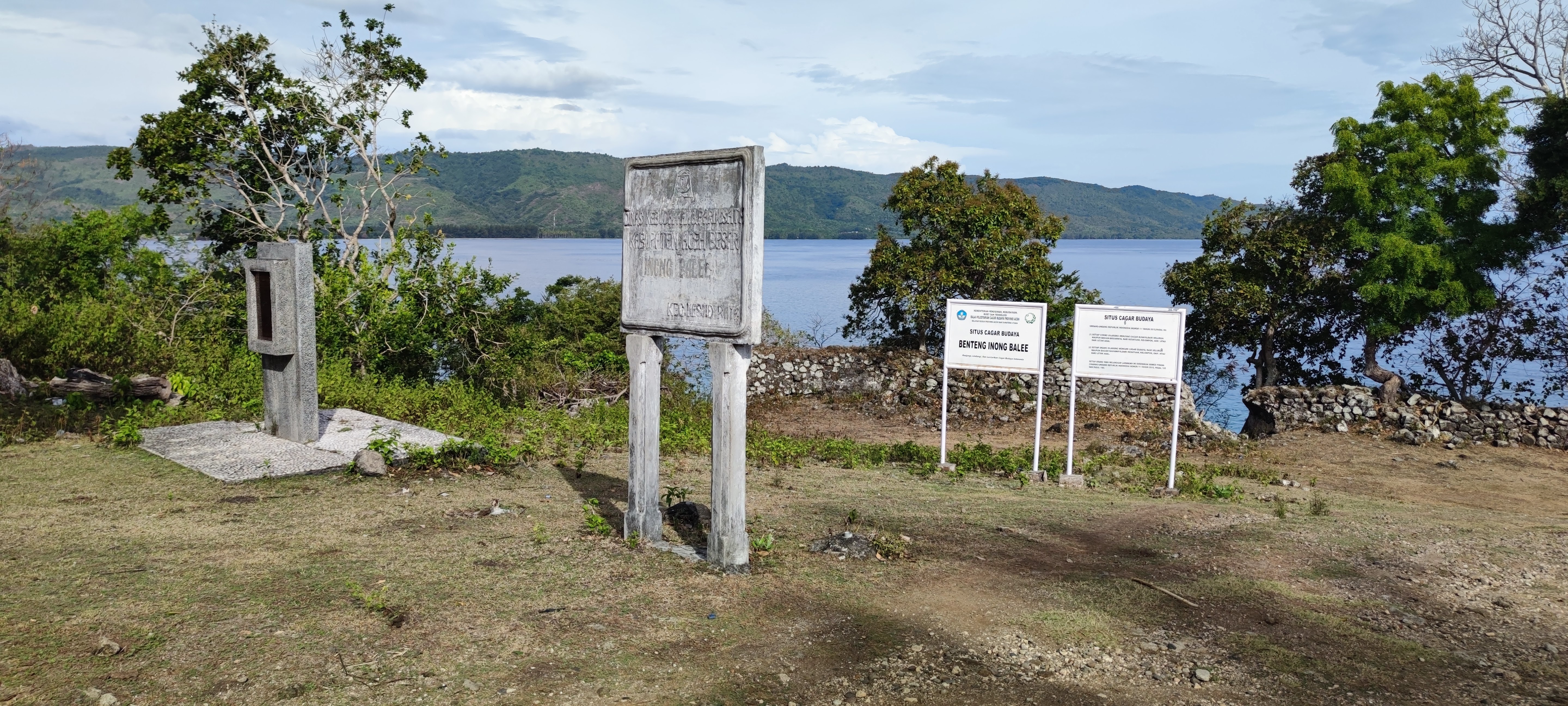
Fort Inong Balee
In 1599, a woman named Keumalahayati looked out across Krueng Raya Bay and decided to build a fortress. She was not a queen, not a regent, not a figurehead. She was an admiral of the Aceh Sultanate's navy, and she had a problem: the Portuguese were pushing into Southeast Asian waters, the Dutch East India Company was not far behind, and the men who had fought them were dead. So Keumalahayati recruited their widows. The fort she raised on the hillside above the bay would become the headquarters of one of history's most remarkable military units - an army of women who chose to fight rather than mourn.
The Admiral's Gamble
Keumalahayati's Inong Balee - the name translates roughly to "widows" in Acehnese - began with about a thousand women whose husbands had died fighting the Portuguese in the Battle of the Haru Sea. These were not symbolic appointments or ceremonial roles. Keumalahayati expanded the force to approximately two thousand soldiers, incorporating young women who volunteered alongside the original widows. She trained them at the fort she built on a hill roughly 100 meters above sea level along Krueng Raya Bay, where the terrain gave defenders an unobstructed view of every vessel entering the port. The position was deliberate: from that elevation, the Inong Balee could spot Portuguese and Dutch warships while they were still far offshore, leaving time to prepare an attack or organize a defense.
Stone Walls Over the Bay
The Medan Archaeological Agency estimates that Fort Inong Balee was a rectangular compound measuring approximately 60 meters by 40 meters, encircled by stone walls two meters thick and two and a half meters high. Half-circle openings pierced the walls at intervals, each one facing the bay below - firing positions designed for the defenders to engage ships in the harbor. The fort served triple duty: fortification, barracks for the widows and young recruits, and logistics center for the sultanate's naval operations. It was a self-contained military community perched above one of the most strategically important harbors in the region, guarding the northern approach to the Strait of Malacca at a time when European powers were willing to wage war for control of the spice trade.
What the Ruins Remember
Today, the fort is in disrepair. Portions of the west wall survive with four loopholes still visible, along with fragments of the north wall and foundation stones from the eastern structure. The jungle and the weather have done what European cannon could not. Yet the site still commands the same sweeping view of Krueng Raya Bay and Malahayati Harbor that made it valuable four centuries ago. Nearby sits the tomb of Admiral Keumalahayati herself, a site of local pilgrimage. And below the hill, the village that grew up around the fort still carries the name Inong Balee - the Village of Widows. The name is not a lament. It is a title, earned by women who transformed grief into defiance and built a military tradition that Aceh has never forgotten.
An Acehnese Legacy
Fort Inong Balee stands alongside other fortifications in Aceh - Indra Patra Fortress, Fort Iskandar Muda, Fort Kuta Lubok - as evidence of a sultanate that took coastal defense seriously during the age of European colonial expansion. But none of the others carry quite the same story. Keumalahayati is remembered in Indonesia as one of the country's first female military leaders, and her Inong Balee warriors as proof that Acehnese resistance to foreign domination drew on every resource the kingdom had, including the courage of women whom the conventions of the era might have consigned to silence. The crumbling walls on the hill above Krueng Raya Bay are modest ruins. The history they represent is anything but.
From the Air
Located at 5.87°N, 95.31°E on a hilltop overlooking Krueng Raya Bay in Aceh province, northern Sumatra. The fort site sits approximately 100 meters above sea level on the coastline. Nearest airport is Sultan Iskandar Muda International Airport (WITT) in Banda Aceh, roughly 30 km to the southwest. From the air, look for the bay's natural harbor and the hillside above Malahayati Harbor. Best viewed at 2,000-3,000 feet for the coastal fortification context.