Fort Kalamata
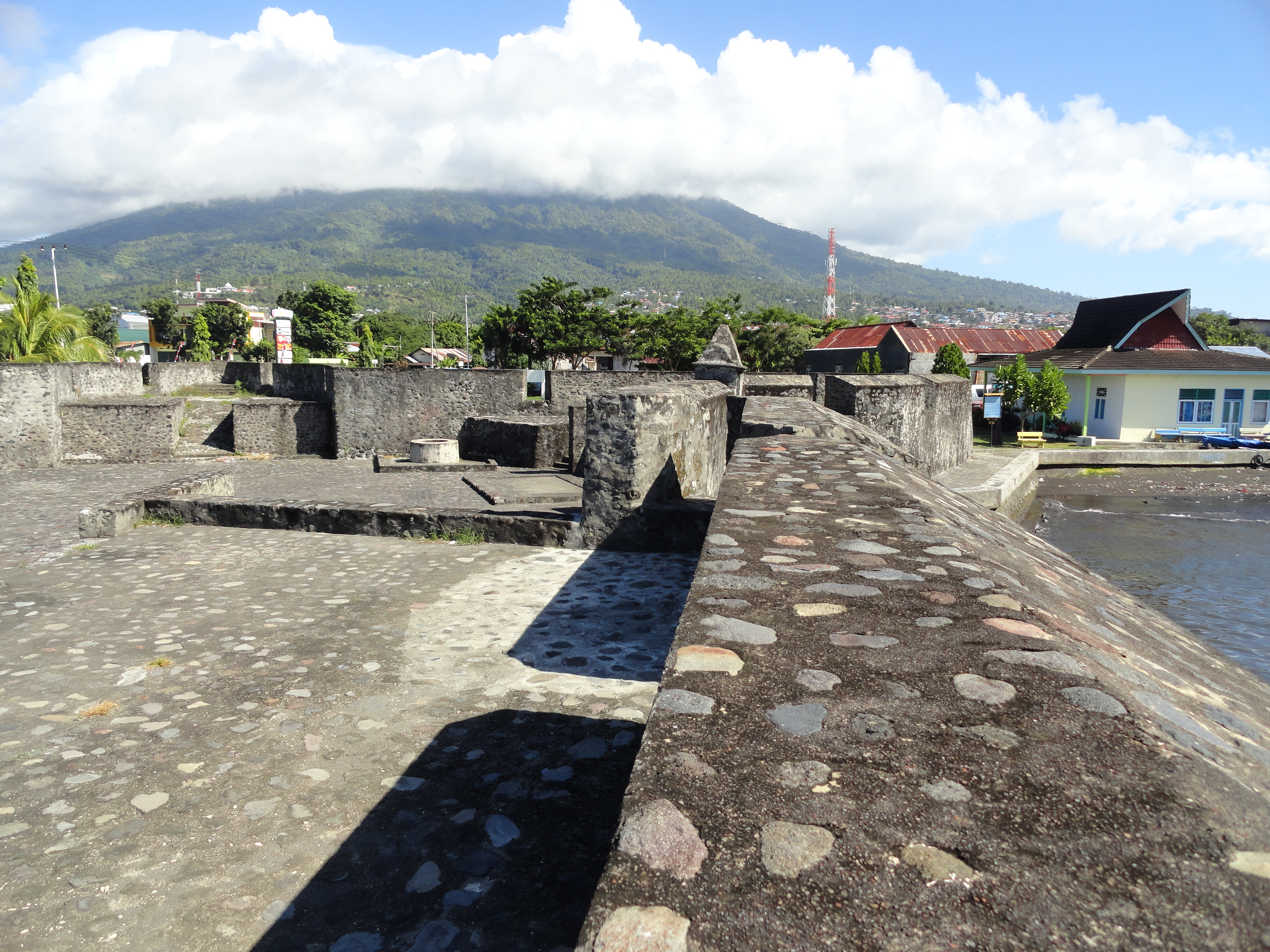
Four pointed bastions, oriented to the four points of the compass, look out over the water toward Tidore and the small island of Maitara. Fort Kalamata sits on Ternate's coastline in the village of Kayu Merah, its name deriving not from a European commander but from a Ternatan prince: Pangeran Kalamata, younger brother of a sultan. The Portuguese who built it called it Santa Lucia. The Spanish, the Dutch, and the British each held it in turn. It is a fort whose identity shifted with every new flag raised above its walls.
A Fort by Any Other Name
The Portuguese constructed Fort Kalamata on Ternate as part of their effort to control the clove trade in the Maluku Islands. Originally named Santa Lucia, the fort was also known locally as Benteng Kayu Merah, the Red Wood Fort, after the village where it stands. But the name that stuck was Kalamata, honoring the Ternatan prince who became associated with the site. This layering of names, Portuguese, Malay, and Ternatan, reflects the reality of colonial Ternate: a place where European military infrastructure and indigenous political authority existed in constant, uneasy overlap. The fort's star-shaped design, with its four pointed bastions and elevated viewfinders, was a European military innovation adapted to a volcanic island in the equatorial Pacific.
Four Flags Over Kalamata
The fort's colonial timeline reads like a condensed history of European rivalry in Southeast Asia. The Portuguese built it and held it until Spain, having absorbed Portugal's crown in a personal union, took possession in 1625 after the Portuguese garrison under Geen Huigen Schapen departed. The Spanish occupation eventually gave way to the Dutch, who repaired the fort under Mayor Lutzow in 1799. Then came the British, who captured it during their 1810 invasion of the Spice Islands, part of the broader Napoleonic-era campaigns that reshuffled colonial territories across the globe. Each occupying power modified the fort to suit its needs, but the basic star plan with its compass-oriented bastions survived every transition.
Restoration and Memory
By the twentieth century, Fort Kalamata had fallen into disrepair. The Government of Indonesia began restoration in 1994, completing the work and inaugurating the restored fort in 1997. In 2005, the Ternate City Government expanded the site, adding a yard and a protective perimeter around the fortress. Today Fort Kalamata stands as one of several colonial-era fortifications ringing Ternate Island, alongside Fort Kastela, Fort Oranje, and Fort Tolukko. Together they form a circuit of stone reminders that this small volcanic island was once among the most strategically valuable pieces of real estate on Earth, all because of the clove trees that grew on its slopes and those of its neighbors.
From the Air
Fort Kalamata is located at approximately 0.76N, 127.37E on the southern coast of Ternate Island, in the village of Kayu Merah. From the air, the star-shaped fort is visible on the coastline with its bastions pointing toward the four compass directions. Tidore Island and Maitara are directly visible across the water to the south and southeast. The nearest airport is Sultan Babullah Airport (WAMN) on the eastern side of Ternate, just a few kilometers away. Best viewed at 2,000-5,000 feet when orbiting Ternate's volcanic cone (Gamalama, 1,715 m), which dominates the island.