Fort Laramie National Historic Site
Jacques La Ramee trapped beaver along this river in 1815 or 1816. He went out alone in 1819 or 1820 and was never seen again. The Arapaho were accused of killing him and burying his body in a beaver dam. The river took his name, then the mountains, then the fort, then two Wyoming towns. Everything here carries the name of a man who vanished, which seems fitting for a place where so many passed through on their way to somewhere else. Fort Laramie was never the destination. It was the last reliable stop before the hard part began.
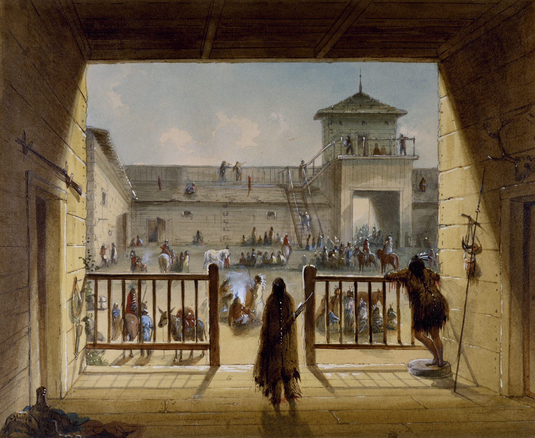
The Fur Trade Crossroads
William Sublette and Robert Campbell built Fort William here in 1834, where the Laramie River meets the North Platte. The location was no accident: two rivers meant water on two sides, forming a natural partial moat, and the nearby ford allowed easy crossing for travelers following the Platte westward. When the American Fur Company bought the post in 1836, they hired workers from Santa Fe to construct an adobe replacement called Fort John. The fur trade was still profitable then, but the real value of the site lay in what was coming: wagon trains. Fort Laramie sat roughly a quarter of the way to California or Oregon, just east of the long climb to South Pass, the lowest crossing over the Rockies. Along with Bent's Fort on the Arkansas River, it became the most significant commercial hub between the Missouri and the Pacific.
Gateway to the West
The U.S. Army purchased Fort Laramie in June 1849 for $4,000, just as the California Gold Rush transformed the Oregon Trail into a highway. The Mormon Trail ran along the north bank of the Platte and North Platte, merging with the other emigrant trails at the fort. Every route west passed through this junction. Migrants could rest their draft animals on the surrounding grazing lands, repair their wagons, resupply at the Post Traders store, and prepare for the mountains ahead. The 1858 Colorado Gold Rush, centered on Cherry Creek near Denver over 200 miles away, still funneled miners through Fort Laramie. The first Treaty of Fort Laramie was signed here in 1851, attempting to establish peace between the United States and the Plains tribes. A second treaty in 1868 created the Great Sioux Reservation, though it would be violated within years.
Adobe, Concrete, and Old Bedlam
The Army faced practical problems building on the High Plains: few laborers, brutal winters, limited wood and stone. Adobe bricks solved some of these challenges, providing insulation against the cold. Old Bedlam, constructed in 1849, is the oldest known U.S. military structure in Wyoming. It served as officers' quarters, with men of various ranks sharing rooms around public kitchen areas. The Cavalry Barracks, built from 1872 to 1874, held 60 men per room on its second floor. The Post Surgeon quarters, finished in 1875, has been reconstructed to its 1880s appearance. Burt House, completed in 1884 from lime grout concrete, housed Lieutenant Colonel Andrew Burt and his family until the abandonment order came in 1889.
The Last Soldiers Leave
In March 1890, about 30 cavalry soldiers and civilian mechanics arrived to strip the fort. They removed doors, windows, flooring, and anything the government deemed valuable. The last soldiers left Fort Laramie on April 20, 1890. All but one structure was sold at auction. The entire nine-by-six-mile military reservation opened to homesteaders on October 5, 1891. The buildings deteriorated for nearly five decades until the federal government repurchased the site in 1938. Fort Laramie National Monument was established, becoming a National Historic Site in 1960. Today, the National Park Service maintains 13 standing buildings, 11 standing ruins, and several foundation remnants across a 536-acre historic district, preserving the crossroads where hundreds of thousands of emigrants paused before continuing west.
From the Air
Fort Laramie National Historic Site sits at 42.209°N, 104.536°W at the confluence of the Laramie and North Platte Rivers in eastern Wyoming. The historic buildings and parade grounds are visible along the south bank of the North Platte. Nearby airports include Torrington Municipal Airport (KTOR), 25 miles southeast, and Scottsbluff County Airport (KBFF) in Nebraska, 50 miles east. Best viewed at 2,000-3,000 feet AGL. The strategic river confluence that made this location valuable for both the fur trade and emigrant trails is clearly visible from the air. The town of Fort Laramie lies on the opposite bank. South Pass, the destination for westbound travelers, lies 150 miles to the northwest.