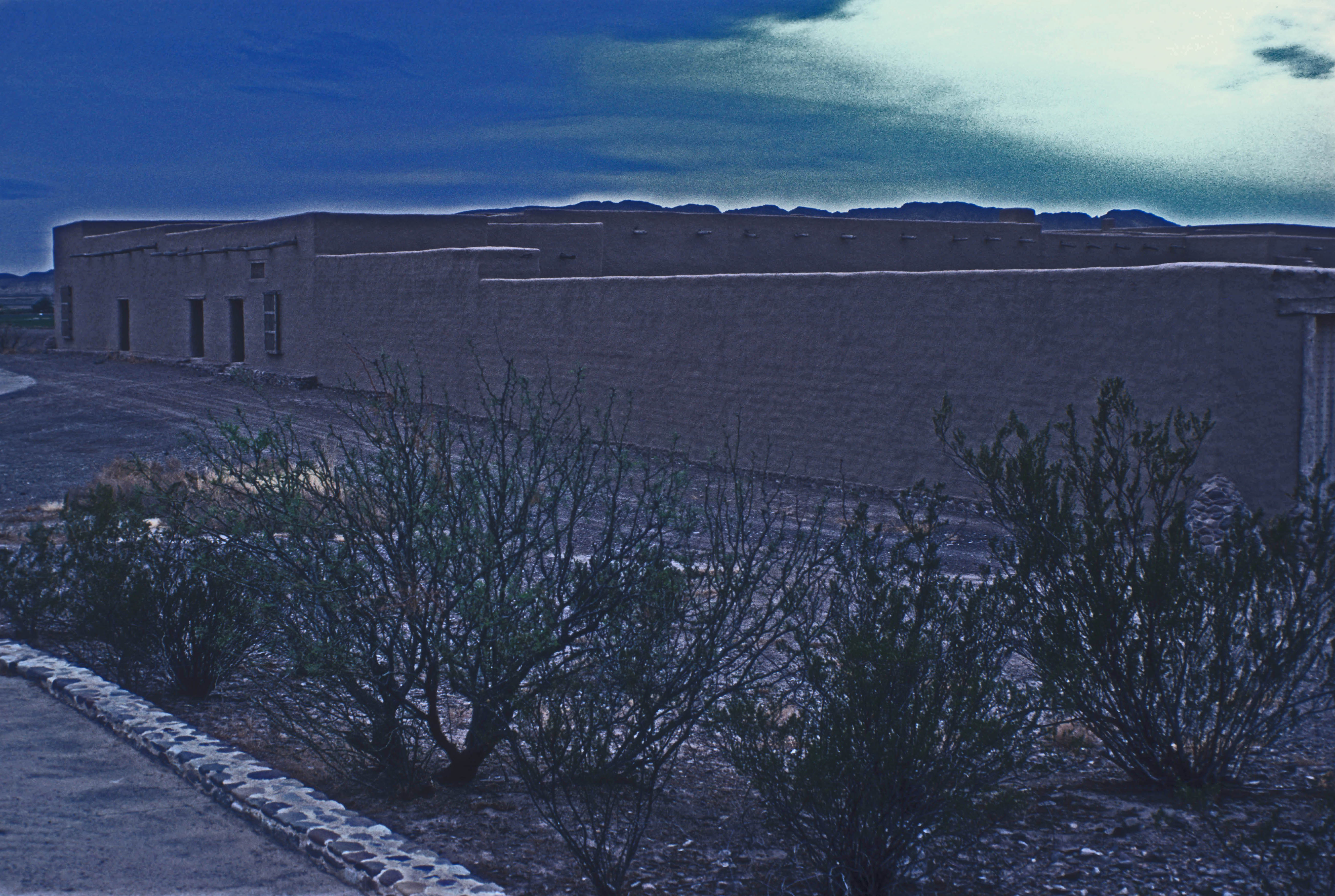
Fort Leaton State Historic Site
Three owners, three murders, three generations of blood soaking into adobe walls. Fort Leaton sits four miles downriver from Presidio on the Texas side of the Rio Grande, a massive earthen fortress that served as trading post, smuggler's den, and county seat before becoming a monument to the savage contradictions of the borderlands. Benjamin Leaton bought the place in 1848 and made it the center of his empire—an empire built on hauling freight, trading guns to the Comanche and Apache, and collecting Mexican bounties for indigenous scalps. He died in his bed in 1851. His successors were not so fortunate.
The Scalp Hunter's Fortress
The original adobe structure was built in the 1830s by Juan Bustillos, a Mexican rancher who chose a location where the Chihuahua Trail crossed the Rio Grande. In 1848, Benjamin Leaton saw its potential and took possession. Leaton was a man of many trades, all of them violent. He hauled freight along the Chihuahua Trail, that ancient route connecting Santa Fe to the silver mines of Mexico. He traded weapons and ammunition to Apache and Comanche warriors in exchange for cattle they had stolen from Mexican ranchers. And he collected bounties from local Mexican governments for the scalps of indigenous people—any indigenous people, since hair does not carry identification. When Presidio County was established in 1850, the territorial government made Fort Leaton its first seat of government, recognizing Leaton as the de facto power on this stretch of the border.
Murder Begets Murder
Leaton died of natural causes in 1851, leaving behind a widow and a thriving criminal enterprise. His widow married Edward Hall, who continued operating the freight business and presumably the less legitimate trades as well. But Leaton had owed money to his scalp hunting partner, John Burgess. Hall inherited the debt along with the widow, and when he defaulted in 1864, Burgess came to collect. Hall was murdered. Burgess took over the fort, running it as his own until 1875, when Bill Leaton—Benjamin's son, now grown—returned to settle accounts. He killed Burgess. The Burgess family stayed on, perhaps because no one else wanted a property with such a violent history, until they finally abandoned it in 1926.
Ruins and Redemption
For decades, the desert reclaimed Fort Leaton. Adobe melts slowly in the dry climate, but it melts. The thick walls that had sheltered scalp hunters and smugglers sagged and crumbled. The Marfa State Bank acquired the property in the 1930s and donated it to Presidio County, but restoration efforts foundered for lack of funds. It took another private purchase and donation before Texas finally took possession in 1967, designating it Fort Leaton State Historic Site the following year. The restored fort opened to the public in 1978 and was added to the National Register of Historic Places in 1973—recognition, at last, not of the men who built and bloodied it but of the architecture itself, a rare surviving example of the fortified trading posts that once dotted the borderlands.
Crossroads of Violence
Fort Leaton tells the uncomfortable truth about the American frontier: it was built on intersecting violence. Leaton sold guns to the Apache and Comanche so they could raid Mexican settlements, then collected Mexican bounties for Apache and Comanche scalps. He served as the agent of one government while arming its enemies, profiting from every death on every side. The Chihuahua Trail that passed his door carried silver north and manufactured goods south, but also carried slavery, weapons, and disease. The fort's massive walls—some three feet thick—were not built to repel any army but to protect a man who had made enemies of everyone. That he died peacefully is perhaps the greatest irony of the place.
The Fort Today
Fort Leaton State Historic Site preserves what remains of the original adobe complex along with interpretive exhibits that do not flinch from the site's dark history. Nature trails wind through the surrounding Chihuahuan Desert scrubland, offering views of the Rio Grande and the mountains of Mexico beyond. The restored buildings house museum displays on borderlands history, from the indigenous peoples who first crossed here to the Mexican Revolution that would rage through nearby Ojinaga decades after the fort fell silent. A gift shop operates in one of the outbuildings. The fort sits on Farm to Market Road 170, one of Texas's most scenic drives, which follows the river through Big Bend country. It is open daily except Christmas, though guided tours require advance arrangement.
From the Air
Located at 29.54°N, 104.33°W on the Texas side of the Rio Grande, approximately 4 miles southeast of Presidio. The large adobe compound is visible from the air as a rectangular structure near the river, surrounded by desert scrubland. Farm to Market Road 170 (the River Road) passes directly by the site. Presidio Lely International Airport (KPRS) is 4 miles northwest. The fort sits at approximately 2,600 feet MSL in classic Chihuahuan Desert terrain. Best viewed at 1,500-2,500 feet AGL when the thick adobe walls cast distinctive shadows. The Rio Grande and Mexican mountains provide dramatic backdrop. Big Bend Ranch State Park begins just to the southeast.