Fort Leonard Wood
The mural almost disappeared. Painted around 1942 by Staff Sergeant Samuel A. Countee -- one of the few African-American artists to create military art during World War II -- it adorned the walls of the Black Officers' Club at Fort Leonard Wood, a building that had served the segregated Army's African-American officers. Decades of neglect nearly destroyed both the painting and the club. In 2019, the Army renamed the building SSG Samuel A. Countee Hall, restored the mural, and in 2021, the National Trust for Historic Preservation recognized the work with its Federal Partnerships in Historic Preservation Award. It was a fitting act of recovery for a base that has been constantly reinventing itself since December 1940.
From Infantry Camp to Engineer Post
Fort Leonard Wood was born in haste. Created in December 1940 as war loomed, the post was named the following month for General Leonard Wood, a former Army Chief of Staff. It was initially meant to train infantry troops, but in 1941 the Army pivoted and established the Engineer Replacement Training Center, transforming the base into an engineer training installation. During World War II, the fort served double duty: training American soldiers while interning Italian and German prisoners of war. The Ozark landscape -- rugged, forested, laced with rivers -- proved ideal for the kind of terrain training that combat engineers required. The base sprawls across 97.6 square miles of Pulaski County, making it one of the larger Army installations in the country. In 1988, the Base Realignment and Closure process consolidated most U.S. Army Engineer School operations at Fort Leonard Wood, relocating functions that had previously been spread between the Ozarks post and Fort Belvoir, Virginia.
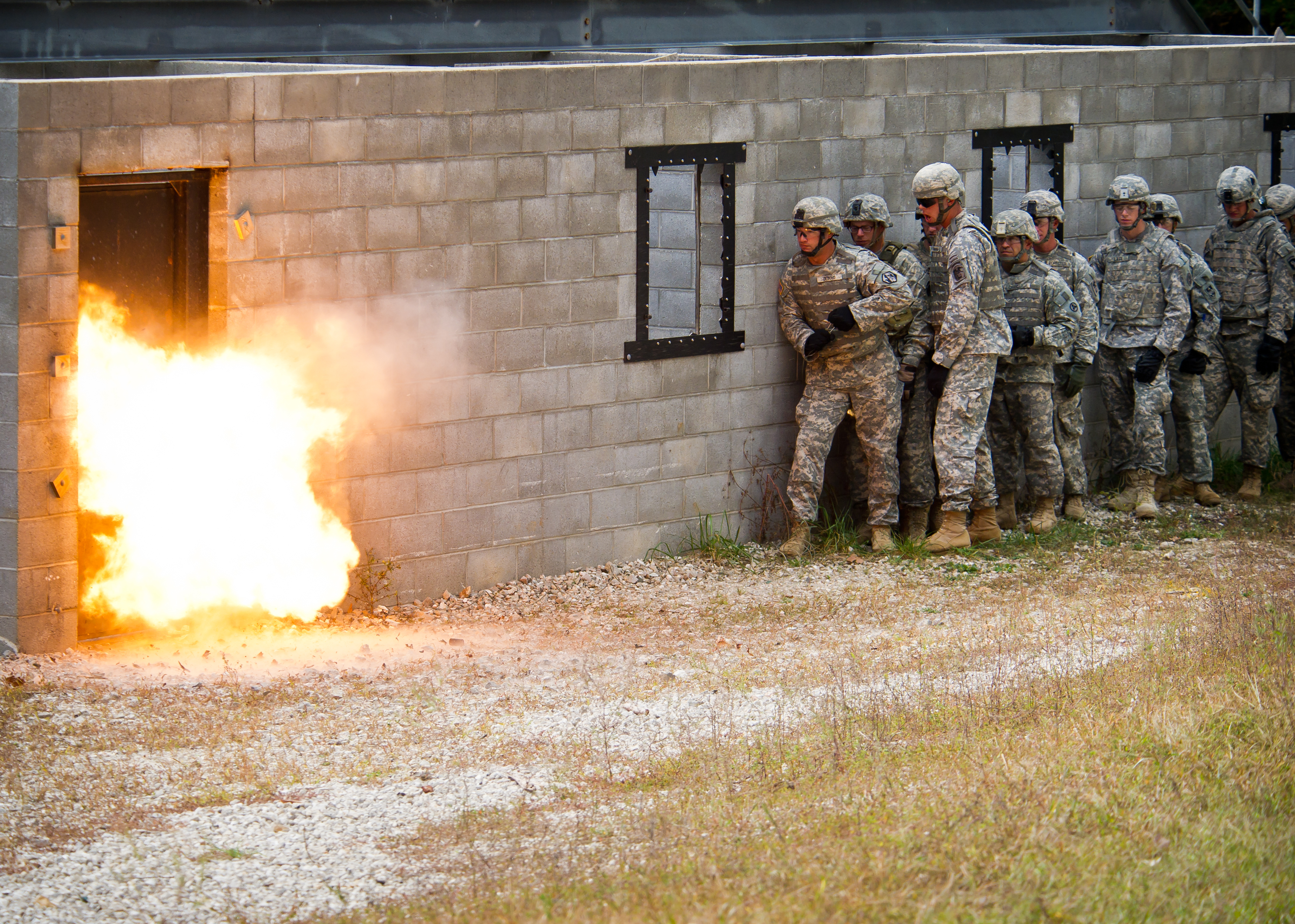
The Maneuver Support Center of Excellence
Today Fort Leonard Wood is home to the Maneuver Support Center of Excellence, a title that reflects the base's evolution into a triple-threat training hub. It provides Basic Combat Training for most non-combat arms soldiers, One Station Unit Training for combat engineers and bridging engineers, and Advanced Individual Training for motor transport operators, CBRN (Chemical, Biological, Radiological, and Nuclear) specialists, and military police. All training is gender-integrated. Newly commissioned second lieutenants in the CBRN, Engineer, and Military Police branches attend their Basic Officer Leader Course here. The NCO Academy conducts Senior and Advanced Leader Courses for those same branches. After the U.S. wars in Iraq and Afghanistan, the 94th Engineer Battalion was relocated from Germany to Fort Leonard Wood, along with the 92nd Military Police Battalion, 193rd Brigade Support Battalion, and 94th Signal Company. The base's population reflects its training mission: the median age is 21, and for every 100 women there are more than 158 men.
Route 66 Runs Through It
Fort Leonard Wood sits at the intersection of military mission and American roadside nostalgia. Interstate 44 slices through the area east to west, but the older highway it replaced -- U.S. Route 66 -- still winds through the surrounding communities of Devil's Elbow, St. Robert, Waynesville, Buckhorn, and Hazelgreen as a scenic route known variously as Teardrop Road, Highway Z, Old Route 66, and Historic Route 66. The Old Stagecoach Stop in downtown Waynesville, the oldest standing structure in the county, began as a tavern and boarding house and served as a Civil War hospital for Union troops garrisoned at the now-demolished Fort Wayne. Three bridges cross the Gasconade River at Devil's Elbow -- the modern Interstate 44 bridge, the later Route 66 alignment through the legendary Hooker Cut, and the original Route 66 alignment on Teardrop Road with its historic bridge under renovation. The Elbow Inn, a biker bar on the original alignment, is a popular stop for Route 66 travelers.
Rails, Runways, and the Ozark Hills
The base maintains its own 27-mile post utility railway, 18 miles of which connect to the BNSF Railway at Bundy Junction. The mainline grade reaches 3 percent in places -- so steep that only 20 cars can be pulled at a time. Two EMD GP10 locomotives and a GP40-2 handle the work, successors to Korean War-era SW8 engines that once served Army railway operating battalions. Waynesville-St. Robert Regional Airport, though located on Fort Leonard Wood, is jointly operated by the cities of Waynesville and St. Robert and serves both military and civilian traffic, including scheduled commercial passenger service. The surrounding communities -- Richland, Crocker, Dixon, Laquey, and Swedeborg -- house a significant percentage of the base's personnel who choose to live off post, drawn by lower housing costs in the Ozark hill towns. Fort Leonard Wood is a small city unto itself, anchoring an economy and a community across the wooded ridges and hollows of the Missouri Ozarks.
From the Air
Located at 37.77N, 92.11W in the Missouri Ozarks, Pulaski County. The installation covers 97.6 square miles and is visible from altitude as a large cleared and developed area amid forested Ozark terrain. Waynesville-St. Robert Regional Airport (KTBN) is located on the post and available for civilian use. Interstate 44 bisects the area east-west. Nearest ICAO airports: KTBN (on post), KVIH (Rolla National Airport, roughly 25nm east). Recommended viewing altitude: 5,000-8,000 ft AGL to appreciate the base's full extent against the surrounding Ozark hills. The Gasconade River system and Big Piney River are visible navigational references.