Fort Liberte
Four forts once guarded the entrance to this bay, spaced along the narrow channel the French called the "bouque" -- the mouth. They were built to keep enemies out. But Fort-Liberte's history is really about what came in: Spanish settlers who founded one of the island's oldest cities, French planters who turned the surrounding hills into coffee plantations, pirates who hid among the islands, and revolutionaries who gave the place the name it carries today. The bay itself is the reason any of them came. A natural harbor on the Atlantic coast of Saint-Domingue, strategically positioned and deep enough for warships, Fort-Liberte was worth fighting over for three centuries. Much of that fight is still visible in stone.
Beads on a String
The French understood the bay's value in military terms. By the 1730s they had begun constructing a defensive network that would eventually include Fort Dauphin (also called Fort Saint-Joseph) at the end of the Grande Rue, positioned at the Pointe de Roche to control the inner harbor. Fort Saint Frederique, started in 1740, anchored the northern approach. Fort Saint Charles, built in the same decade, covered the middle ground, while the Battery of the Cove -- Batterie de l'Anse -- completed in 1756, ran its broken-line parapet right along the water's edge, with a powder magazine tucked behind. This last fortification sat on the ruins of an older Spanish fort, a reminder that the French were not the first to recognize what the bay was worth. Together, these positions formed a defensive system that visitors described as guarding the bay "like beads on a string."
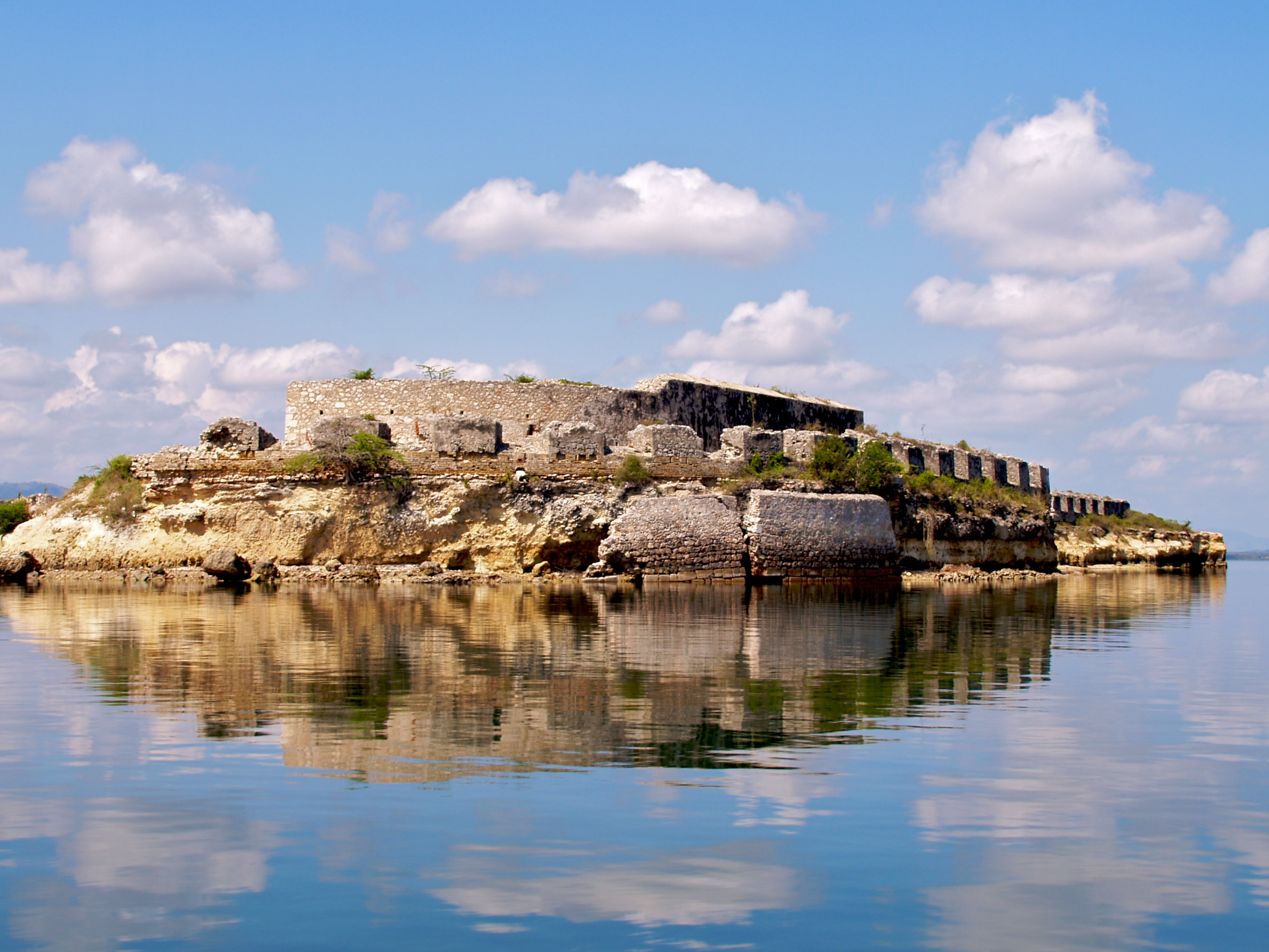
The Pirate Island
Before the forts, before the coffee plantations, the bay attracted a different kind of visitor. Bayau Island, sitting within the harbor, was a favorite haunt of pirates in the seventeenth century. The western side of the island served as a refit station for large vessels -- a place where crews could careen their ships, scrape hulls, and make repairs away from the eyes of colonial authorities. The bay's geography made it ideal: sheltered from Atlantic storms, with multiple channels and enough depth for ocean-going vessels. By the time the French fortified the approaches, the pirates had moved on, but the infrastructure of their presence -- the knowledge of currents, anchorages, and escape routes -- was absorbed into the colonial naval tradition that replaced them.
Coffee, Charcoal, and the Colonial Fountain
Fort-Liberte's economy has always drawn from the land surrounding its harbor. In the colonial era, the hills above the bay were plantation country, and coffee was the primary crop. That legacy persists: the region remains an important coffee-producing area. The pine forests that once blanketed the higher elevations are now heavily exploited for charcoal, a pattern repeated across Haiti wherever deforestation and energy poverty intersect. In the city itself, traces of colonial investment survive in unexpected forms. A fountain on the Grande Rue -- avenue Stenio-Vincent -- was built from freestone imported from France. It is now painted red and wedged between two houses, easy to miss if you are not looking. The Place d'Armes, the old military square, still anchors the center of town. Its own fountain, completed in 1787, caused controversy at the time for its extravagant cost -- a flash of vanity in a colonial outpost that was, above all, a military installation.
A Harbor That Remembers
Today Fort-Liberte is a city of roughly 34,000 people, its climate tempered by a cool ocean breeze that holds the average temperature around 30 degrees Celsius. The forts are mostly ruins, but they remain accessible. Fishermen at the pier near customs organize excursions into the bay, their boats threading past the same stone walls that once bristled with French cannon. Fort de La Bouque, at the eastern mouth of the bay, can be reached by canoe or motorboat. The ruins of Fort Dauphin still stand at the end of the Grande Rue, the central axis of the city pointing directly at its oldest fortification. Hispaniola's weather -- hurricanes, tropical storms, relentless sun -- has shaped these structures as much as the engineers who built them. But the bay endures, still sheltered, still deep, still the reason this city exists. What changes is who controls the mouth.
From the Air
Coordinates: 19.668N, 71.839W, on the north coast of Haiti facing the Atlantic. The bay of Fort-Liberte is a clearly visible natural harbor from the air, with a narrow entrance channel (the 'bouque') flanked by fort ruins. The city sits at the center of the bay. Look for the distinctive enclosed harbor shape. Nearest major airport: MTCH (Cap-Haitien International Airport), approximately 30 nautical miles to the west. Best viewed at 3,000-8,000 feet to appreciate the bay's defensive geography and the fort positions along its entrance.