Fort Massachusetts
Six miles makes all the difference. In 1852, the United States War Department commissioned a fort at the base of Mount Blanca, on the western bank of Ute Creek in the vast, unsettled San Luis Valley. Six years later, the Army abandoned it and built a replacement six miles to the south. Fort Massachusetts, the first regularly garrisoned government installation on the soil that would become Colorado, had been rendered obsolete not by enemy action but by the simple fact that settlers had found better trails into the valley, leaving the fort guarding a path no one used.
A Fort for a New Territory
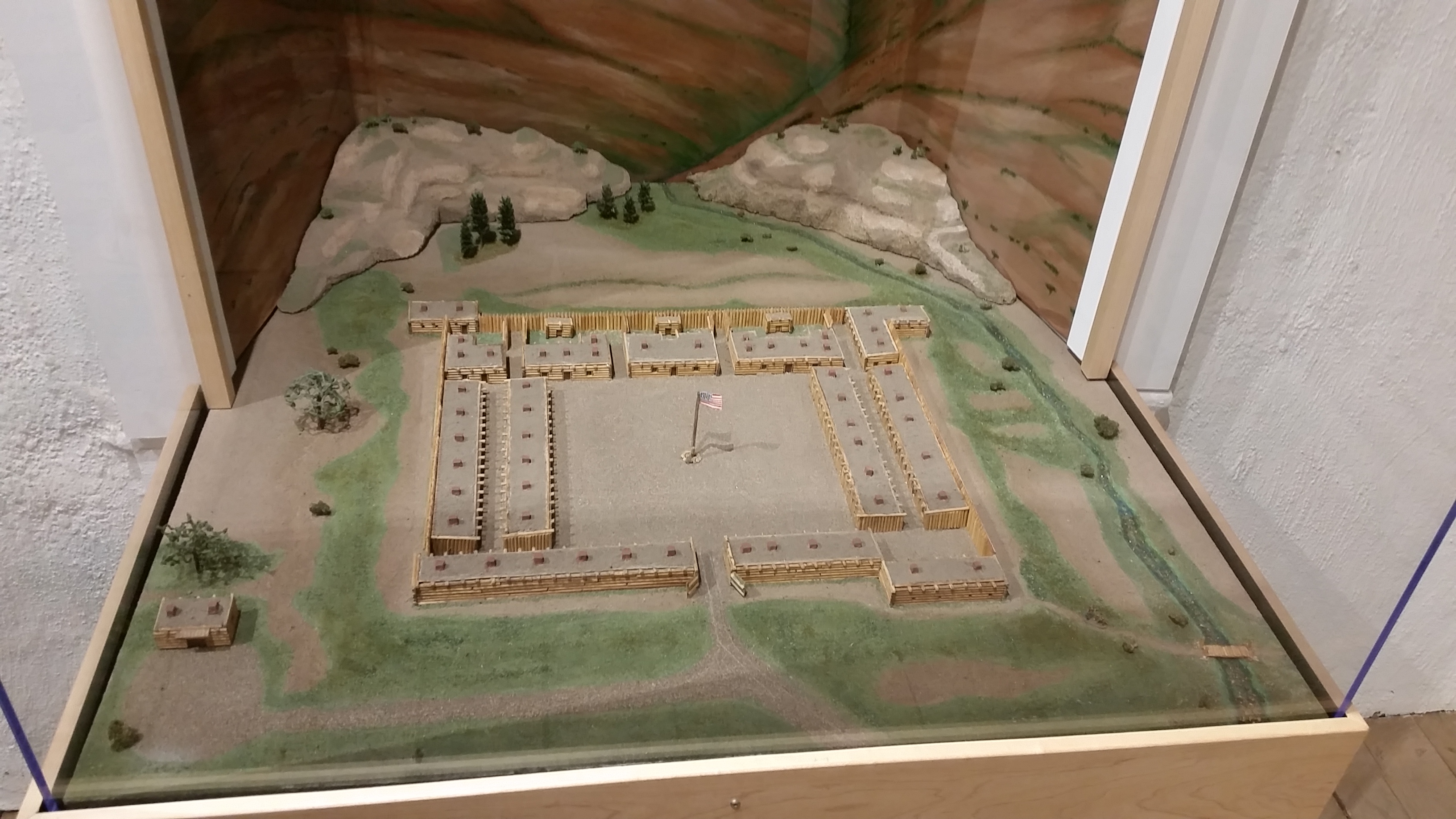
When Fort Massachusetts was built in 1852, the San Luis Valley was technically part of New Mexico Territory, acquired by the United States through the Treaty of Guadalupe Hidalgo just four years earlier. The fort served multiple purposes: it maintained order in the valley, provided a headquarters for Indian Agents, and signaled to Mexico that the United States considered the territory firmly its own. Major George A.H. Blake of the First Dragoons commanded the post, which sat at an elevation of 8,000 feet against the towering backdrop of Mount Blanca. The valley around it was vast and largely empty, home to Ute hunting grounds and only a scattering of settlers.
Conflict Across the Valley
The fort's primary mission was to protect white settlers and Ute Indians from one another, a mandate that proved difficult to carry out peacefully. Tensions escalated until Governor Meriwether authorized military action, mustering 500 volunteers into service on January 31, 1855. Colonel Thomas T. Fauntleroy, commanding forces dispatched by Colonel John Garland, ordered his troops to pursue Chief Blanca and his band across the San Luis Valley. The pursuit lasted several days, driving the Ute forces across the open valley floor until the majority were killed or scattered. The campaign underscored the fort's role as a projection of federal power into a contested landscape.
Abandoned for Adobe
Military scouts had originally chosen the site because it sat along the route settlers used to enter the valley. But by the time construction was finished, those settlers had discovered easier trails, and the fort found itself guarding empty ground. In 1856, the Army began building a replacement six miles to the south. The new installation consisted of twenty-two one-story adobe buildings, a significant upgrade from Fort Massachusetts. Completed in 1858, it was named Fort Garland in honor of Colonel John Garland. Fort Massachusetts was promptly abandoned. Kit Carson would later command Fort Garland during the Civil War, cementing its place in Western history while its predecessor faded into memory.
Gone but Not Forgotten
Nothing remains of Fort Massachusetts above ground today. The site sits on private land, closed to the public, at the base of one of Colorado's most dramatic fourteeners. Mount Blanca rises to 14,345 feet directly behind where the fort once stood, its massive bulk visible from across the San Luis Valley. Fort Garland, the replacement post, fared better in the long run. It operated until 1883 and is now preserved as a museum. The story of Fort Massachusetts endures as a reminder that even in the era of Manifest Destiny, location was everything, and a six-mile miscalculation could render a military installation obsolete before its logs had time to weather.
From the Air
Fort Massachusetts was located at approximately 37.49N, 105.40W, at the base of Mount Blanca on the eastern edge of the San Luis Valley. Mount Blanca (14,345 feet) is one of the most prominent peaks in the Sangre de Cristo Range and serves as an unmistakable visual landmark. The fort site is approximately 6 miles north of the town of Fort Garland along Highway 159. The San Luis Valley stretches flat and wide to the west, with the Sangre de Cristo Range forming a wall to the east. Nearest airports: San Luis Valley Regional/Bergman Field (KALS) in Alamosa approximately 20nm southwest. Be aware of high terrain in all quadrants; Mount Blanca and its neighbors exceed 14,000 feet.