Fort Santa Luzia
The engineers argued over scale. A larger fort -- a proper royal fortification whose defensive perimeter matched the range of a musket -- would have been imposing. But Governor Matias de Albuquerque wanted something that could be built fast, fight hard, and hold the line against Spain. In 1641, with Portugal barely a year into its war to restore independence from the Spanish crown, speed mattered more than grandeur. The smaller design won. By 1643, the first stone was blessed by the Bishop of Elvas, and Fort Santa Luzia began to rise on the hills south of the city -- a compact killing ground built according to the principles of the First Dutch Method of Fortification.
Guardians of a Fragile Border
Elvas sits just 15 kilometers from the Spanish fortress city of Badajoz, making it one of the most contested points along the Iberian frontier. For centuries, control of Elvas meant control of the main invasion corridor between Lisbon and Madrid. Fort Santa Luzia was never designed to stand alone. It was part of an elaborate defensive network -- alongside the Fort of Graça and the fortlets of São Mamede, São Pedro, and São Domingos -- that together formed a defensive web around the garrison town. This entire network, recognized as the Garrison Border Town of Elvas and its Fortifications, was inscribed as a UNESCO World Heritage Site on June 30, 2012, one of the finest surviving examples of the Dutch school of military fortification.
The Siege That Made a Legend
Fort Santa Luzia earned its reputation in 1658, when Spanish forces under Don Luis de Haro laid siege to Elvas. The fort's garrison, vastly outnumbered, held on through weeks of bombardment and assault. Their resistance was not just defensive -- it was defiant, buying time for Portuguese reinforcements to arrive. That relief came on January 14, 1659, when Portuguese forces shattered the Spanish besiegers at the Battle of the Lines of Elvas, one of the decisive engagements of the Restoration War. Without the fort's stubborn defense, the battle might never have been fought. The garrison's endurance became a point of national pride, a story retold across Portugal as proof that independence, once reclaimed, would not easily be surrendered again.
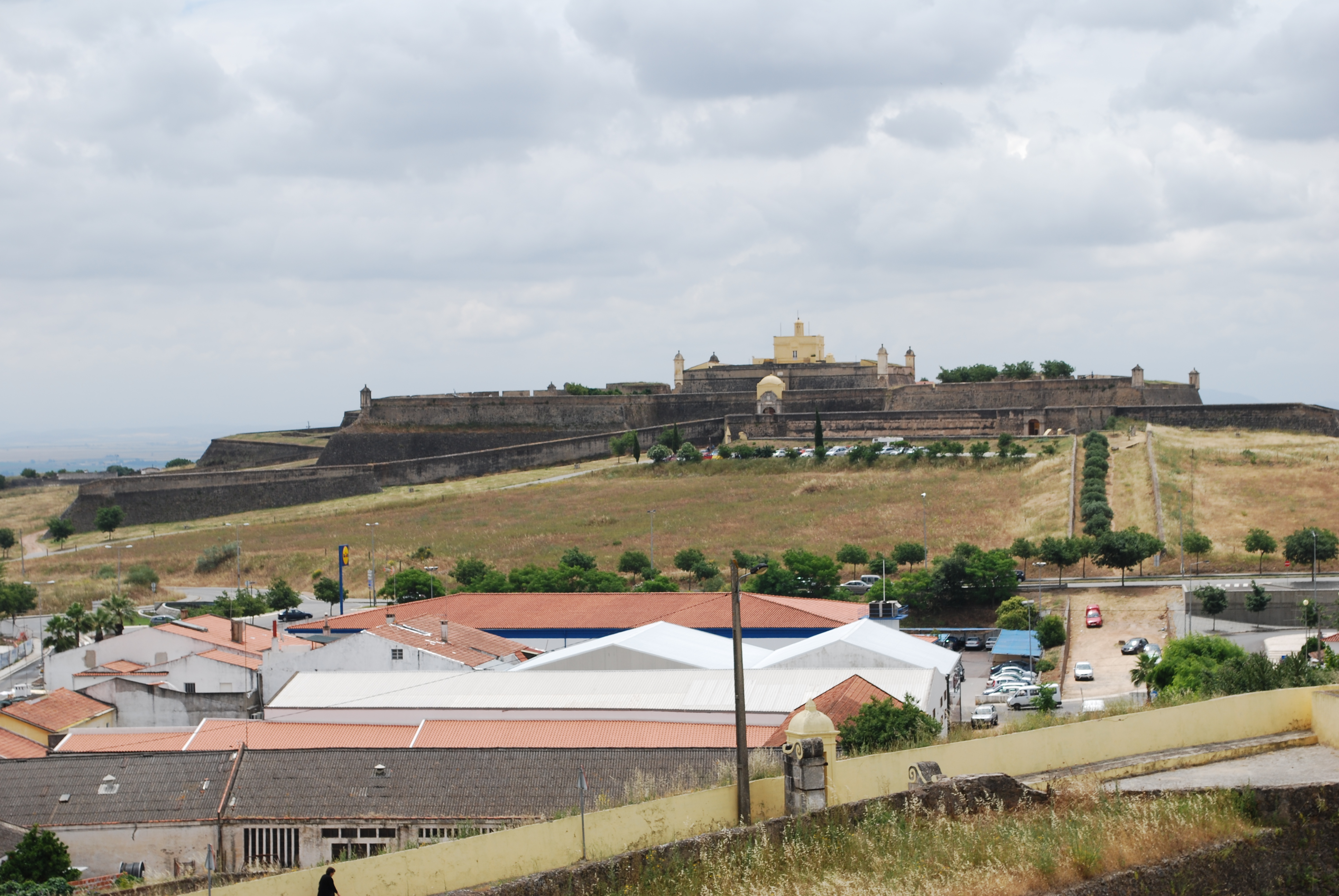
Stone, Moat, and Memory
From the air, the fort's geometry is unmistakable -- a textbook star shape with angular bastions projecting outward to eliminate blind spots, a moat encircling the whole structure, and sentry boxes perched at intervals along the walls. The commander's quarters sit inside the fortification, modest compared to the elaborate defenses surrounding them. Classified as a National Monument since 1940, the fort was integrated in 2014 into a new initiative by the Portuguese Ministry of National Defense called Turismo Militar, which created historical itineraries tracing Portuguese military history across the country. Today the fort houses a small military museum, its thick walls sheltering exhibits about the campaigns and sieges that shaped this border region across four centuries of conflict.
From the Air
Located at 38.87N, 7.16W, just south of the fortified city of Elvas in eastern Portugal. The star-shaped fort is clearly visible from the air against the surrounding terrain. Badajoz airport (LEBZ) lies approximately 20 km to the east across the Spanish border. The flat terrain along the border corridor provides excellent visibility in most conditions.