Fort Santo Domingo
Governor-General Corcuera was furious. His man in Formosa had just been ordered to dismantle Fort Santo Domingo and withdraw the garrison to Keelung, but the governor in Keelung had refused -- he had only just finished rebuilding the fort in stone. In 1637, Corcuera replaced him, exiled him to Ternate for disobedience, and sent a new governor to finish the job. The fort was dismantled. Five years later, the Dutch took what was left. This pattern of construction, destruction, and reoccupation would define Fort Santo Domingo for four centuries, making it one of the most contested structures in all of Asia.
Spain's Expendable Outpost
The Spanish established a permanent colony on northern Formosa at San Salvador in 1628, then pushed west to Tamsui in 1629 to control a port already frequented by Chinese merchants from Fujian. They built a wooden fort and named it Santo Domingo. In 1636, local residents, angered by Spanish taxation, attacked and demolished it. The Spanish rebuilt in stone, raising walls to twenty feet. But the Spanish Empire was overstretched. Governor-General Corcuera in Manila wrote to King Philip IV that the Formosa colony "serves only to consume a large part of the revenues" and proposed abandonment. A war council agreed. The garrison was stripped to 125 soldiers in Keelung, and Fort Santo Domingo was dismantled. When the Dutch invaded in 1641, they found a skeleton defense. They won the Second Battle of San Salvador in 1642 and rebuilt the fort in 1644, naming it Fort Antonio after their Governor-General Antonio van Diemen.
The Red Fort's Long Lease
Local Han Chinese immigrants called the Dutch "red-haired people" in Taiwanese Hokkien, and the fort became known as the "Redheads' Fort." In 1724, the Qing government repaired the structure and added a perimeter wall with four gates. Then, beginning in 1868, something unusual happened: the fort was leased to the British government as its consulate in Tamsui. A new two-story Victorian residence, fused with Chinese architectural elements, was built next door for the consul. The British used the fort through the Japanese colonial era, closing it only briefly during the Pacific War. After 1945, it served as an unofficial British embassy until 1972, two decades after official diplomatic relations between the Republic of China and the United Kingdom were severed in 1950.
A Fort Between Flags
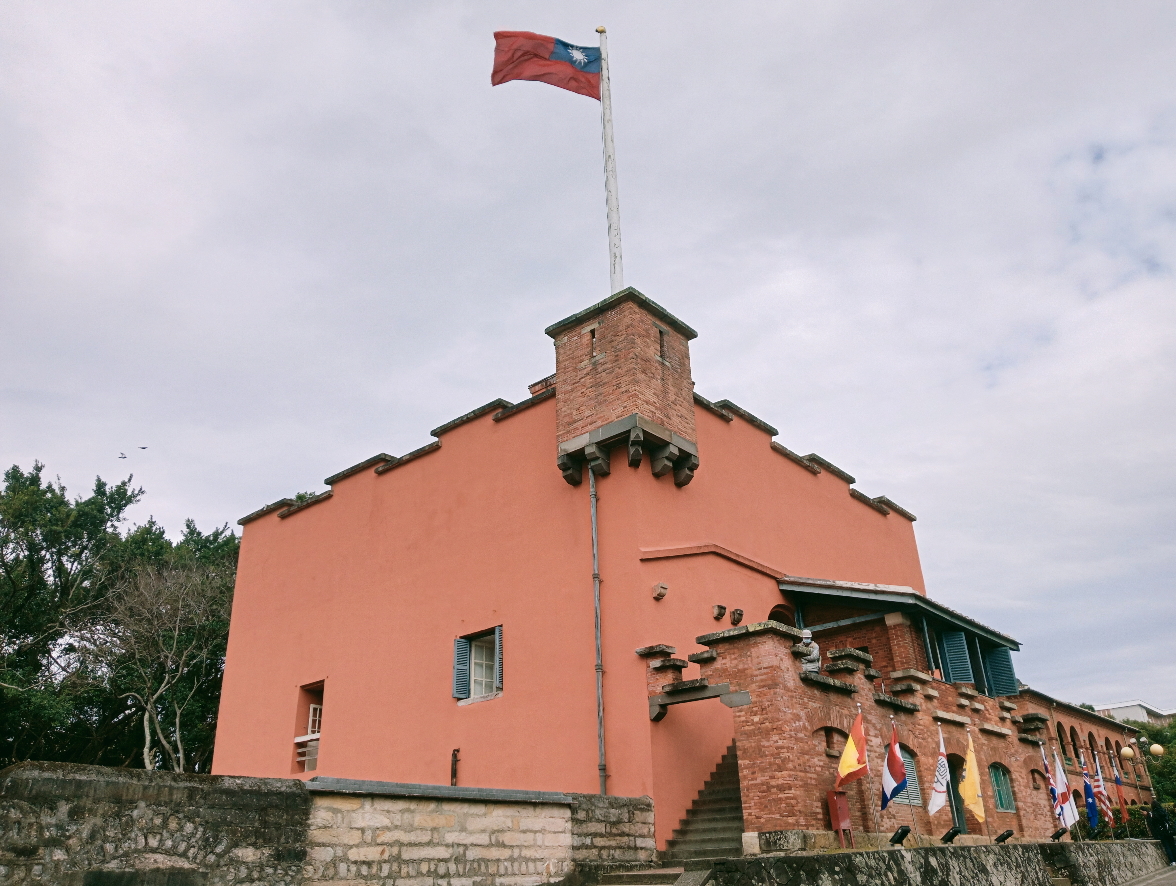
After the British departed, the fort passed through Australian and then American management before being returned to the Republic of China in 1980. Since then, it has been designated a National Historical Site and is considered a potential World Heritage Site. The main fortress is among the oldest buildings on the island, with four cannons in front that date to the Jiaqing era of the Qing dynasty. The former British consul's residence, an elegant Victorian building on the east side, now functions alongside the fortress as a museum. The south gate, the only Chinese-style structure among the buildings, is made from Guangin Stones. Together, the site layers Spanish military engineering, Dutch colonial pragmatism, Qing imperial renovation, British Victorian domesticity, and Taiwanese preservation into a single compact hillside.
The View from the River
Fort Santo Domingo sits on a hillside overlooking the Tamsui River and Guanyin Mountain, a location chosen for its command of the river mouth and the trade routes beyond. The neighboring Hobe Fort, built during the late Qing era after the Sino-French War exposed the vulnerability of Taiwan's coastline, reinforces the sense that this stretch of Tamsui has always been worth fighting over. Today the fort is open Tuesday through Sunday, accessible by a short walk from Tamsui Station on the Taipei Metro. The museum interior has been recreated from historical photographs, and the outlook from the former consul's residence across the river remains one of the most beautiful views in the greater Taipei area -- a panorama that Spanish soldiers, Dutch traders, Qing officials, British diplomats, and Taiwanese families have all contemplated, each from a very different world.
From the Air
Located at 25.175N, 121.433E on a hillside in Tamsui District, New Taipei City, overlooking the Tamsui River and Guanyin Mountain. The fort is visible as a compact hilltop structure near the river's north bank, close to the coast where the Tamsui River meets the Taiwan Strait. Hobe Fort is visible nearby. Taipei Songshan Airport (RCSS) is approximately 18 km to the southeast. Taiwan Taoyuan International Airport (RCTP) is about 25 km to the south. Best viewed at 1,500-3,000 feet for detail of the fort and river confluence.