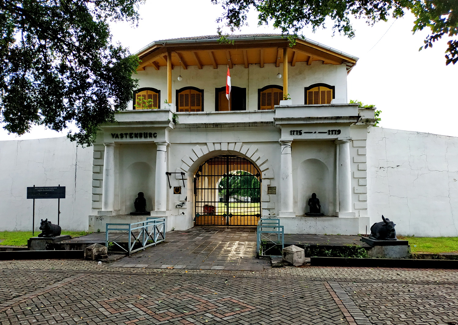
Fort Vastenburg
Nine different owners claim pieces of the same ruin. Fort Vastenburg, a square Dutch fortress ringed by six-meter walls and a dry moat, sits in the commercial center of Surakarta like a puzzle no one can solve. Built in the 1740s on the orders of Governor-General Baron van Imhoff to keep fractious Javanese royals in check, the fort has outlived its colonial purpose by centuries. Today it hosts jazz festivals and culinary fairs in the shadow of a bank tower, while developers and preservationists argue over whether its walls should stand or fall.
Magnanimity, Then Steadfastness
The fort's origin story is itself a matter of dispute. Most historians place construction between 1743 and 1745, when the Dutch East India Company needed a permanent garrison in Central Java. The VOC first called it de Grootmoedigheid -- "Magnanimity" -- a characteristically grand Dutch name for what was essentially a police station designed to keep the Javanese trade network under control. By 1750, the name had shifted to Vastenburg, meaning "Steadfast," perhaps reflecting a hardening colonial attitude. A competing account places the fort's construction later, between 1755 and 1779, arguing that Vastenburg replaced an earlier trading post near the Bengawan Solo river. Whatever the precise dates, the result was the same: a square fortress with four bastions, three portals, and a canal-style bascule bridge on the western approach -- a piece of Amsterdam transplanted into the Javanese interior.
The Keeper of Two Courts
Fort Vastenburg's primary job was managing a city divided against itself. The Sunanate of Surakarta, unlike the relatively unified royal court of Yogyakarta, was fractious from the start. In 1757, Pakubuwono II faced rebellion from his own relative, Raden Mas Said. The Dutch brokered the Treaty of Salatiga, which resolved the conflict by splitting power: Raden Mas Said built his own palace, Kraton Mangkunegaran, establishing a second royal court within the same city. Two palaces meant two centers of ambition, and Fort Vastenburg sat between them like a referee with cannons. The garrison's presence ensured that rivalries between the courts simmered rather than boiled over, turning the fort into something more nuanced than a military installation -- it was the physical embodiment of colonial leverage.
From Fortress to Open Road
Napoleon's influence reached even into Central Java. When Marshal Daendels took charge of the French-aligned colonial government in the early 1800s, he declared the fort system obsolete. Defense strategy shifted from static fortifications to territorial mobility. Cavalry moved to open barracks in Kestalan; artillery relocated to Stabelan. Daendels connected strategic points with new roads, linking Fort Vastenburg to garrisons in Kartasura, Boyolali, Salatiga, Ungaran, and Semarang. The colonial administrator moved out of the fort, though not far. Europeans settled in the surrounding streets, forming a new community with its own social club, the Societeit. The neighborhood they built still marks the area around the fort today -- a visible layer of colonial urban planning pressed into the Javanese city grid. The fort itself endured, but its role had changed from active garrison to administrative relic.
Soldiers, Squatters, and Festivals
The Japanese army occupied Fort Vastenburg during World War II. After Indonesian independence, the national army used it briefly, and from the 1970s through the 1980s the Army Strategic Reserve Command turned the interior into a training ground and housing for military families. Without institutional maintenance, the fort crumbled. By 1986, neglect had become the defining feature of the site. The disrepair persisted for decades, but in 2008 the situation grew more absurd: one of the fort's multiple private owners announced plans for a thirteen-story hotel and shopping mall on top of the ruins. Public protests erupted. The city government of Surakarta fought back, naming the fort a protected cultural site under bylaw No. 1/2012 and blocking seven landowners from renewing their permits. Two other holders extended their claims to 2032. In the meantime, the fort has found an unlikely second life as an event venue -- Solo Carnival, Grand Gamelan Concert, Solo City Jazz Festival, and the Solo 24-hour Dance all unfold within its weathered walls.
A Ruin That Refuses to Disappear
Fort Vastenburg endures in the way colonial architecture often does in Southeast Asia: not as a monument to the past but as contested ground for the present. Its walls still stand six meters high. The dry moat still traces the perimeter. The bascule bridge is gone, demolished at some unknown point, but three of the original portals remain. To the west, a Danamon bank building rose in 2015, pressing modern commerce against 18th-century stone. The fort's survival now depends less on structural engineering than on legal battles and civic will. Surakarta's government has made its case -- this is heritage worth preserving -- but the ownership tangle involves nine parties with different interests and different timelines. For now, the fort exists in a state that mirrors its original Dutch name: steadfast, not because anyone planned it that way, but because it simply refuses to fall.
From the Air
Fort Vastenburg sits at 7.572S, 110.831E in central Surakarta (Solo), Central Java. From the air, look for the distinctive square fortification footprint in the dense urban core, just south of the main commercial district. The nearest major airport is Adisumarmo International Airport (ICAO: WARQ), approximately 10 km northwest of the city center. At low altitude, the fort's walls and dry moat outline are visible amid surrounding modern development. The Bengawan Solo river curves through the broader landscape to the east.