Fort William First Nation
The Ojibwe called it Animkii Wajiw -- Thunder Mountain. Long before surveyors drew lines on maps or politicians drafted treaties, the flat-topped peak south of what is now Thunder Bay served as a place of sacred ceremony for the Anishinaabe people. Today, Mount McKay still rises abruptly from the Lake Superior shoreline, a billion-year-old remnant of the Midcontinent Rift, and the Fort William First Nation still gathers at its base. The community's story is one of persistence: treaty promises broken and slowly reclaimed, traditional governance maintained despite colonial imposition, and a people who have never stopped calling these waters and mountains home.
The Grand Fishery
Before the Robinson-Superior Treaty of 1850, the Chippewas of Fort William thrived along the western shore of Lake Superior. Their territory stretched from Pigeon River in the south to the Treaty 9 boundary in the north and east to Lake Nipigon -- a vast expanse of Canadian Shield country, rock scraped clean by glaciers, laced with waterways. About ten families worked the commercial fishery, packing barrels of salted fish for export to Detroit and points east. Others sold furs at the nearby Hudson's Bay Post. The waters around Pie Island and Flatland south to Sturgeon Bay were so vital that the Ojibwe called them simply "The Grand Fishery." When the treaty was signed, the community agreed not to interfere with foreign settlers. In return, the Crown promised cash payments, annuities, freedom to hunt and fish, and a reserve. But the fishery was never formally protected, and for decades after 1850, the Fort William people petitioned the Crown repeatedly to safeguard these waters that sustained them.
Promises Made, Land Taken
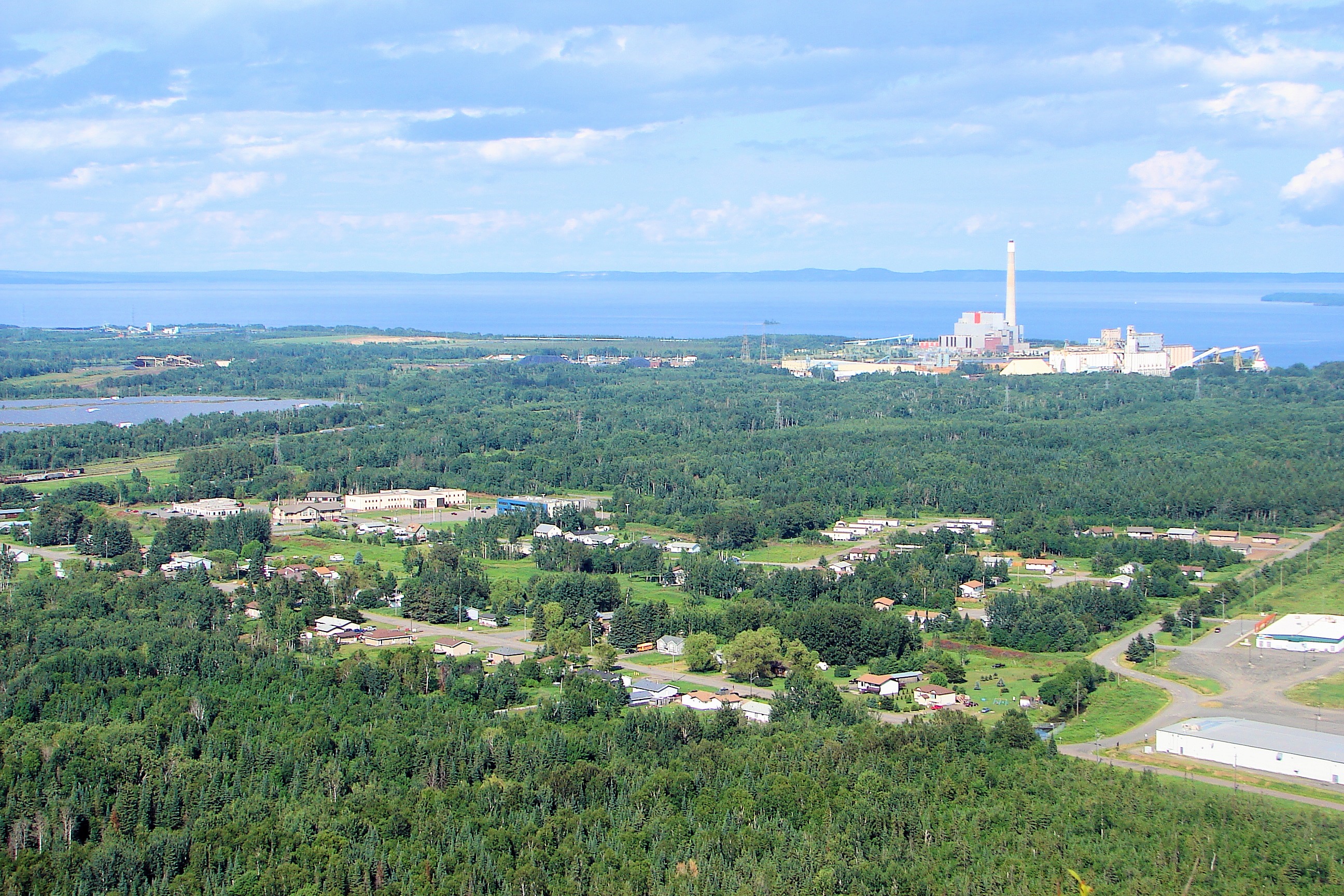
The Fort William Reserve was formally created in 1853. The chiefs and headmen who signed the Robinson-Superior Treaty intended it to provide for their grandchildren's grandchildren. Within three generations, most of the best reserve land had been taken. The community found itself squeezed between a growing Thunder Bay and the constraints of colonial policy. Yet the people adapted. The reserve occupies a landscape of striking contrasts: swampland near the lake's edge gives way to the Nor'Wester Mountains in the west, where Loch Lomond sits in the hills. Most homes cluster along Mission Road, while cottages line Sandy Beach Road. The geography itself tells the story of a people who have always lived between worlds -- the vast waters of Lake Superior on one side, the ancient mountains on the other.
Thunder Mountain's Ancient Bones
Mount McKay, the northernmost peak of the Nor'Wester range, is a mafic sill formed during a period of intense magmatic activity roughly 1.1 billion years ago. Its shale slopes are steep enough that climbing the north face requires gripping a heavy gauge steel cable bolted into the rock. Jack pines crown the summit alongside glacial erratics -- boulders dropped by retreating ice sheets. Red and sugar maples color the lower slopes, and the Ojibwe have their own name for the poison ivy that grows there: animikiibag, meaning "thunder-leaf." A lookout on the lower eastern plateau provides sweeping views of Thunder Bay's harbour, and a small memorial honors Aboriginal veterans. The mountain remains a site of sacred ceremony for the Ojibwe, and non-First Nations visitors were only permitted after a road was built to the plateau. The name McKay came later; the Ojibwe name, Animkii Wajiw, came first and endures.
Governing on Their Own Terms
Fort William First Nation navigates a tension familiar to Indigenous communities across Canada: the imposed Chief and Council system versus traditional Anishinaabe governance. The colonial model, rooted in the Indian Act, centralized leadership and made it accountable to Ottawa rather than to the people. But traditional Anishinaabe governance persists here -- decentralized, emergent, grounded in collective family decision-making. The Robinson-Superior Treaty itself was signed by two Fort William chiefs, reflecting this distributed authority. Families still practice Anishinaabe citizenship law, honoring collective self-determination over top-down directives. In 2019, the band held its first election under the new First Nations Election Act, another step in a long journey of adapting imposed structures while preserving Indigenous political principles. As a signatory to the Robinson-Superior Treaty, Fort William First Nation is also a member of the Anishinabek Nation, representing Anishinaabe governments around Lake Superior and Lake Huron.
Gifts from the Mountain
When industrial pollution began threatening community health, Fort William First Nation citizens did not wait for government intervention. Between 2007 and 2009, they formed Anishinabek Gitchi Gami Environmental Programs -- the first environmental non-profit in an Ontario First Nation community. The name reaches back to the community's original identity: Anishinabek Gitchi Gami, "the people of Lake Superior." By 2014, the community had established the Animikii Wajiw Miinigoowizwinan Charitable Foundation -- Thunder Mountain Gifts -- to support further development. The reserve now hosts the head offices of Wasaya Airways, a business park, and a two-rink arena home to the Thunder Bay Bearcats. Among its notable members are journalist Tanya Talaga, actress and playwright Yolanda Bonnell, and entrepreneur Mel Pervais. Fort William First Nation has become what the treaty-signers envisioned: a self-sustaining hub for Northwestern Ontario's Indigenous communities, rooted in the same landscape the Anishinaabe have called home for generations.
From the Air
Fort William First Nation sits at 48.30°N, 89.27°W on the western shore of Lake Superior, just south of Thunder Bay. Mount McKay (Animkii Wajiw) is the prominent flat-topped mesa visible immediately south of the city -- the northernmost peak of the Nor'Wester range. Look for the sharp geological contrast between the low swampland along the lakeshore and the abrupt mesa rising to the west. Nearest major airport is Thunder Bay International (CYQT), approximately 10 nm north-northwest. Best viewed at 3,000-5,000 ft AGL for the full scope of the reserve's geography from lakeshore to mountain.