Fort York
The gunpowder magazine held 74 tons of iron shells and 300 barrels of powder. When the British ignited it during their retreat in April 1813, the explosion launched debris skyward and rained it down onto the American troops assembled outside the walls, killing or wounding over 250 soldiers, including Brigadier General Zebulon Pike. The fort they had come to capture was already abandoned. Fort York, established on the Toronto waterfront in 1793 and destroyed and rebuilt during the War of 1812, is the place where the city began -- and the oldest surviving collection of buildings in Toronto.
Garrison on the Lakeshore
John Graves Simcoe established the garrison in 1793 to defend the entrance to Toronto Harbour. By 1798, rising Anglo-American tensions led to its formal designation as an official British Army post, with a stockade, barracks, guardhouse, gunpowder magazine, and storehouses replacing the original rough structures. As tensions escalated further in the early 19th century, Major-General Isaac Brock ordered three artillery batteries built along the western boundary, equipped with furnaces for firing heated shot. A wall and dry moat fortified the approach. Plans even circulated to expand the site into a naval base, though the bulk of Upper Canada's fleet remained at Kingston. When news of the American declaration of war arrived at York, the regulars and cavalry departed for the Niagara peninsula, leaving Fort York defended by the Canadian militia.
The Battle That Leveled York
American forces attacked in April 1813, the first phase of Henry Dearborn's campaign to take the Canadas by striking York, then Niagara, Kingston, and Montreal in succession. Professional troops, First Nations-allied warriors, and local militia assembled at the fort, but the Americans landed to the west and pushed the defenders back behind the walls. Artillery fire was exchanged from both sides while the American naval squadron repositioned to bombard the stockade from the south. Recognizing the battle was lost, British commander Roger Hale Sheaffe ordered a silent withdrawal and rigged the gunpowder magazine to detonate. The British flag remained on the flagpole, fooling the Americans into believing the fort was still occupied. Then the magazine blew. After the explosion, American forces occupied the fort, detained the militia, and razed most of the structures before departing.
Rebuilt Among the Ruins
Reconstruction began in the second half of 1813 to protect a Royal Navy squadron planned for York's harbour. By November, the Government House Battery and Circular Battery were operational, each armed with two mortars, and two blockhouses neared completion. Seven of the eight historical buildings standing in the fort today date from this 1813-1815 reconstruction, including the two blockhouses, two soldiers' barracks, the officers' brick barracks and mess hall, and two magazines -- one brick-walled, one stone-walled. The fort remained active through the Rebellions of 1837-1838, the Second Boer War, and both World Wars, serving variously as barracks, militia offices, a training ground, and an enlistment center. On 25 May 1923, it was designated a National Historic Site of Canada.
A Fort Swallowed by the City
When the garrison was established, it stood on the waterfront. Decades of land reclamation beginning in 1850 pushed the shoreline south, stranding the fort inland by the 1920s. Today it sits surrounded by the Gardiner Expressway overpass and clusters of condominium towers, its earthwork walls and stone-lined ramparts holding ground against the modern city pressing in from every side. A visitor centre designed by Patkau Architects, opened in 2014, is built along the original Lake Ontario escarpment. Its exterior is clad in weathering steel panels that trace where the historical shoreline once ran. Inside, an immersive exhibit re-creates the Battle of York, and a climate-controlled vault protects light-sensitive artifacts from the War of 1812.
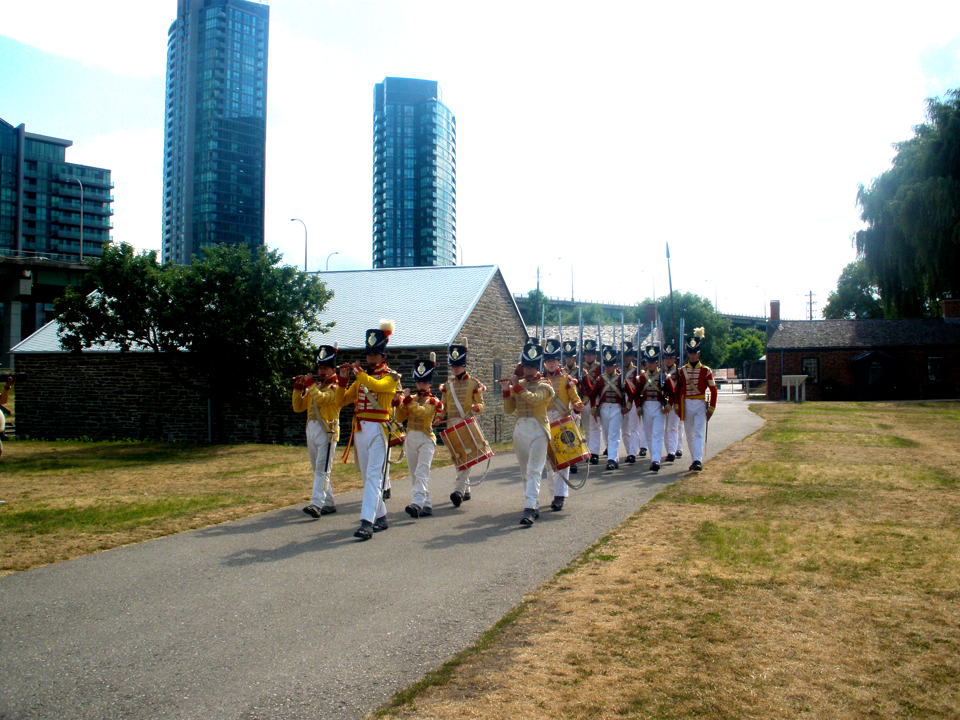
Living History on Garrison Common
In 1932, the City of Toronto restored the fort to its 1816 configuration as both a make-work project during the Depression and a celebration of the city's centennial. A historical reenactment unit of infantry soldiers, fifers, and drummers was created to support museum operations. The adjacent military cemetery, used for the interment of soldiers and their families from 1793 to 1863, is now partially known as Victoria Memorial Square. In September 2017, Fort York hosted the archery events for the Invictus Games. Two stainless-steel pedestrian bridges -- the first of their kind in Canada -- were completed in 2019, connecting the historic grounds to the surrounding neighborhoods. The parkland of Garrison Common remains open year-round, a quiet pocket of 18th-century military history embedded in one of North America's fastest-growing urban landscapes.
From the Air
Fort York sits at 43.6389N, 79.4036W along the original Toronto waterfront, now inland due to land reclamation. From the air, look for the star-shaped earthwork fortification tucked between the elevated Gardiner Expressway to the south and the condo towers of the Fort York neighbourhood to the north and west. The fort is approximately 1 nm southwest of the CN Tower. Billy Bishop Toronto City Airport (CYTZ) lies 1.5 nm to the south on the Toronto Islands. Toronto Pearson International (CYYZ) is 14 nm to the northwest. Best viewed at 1,500-2,500 feet AGL for detail on the earthworks and historical buildings.