Fort Zoutman
The oldest building on Aruba was not built by the people who ordered it. In 1798, enslaved Africans laid the stone walls of Fort Zoutman in what would become Oranjestad, using materials gathered by Amerindian laborers performing corvee -- forced, unpaid work -- for the Dutch West India Company. The fort they raised still stands, the only structure from the 18th century to survive on an island where hurricanes, neglect, and development have erased nearly everything else from that era. UNESCO designates it a 'Place of Memory of the Slave Trade Route in the Latin Caribbean,' a title that insists the building be understood not just as colonial architecture but as evidence of the human cost embedded in its walls.
A Fortress That Built a City
Fort Zoutman was a military fortification, built to protect Dutch colonial interests in the southern Caribbean at a time when European powers contested every island, every harbor, every strategic anchorage. The fort's position was practical: it commanded the waterfront at a natural harbor on Aruba's southwestern coast. What its builders could not have anticipated was that the fort would become the nucleus around which an entire capital city would crystallize. Oranjestad grew outward from Fort Zoutman, its streets and markets and government buildings arranged in relation to the fortification like rings around a stone dropped in water. The city that exists today -- Aruba's largest, its seat of government, its commercial heart -- began as the settlement that grew up in the fort's shadow.
The Tower That Told the Time
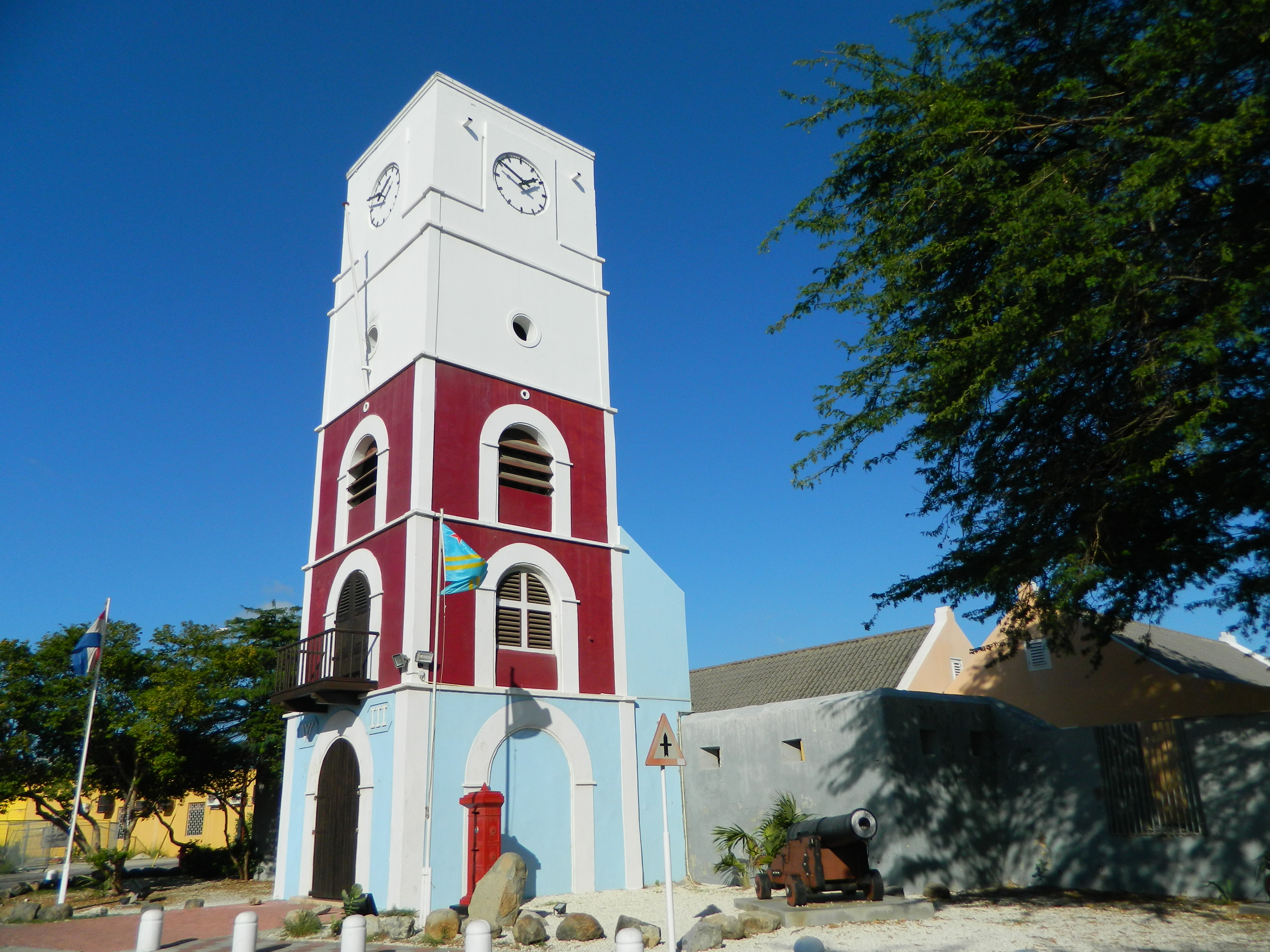
Seventy years after the fort's construction, the Willem III Tower was added to its western face. Completed in 1868, the tower served multiple purposes -- clock tower, lighthouse, and civic landmark -- all at once. Named for King William III of the Netherlands, it gave the fort a vertical element that made it visible from the harbor and from the surrounding streets, a marker that oriented daily life in the growing town. The lighthouse function was especially practical for a settlement whose economy depended on maritime trade. Ships approaching Oranjestad's harbor could fix on the tower's light, and residents could hear its clock marking the hours. For a small colonial outpost in the Caribbean, a structure that simultaneously guided ships, told time, and projected authority was remarkably efficient.
Decay, Restoration, and a Second Life
By the mid-20th century, the fort had outlived its military purpose and fallen into disrepair. The restoration that saved it took six years, from 1974 to 1980, a painstaking process of stabilizing walls that had weathered nearly two centuries of tropical storms and salt air. On September 15, 1983, Fort Zoutman reopened as the Historical Museum of Aruba. The Fundacion Museo Arubano, which has administered the museum since 1992, uses the space to tell the story of Aruba's development from pre-colonial times through the early 20th century. Multilingual guides lead walking tours of the surrounding city center, connecting the fort to the streets it spawned. The transformation from military installation to cultural institution reflects a broader pattern across the Caribbean, where colonial-era buildings find new purposes as the societies they once controlled claim ownership of their own histories.
Tuesday Nights at the Fort
Every Tuesday evening, the fort's courtyard fills with music, food, and dancing for the Bon Bini Festival. The name comes from the Papiamento word for welcome -- bon bini -- and the weekly gathering is designed to introduce visitors to Aruban culture through live performance, local cuisine, and traditional crafts. Running from seven to half past eight in the evening, the festival transforms a space built for military defense into one of communal celebration. It is a deliberate inversion: the fort that once existed to project colonial power over a subject population now serves as the stage where that population's descendants share their culture on their own terms. The thick stone walls that were meant to keep people out now draw them in.
From the Air
Fort Zoutman (12.518N, 70.036W) sits in the heart of Oranjestad, Aruba's capital, one block inland from the waterfront. The Willem III Tower provides a modest but identifiable vertical landmark amid the low-rise downtown area. Nearby airport: Queen Beatrix International Airport (TNCA), approximately 3 km southeast. Best viewed at 1,500-2,500 ft AGL. The fort is near the cruise ship terminal and can be identified relative to the harbor and the main commercial streets of downtown Oranjestad.