Fortress of Louisbourg
The fort cost so much that King Louis XV joked he expected to see its rooftops from Versailles. Thirty million livres -- more than seven times the original budget -- went into two and a half miles of walls, six bastions, and a harbor bristling with cannons on this wind-battered headland of Cape Breton Island. By the 1740s, Louisbourg was the third busiest port in North America, trailing only Boston and Philadelphia, and the most formidable French fortification on the continent. Then the British took it. Twice.
The Dunkirk of America
Founded in 1713 by settlers displaced from Newfoundland after the Treaty of Utrecht, the fishing village initially called Havre a l'Anglois grew into something far more ambitious. Named for Louis XIV, Louisbourg became France's only Atlantic seaboard stronghold, strategically positioned near the Grand Banks fishing grounds and guarding the entrance to the Gulf of St. Lawrence. By 1752, its population had swelled to 4,174, despite smallpox outbreaks in 1731 and 1732 that thinned the ranks. The British colonies to the south called it the "American Dunkirk" for the privateers who sailed from its harbor. Four hundred shallop-fishing vessels worked its waters daily, and 60 to 70 ocean-going schooners ranged further down the coast. In 1731 alone, Louisbourg fishermen exported 167,000 quintals of cod. For France, the fishing industry here was more lucrative than the entire fur trade.
A Fortress with Fatal Flaws
The walls looked formidable from the sea -- and that was precisely the problem. Louisbourg's designers oriented its heaviest defenses against naval assault, leaving the landward approaches relatively weak. Low hills behind the fortress provided natural platforms for siege batteries, a vulnerability that military engineers either underestimated or chose to ignore. The garrison was poorly paid, poorly supplied, and led by inexperienced officers who distrusted their own soldiers. A third weakness was sheer distance: reinforcements from France or Quebec took weeks to arrive, if they came at all. In 1745, a force of New England colonists exploited every one of these flaws, capturing the fortress after a 46-day siege. Britain traded it back to France in 1748 for border towns in Belgium. When British forces under Jeffrey Amherst returned in 1758, the result was the same -- a six-week siege ending in French surrender. This time, there would be no return.
Six Years of Demolition
After the 1758 capture, British engineers received orders to ensure Louisbourg could never be used again. The demolition took six years. Soldiers systematically dismantled walls, bastions, and buildings that had taken two decades to construct. The French inhabitants were expelled back to France. Cut stone was shipped to Halifax for reuse, and later to Sydney, Nova Scotia. The British maintained a garrison until 1768, then abandoned the site entirely. For nearly two centuries, Louisbourg existed only as overgrown ruins and memory. By the time it was designated a National Historic Site in 1920, just four stone arches remained standing amid foundations slowly being reclaimed by the coastal landscape.
Resurrection in Stone
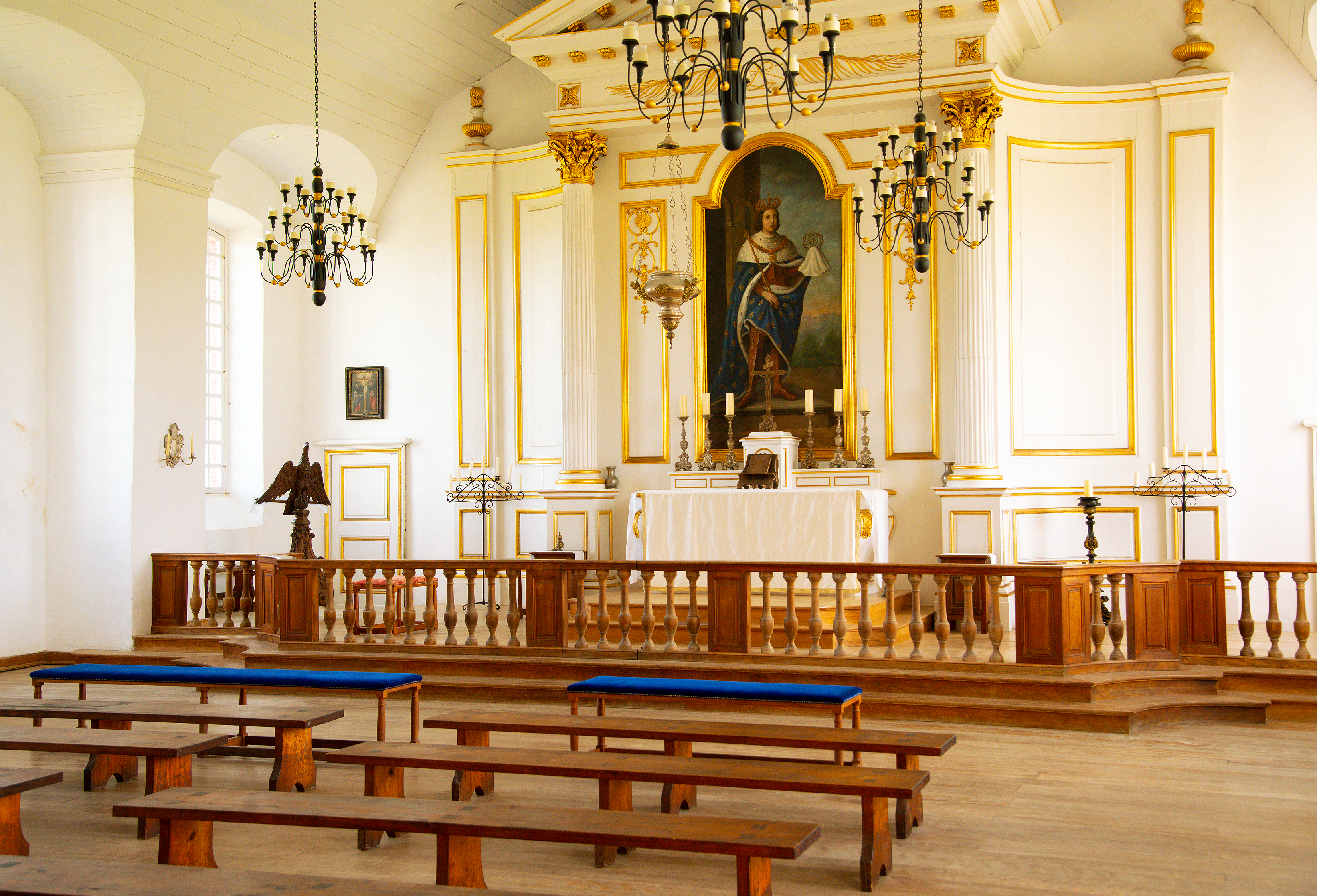
In 1961, the Canadian government embarked on what would become North America's largest historical reconstruction. The goal was audacious: recreate one-fifth of the town as it would have appeared at its peak in 1744. The $26 million project drew on 750,000 pages of archival documents and 500 maps and plans copied from repositories in France, England, Scotland, the United States, and Canada. Much of the labor came from unemployed coal miners in the industrial Cape Breton area, who learned 18th-century French masonry techniques to build some 60 structures and two bastions. Over more than one million artifacts emerged from archaeological excavations during the reconstruction. Today, Parks Canada operates the site as a living history museum where costumed interpreters inhabit the reconstructed buildings -- including North America's finest 18th-century hospital, staffed by the Brothers of Saint-Jean-de-Dieu, and a Military Chapel restored to its original condition. Hurricane Fiona forced additional restoration work in 2022-2023, a reminder that the Atlantic still tests Louisbourg's defenses.
Walking Through 1744
The reconstructed fortress gives visitors an immersive sense of colonial life that few historical sites can match. The Dauphin Gate, once the busiest of four entrances, leads to the fishing compounds around the harbor. The Frederick Gate opens onto the waterfront. Inside, the King's Bastion dominates the skyline as it did three centuries ago. The hospital's tall spire rises beside it, a building that once contained 100 beds and housed a bakery, kitchen, laundry, and stables within its compound. What makes Louisbourg remarkable is not just the scale of what was built, destroyed, and rebuilt, but what it reveals about the fragility of imperial ambition. A fortress meant to secure a continent changed hands based on the willingness of distant governments to send ships, and its ultimate fate was decided not in battle but in treaty negotiations where it served as a bargaining chip.
From the Air
Located at 45.89N, 59.99W on the southeastern tip of Cape Breton Island, Nova Scotia. The reconstructed fortress is visible from moderate altitude as a distinctive cluster of period buildings and walls along the harbor. The nearest airport is J.A. Douglas McCurdy Sydney Airport (CYQY), approximately 35 km northwest. The Louisbourg Lighthouse is visible on the adjacent point. Expect maritime weather conditions with frequent fog and wind off the North Atlantic.