Fortress of Sagres
The ancient Greeks called this place Hieron Akroterion -- the Sacred Promontory. Pliny translated it into Latin as Promontorium Sacrum. For the Romans, it was a place where Saturn or Hercules might be worshipped, at the edge of the known world where the sun appeared to hiss as it sank into the ocean. When Prince Henry of Portugal arrived in the 1440s, he found a lonely, deserted headland far from any village, and he saw exactly what he wanted: the launching point for an empire.
The Village the Infante Built
On October 27, 1443, the Portuguese crown granted the territory around Cape St. Vincent to Infante Henry for life. The region was practically uninhabited -- a 1434 diploma from King Edward described it as 'a lonely and deserted place, far from villages.' Henry set about changing that, founding what he called Vila do Infante, or sometimes 'my town of Tercanabal.' The settlement grew slowly through the 1450s, populated mostly by the Infante's companions and the occasional exile sent there as punishment. The Venetian navigator Alvise Da Mosto arrived in 1454. By 1459, enough people lived there that Henry established a parish church, Santa Maria, erected 'in a place once wild and then populated.' He died there on November 13, 1460, in the village he had willed into existence on the windswept edge of Europe.
The Rose of the Winds
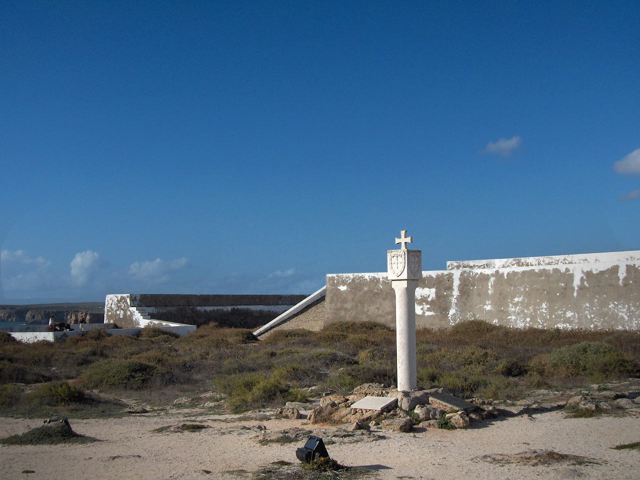
Inside the fortress walls lies one of Portugal's most enigmatic artifacts: a circular structure of unequal-sized stones radiating outward in a star pattern with thirty-two directions. Discovered in the 17th century, the so-called Rose of the Winds has been variously interpreted as a sundial, a compass rose, or a navigational tool connected to Henry's school of exploration. Geophysical studies conducted between 2009 and 2010 examined its composition without definitively settling the debate. The structure measures several meters across, its stone rays splayed against the ground like the points of a giant compass. Whatever its original purpose, it has become the symbolic heart of the fortress -- a physical link between this remote promontory and the voyages that reshaped the world. Around it, the fortress features Renaissance-Mannerist architecture: a polygonal enceinte with six batteries facing the Atlantic, walls topped with bastions, and a turreted cavalier that once stood about eleven meters high.
Shaken and Rebuilt
The 1755 Lisbon earthquake devastated the fortress, as it devastated so much of southern Portugal. Rebuilt in the late 18th century with significant modifications, the structure lost much of its original character. A second earthquake struck on February 28, 1969, causing further damage across the Algarve. Storms in November 2005 damaged interior buildings so badly that the monument partially closed. Through it all, the fortress endured because people kept insisting that it mattered. The Church of Nossa Senhora da Graca, founded during Henry's time and originally dedicated to Saint Mary, still stands within the walls. In 2017, the fortress was named a UNESCO World Heritage Site as part of the 'First Globalization Places' list -- recognition that this windswept headland, where a prince dreamed of what lay beyond the horizon, helped launch the age of global connection. That same year it was awarded the European Heritage Label.
The Most Visited Edge
By 2018, the Fortress of Sagres had become the most visited monument in the Algarve and likely in all of Portugal south of the Tagus River -- ranking third nationally after the Sanctuary of Fatima and the Jeronimos Monastery. The promontory on which it stands stretches roughly a kilometer long and three hundred meters wide, rising forty meters above the Atlantic within the Southwest Alentejo and Vicentine Coast Natural Park. The park is known for its complex biodiversity, with plant and animal species found nowhere else in the region. Visitors walk the same clifftop paths where Henry's navigators might have stood, watching the Atlantic for returning caravels. In December 2018, the fortress received the distinction of International Place of Culture and Peace from the International Observatory of Human Rights. Philip I of Spain reportedly called it 'the end of the world.' For Henry the Navigator, it was the beginning of everything.
From the Air
Located at 37.00N, 8.95W on a dramatic promontory east of Cape St. Vincent. The fortress is highly visible from the air -- a walled compound on a narrow headland jutting into the Atlantic, with sheer cliffs on three sides. The promontory is about 1 km long and 300 m wide. Recommended viewing altitude: 2,000-4,000 feet. Nearest airport: Faro (LPFR), approximately 50 nm east. Lagos aerodrome (LPLG) is about 12 nm northeast. Strong Atlantic winds prevail; approach from the northeast for best views of the fortress against the sea.