Francis Marion National Forest
The British called him the Swamp Fox because they could not catch him. In 1780, Lieutenant Colonel Banastre Tarleton chased Brigadier General Francis Marion for seven hours through twenty-six miles of South Carolina swampland before giving up, reportedly declaring that the Devil himself could not catch the man. The forest that now bears Marion's name covers 263,904 acres of that same swampland, stretching across Charleston and Berkeley Counties north of Charleston. It is a place where blackwater creeks thread through longleaf pines, where bald cypresses rise from flooded wetlands, and where the landscape still holds the character that made it such effective cover for a guerrilla campaign two and a half centuries ago. Established in 1936, the Francis Marion National Forest preserves one of the largest remaining tracts of coastal plain forest in the southeastern United States.
The Ghost of the Swamp Fox
Francis Marion earned his nickname through tactics that would later influence modern American military doctrine. A South Carolina planter turned militia commander, he learned from the Cherokee how to use terrain as a weapon, hiding his small band of fighters in dense forest and striking British encampments with sudden raids before vanishing back into the swamps. His guerrilla methods proved so effective that the Continental Army's struggle in the southern theater turned partly on Marion's ability to disrupt British supply lines and free American prisoners. The 75th Ranger Regiment traces elements of its tactical philosophy to Marion's campaigns. The forest named for him encompasses the very landscape where he operated - a labyrinth of blackwater swamps, dense understory, and winding creeks where visibility drops to nothing and unfamiliar travelers lose their bearings within minutes.
The Night Hugo Arrived
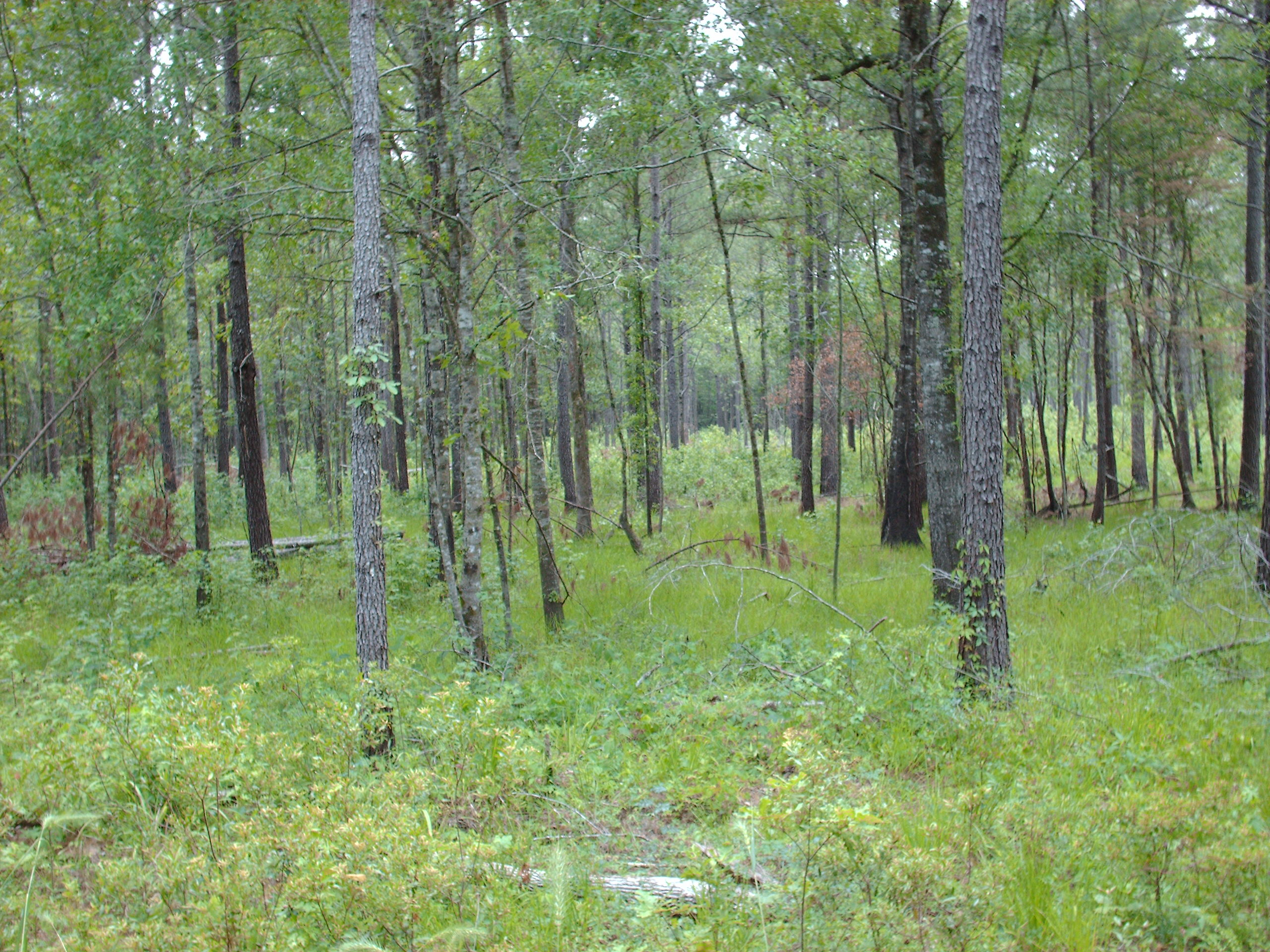
On September 21, 1989, Hurricane Hugo made landfall near Charleston as a Category 4 storm. The Francis Marion National Forest absorbed a direct hit. In a single night, winds exceeding 135 miles per hour snapped and sheared approximately three-quarters of the forest's trees, many broken off ten to twenty-five feet above the ground. An estimated one billion board-feet of lumber-grade timber was destroyed overnight, devastating South Carolina's lumber, paper, and sawmill industries. The U.S. Forest Service described the damage as unprecedented for any national forest. Only the youngest growth survived - saplings flexible enough to bend rather than break. Today, most trees standing in the Francis Marion are younger than the storm, a fact that gives the entire forest a distinctly different character from old-growth Lowcountry woodlands. The canopy is lower, the light penetrates deeper, and the understory is thicker than it would have been before that September night.
The Woodpecker's Comeback
Before Hugo, the Francis Marion harbored the second-largest population of red-cockaded woodpeckers in the country and the only one documented as naturally increasing. The hurricane destroyed 87 percent of the birds' active cavity trees and killed 63 percent of the population. Forest Service biologists launched an aggressive recovery program, installing 940 artificial nesting cavities in remaining longleaf pines within the first three years after the storm. The response was immediate - the woodpecker population surged more than 40 percent by 1995. Decades of continued longleaf pine management have pushed the count past 512 active colonies. In November 2024, the red-cockaded woodpecker was downlisted from Endangered to Threatened, a milestone that owes a significant debt to the recovery work conducted in this forest. The Francis Marion's longleaf pine ecosystem, with its open, parklike stands maintained by prescribed fire, now serves as a model for woodpecker habitat restoration across the Southeast.
Four Wildernesses and a Swamp
Within the forest's boundaries lie four federally designated wilderness areas, all part of the National Wilderness Preservation System: Hell Hole Bay, Little Wambaw Swamp, Wambaw Creek, and Wambaw Swamp. These protected tracts preserve some of the most undisturbed swamp habitat remaining on the Atlantic coastal plain. The names alone evoke the landscape - Hell Hole Bay earned its reputation from the nearly impenetrable tangle of vegetation that fills its interior. The Wambaw areas protect blackwater swamp corridors where bald cypress and tupelo gum trees grow in standing water, their buttressed trunks adapted to the perpetual flooding. Beyond the wilderness areas, the forest offers campgrounds, the Palmetto Trail for hiking and biking, rifle ranges, boat ramps, and the Wambaw Cycle Trailhead for off-highway vehicles. The forest contains the small communities of Awendaw, Huger, Jamestown, and McClellanville, places where the boundary between town and wildland blurs into the creeks and pinelands.
From the Air
Located at 33.17°N, 79.67°W in the coastal plain of South Carolina, the Francis Marion National Forest covers 263,904 acres across Charleston and Berkeley Counties. From the air, the forest appears as a vast expanse of green stretching north from the outskirts of Charleston to the Santee River. Temporarily flooded wetlands and longleaf pine stands are visible at lower altitudes. Charleston International Airport (KCHS) is approximately 20 miles south. Mount Pleasant Regional Airport (KLRO) is closer to the southeast. The Intracoastal Waterway parallels the forest's eastern edge, and the Santee River marks the northern boundary. Best viewed at 2,000-3,000 feet AGL for the contrast between pine uplands and swamp corridors.