Fremont Bridge (Seattle)
Thirty-five times a day, traffic stops on the Fremont Bridge. Bells ring, gates lower, and the twin leaves of this bascule bridge tilt skyward so that a sailboat or tug can pass through the Fremont Cut below. It happens so often that commuters have learned to factor the wait into their schedules, and cyclists along the Burke-Gilman Trail treat each opening as a chance to catch their breath. No other drawbridge in the United States opens as frequently. Federal law gives marine traffic the right-of-way over cars, and the Fremont Bridge honors that rule with a regularity that borders on the absurd.
Third Time's the Charm
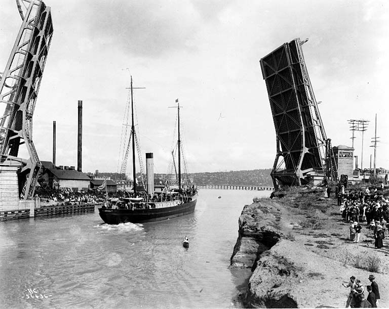
The present Fremont Bridge is actually the third bridge at this spot. A low wooden trestle appeared in 1890 or 1891, when the area was still frontier enough to need one. In 1911, anticipating the construction of the Lake Washington Ship Canal, builders replaced it with a taller trestle intended as a temporary span. It proved even more temporary than planned. On the afternoon of March 12, 1914, the Fremont dam controlling the level of Lake Union gave way. Over the course of a day, the lake dropped nine feet, stranding vessels and floating homes and rupturing the center of the second bridge. Streetcar traffic was rerouted over the Stone Avenue Bridge until the current bascule bridge opened on June 15, 1917, at a cost of $410,000. The first vehicles across were "owl cars," the last trolley run of the night.
First Among Equals
The Fremont Bridge was the first of four city-owned bascule bridges to cross the Lake Washington Ship Canal. The Ballard Bridge followed the same year, the University Bridge in 1919, and the Montlake Bridge in 1925. Together they form a distinctive chain of drawbridges that gives Seattle's waterway crossings their character. The Fremont Bridge earned a place on the National Register of Historic Places in 1982 and holds city landmark status. In 2006, the city undertook a $41.9 million restoration, replacing the bridge approaches and maintenance shop while overhauling the mechanical and electrical systems that operate the bascule leaves. A permanent dynamic lighting installation was added in February 2018, coinciding with the centennial of the bridge and its Ship Canal siblings.
Counting the Crossings
A bicycle counter installed on the bridge in 2012, the first of twelve across the city, turned the Fremont Bridge into a data point in Seattle's cycling culture. By 2019, the counter recorded 1.12 million rides in a single year, a 13 percent increase over the year before. The bridge sits at the seam between the neighborhoods of Fremont and Queen Anne, connecting Fremont Avenue North and 4th Avenue North across one of the busiest waterways in the Pacific Northwest. During rush hours, the bridge closes to most marine traffic, a concession to the practical reality that thirty-five daily openings already push the limits of vehicular patience. Outside those hours, the rhythm resumes: bells, gates, leaves rising, masts gliding through, leaves descending, traffic flowing again.
From the Air
Located at 47.65N, 122.35W, spanning the Fremont Cut of the Lake Washington Ship Canal. The bascule bridge is clearly visible from the air, especially when its leaves are raised. Look for the chain of four drawbridges crossing the canal from west to east: Ballard Bridge, Fremont Bridge, University Bridge, and Montlake Bridge. Nearest airport is Boeing Field/King County International (KBFI), approximately 6 nm south. Best viewed from 1,500-3,000 ft AGL.