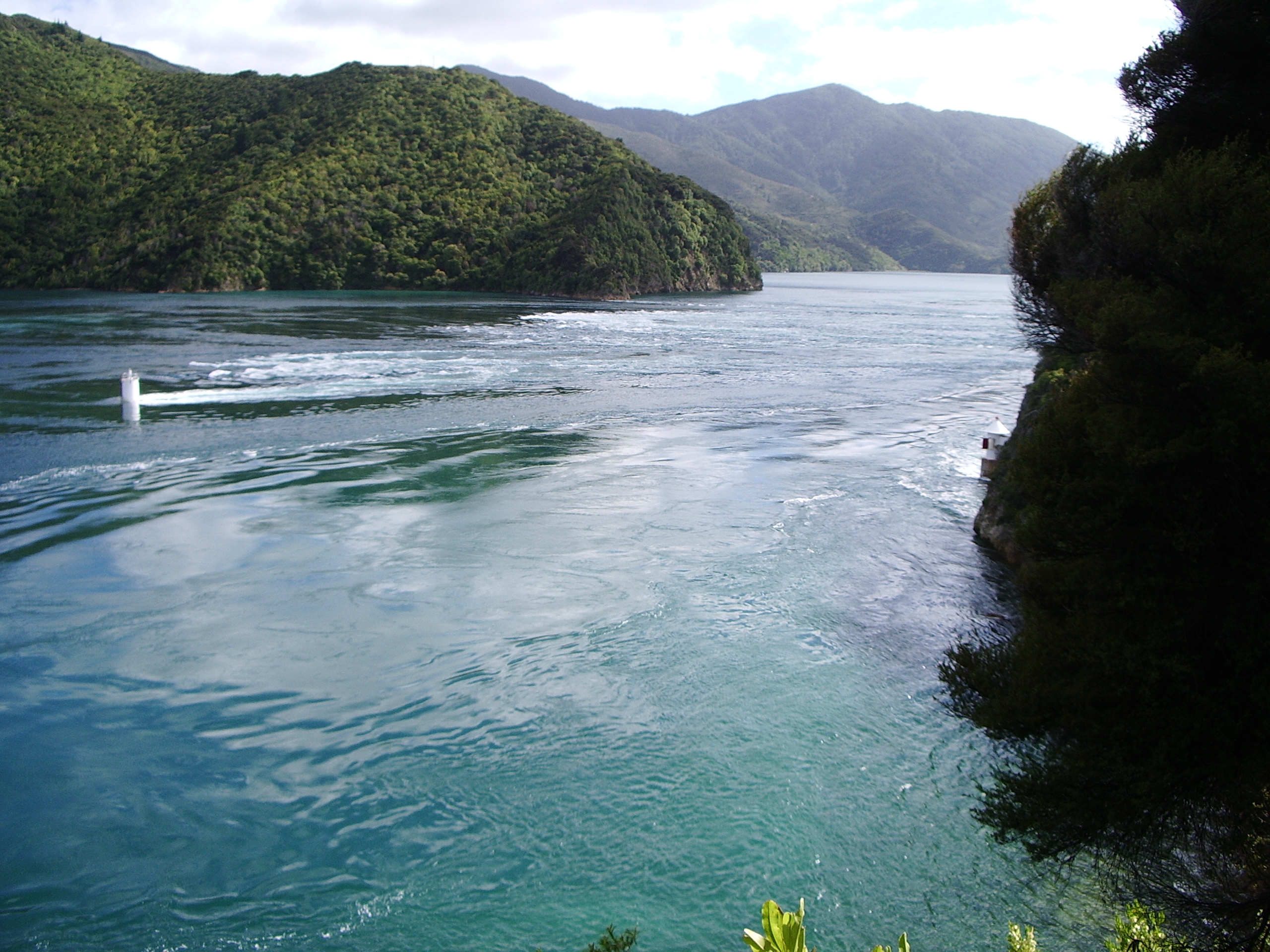
Te Aumiti / French Pass
The current runs at 8 knots. That is roughly walking speed for a person, but in water, it is enough to stun fish. Te Aumiti, officially gazetted as Te Aumiti / French Pass, is a narrow and treacherous strait separating D'Urville Island from the mainland at the northern tip of New Zealand's South Island. On one side, Tasman Bay; on the other, the outer reaches of Pelorus Sound leading to Cook Strait. The pass is 500 meters across, but the navigable channel contracts to just 100 meters, flanked by broken reef. Tidal ranges differ by two meters between the bay and strait sides, with high tides offset by 25 minutes, creating pressure gradients that churn the water into whirlpools and standing waves.
The Shag Turned to Stone
In Maori oral tradition, Te Aumiti is the resting place of Te Kawau-a-Toru, the loyal king shag of the legendary Polynesian navigator Kupe. The story holds that Kupe discovered Cook Strait while battling a giant octopus, and the violence of that fight gouged the coast into the convoluted shapes that form the Marlborough Sounds today. Kupe's shag, a sacred bird reputed to possess the eye of the ancestor and insight into ancient knowledge, flew ahead to test whether the channel was safe for Kupe's canoe. But the tidal rip caught Te Kawau-a-Toru, broke his wing, and dragged him under. The broken reef adjacent to the channel is that bird turned to stone. A nearby rocky point, where a lighthouse now stands, is said to be the shag's petrified bones. The local tribes, Ngati Koata and Ngati Kuia, know this place by the story it carries: Te Aumiti a te Kawau-a-Toru, the currents that swallowed Toru's shag.
The Corvette on the Reef
The first recorded European navigation of the pass came in 1827, and it did not go well. Admiral Jules Dumont d'Urville attempted the passage in the French Navy corvette Astrolabe during his second voyage to New Zealand. As the vessel entered the narrowest section, the current swung her sideward. The helm went unresponsive. Astrolabe struck rocks twice before the tidal force washed her bodily over the reef and into Admiralty Bay on the far side. D'Urville's assessment was blunt: no one should attempt to navigate French Pass except in extreme emergency. The island on the far side now bears his name, D'Urville Island, and the pass itself carried the French designation until 2014, when its official name was formally altered to Te Aumiti / French Pass to honor both traditions.
Pelorus Jack
In 1888, a Risso's dolphin appeared in the waters near the pass. For the next 24 years, this dolphin made himself indispensable to local shipping. He would meet boats emerging from the pass, ride their bow waves for 8 kilometers into Pelorus Sound, then turn back to escort returning vessels. He never navigated the pass itself or ventured into Tasman Bay, keeping strictly to the Pelorus side. Sailors named him Pelorus Jack, and his fame grew until he became the first dolphin in the world to receive legal protection, shielded by a special order in council. Pelorus Jack was last seen in April 1912. The lightkeeper at French Pass later claimed to have found the dolphin's body decomposing on the shore, though the account was never confirmed.
Jacob's Hole
The dangers of Te Aumiti are not confined to the surface. Near the pass lie deep depressions where powerful vertical currents can drag objects, and divers, down without warning. In 2000, a group of student divers undertaking a drift dive during an ebb tide were separated from their surface float and caught in a whirlpool. The current dragged them into Jacob's Hole, a 68-meter-deep depression southwest of the pass. A dive computer recovered from one survivor recorded a maximum depth of 89 meters, far beyond recreational limits. The descent resulted in multiple fatalities. According to the coroner's report, the accident occurred on a falling tide with current flowing from southwest to northeast, a reminder that the same forces that carved a legend into Maori mythology remain as lethal as ever.
The Long Road In
Reaching French Pass by land requires commitment. The settlement of French Pass / Anaru sits at the end of a 70-kilometer road from State Highway 6, much of it unsealed, with sharp bends that demand two hours of careful driving. A short walk from the settlement leads to a lookout overlooking the channel, where you can watch the current rip through the narrows and understand why d'Urville's warning has held for nearly two centuries. The road itself crosses Ronga Saddle with views of Croisilles Harbour, passes through Okiwi Bay, and skirts Elaine Bay before branching at the head of Admiralty Bay. It is remote, unhurried country. Those who make the journey tend to stay.
From the Air
Te Aumiti / French Pass is located at 40.92S, 173.83E, separating D'Urville Island from the mainland. From the air, the narrow strait is clearly visible as a gap in the ridgeline between Tasman Bay to the west and Pelorus Sound to the east. Tidal flow creates visible surface disturbance. The settlement of French Pass / Anaru sits on the mainland side. No nearby airport; the closest airfields are Blenheim/Woodbourne (NZWB) approximately 100 km southeast, and Nelson (NZNS) approximately 80 km southwest. Best viewed at 3,000-5,000 ft to see the channel detail and current patterns.