Fundy National Park
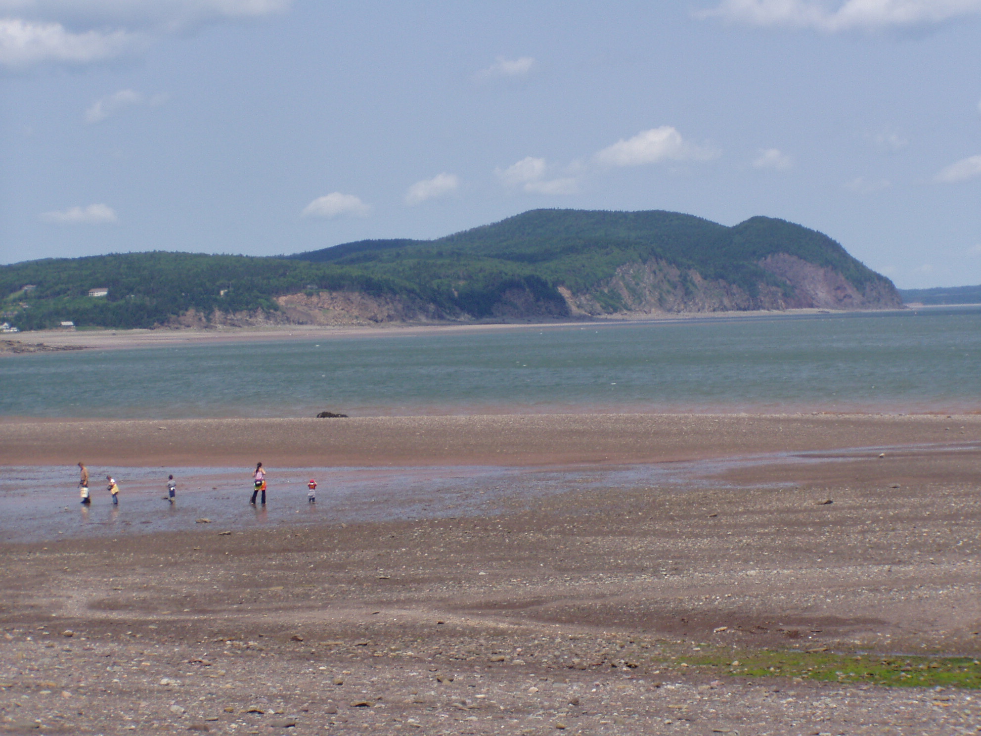
Twice a day, the ocean floor vanishes. Where dog whelks and periwinkles clung to exposed rock just hours ago, 14 meters of cold Atlantic seawater now covers everything. Then, just as reliably, the Bay of Fundy exhales -- and the floor reappears, wet and glistening, stretching hundreds of meters from the base of the cliffs. This daily act of revelation and concealment defines Fundy National Park, a 207-square-kilometer stretch of New Brunswick coastline where the world's highest tides have been sculpting rock, forest, and human history for millennia.
The Breathing Shore
The Bay of Fundy funnels an estimated 160 billion tonnes of water through its narrowing channel with every tidal cycle, and by the time that water reaches the park's section of Goose Bay, the difference between high and low tide can exceed 16 meters. The effect is not subtle. At low tide, visitors walk across a seafloor that feels almost lunar -- ridged sandstone, tidal pools, rockweed draped over boulders that the sea will reclaim within hours. At high tide, that same landscape disappears entirely beneath dark, cold water. The park sits on the northwestern branch of the bay, and on clear days the northern Nova Scotia coast is visible across the water. More than 25 waterfalls cascade down the park's highland escarpment toward the shore, fed by rivers that carry the tannin-stained waters of the interior forest down to the sea.
Layers of Belonging
The Mi'kmaq and Maliseet peoples knew this coast long before Europeans arrived, though the rugged terrain left few traces of permanent settlement. Acadians settled the surrounding area in the early 1700s, establishing the village of Chipoudy -- now Shepody -- in 1710. They farmed the land until the British expelled them during the Acadian deportation. European resettlement did not take hold until 1825, when Scottish, Irish, and English immigrants arrived. The plateau lands defeated them quickly -- the soil was too thin for agriculture, and most families abandoned their farms within a generation. But the coastal village of Point Wolfe thrived on fishing, sawmills, and small shipyards. Life there followed a seasonal rhythm: men worked lumber camps in winter, drove logs downriver in spring, farmed in summer and fall, while women managed households year-round. By the early 20th century, the logging industry had depleted the forests and choked the rivers with sawmill waste, killing the salmon runs. The exodus that followed left the coast quiet enough for a national park.
A Park Born of Disagreement
The idea of a national park in New Brunswick first surfaced in 1927, when the provincial Fish and Game Association petitioned Ottawa to protect endangered wildlife. A committee selected six potential sites, but the federal and provincial governments spent a decade arguing over which one to choose. The National Parks Branch favored a site at Lepreau; prominent provincial figures like botanist William Francis Ganong championed Mount Carleton; Ottawa countered with Mount Champlain, a location nobody had proposed. The stalemate lasted until after the Second World War, when the province finally settled on the Albert County coast. Expropriation began -- 130 private properties plus crown land leased to a Maine forestry company called Hollingsworth and Whitney. The province paid over $850,000 in total, and the process went more smoothly than similar efforts at Cape Breton Highlands or Prince Edward Island. Still, after the land was purchased, every structure was demolished and burned. Most displaced residents resettled in nearby Alma. The park was officially created on April 10, 1948, and opened to the public on July 29, 1950.
A Forest Full of Secrets
Fundy's interior holds 658 species of vascular plants, 276 species of bryophytes, and more than 400 species of lichens. The dominant trees -- red spruce, balsam fir, sugar maple, yellow and white birch -- form a mixed-wood canopy over a forest floor dense with moss, wood fern, and bunchberry. In the Caribou Plain bog, the ground turns carnivorous: pitcher plants, sundew, and bladderwort wait for insects in the saturated peat. Over 260 bird species have been recorded in the park region, and peregrine falcons, once extirpated from the area, have been successfully reintroduced. The endangered Inner Bay of Fundy Atlantic salmon remains a focus of ongoing conservation work, with habitat restoration projects on Bennett Lake Dam and Dickson Brook aiming to reconnect the aquatic corridors that logging once severed.
Trails Through Time
Thirty-five hiking trails span more than 100 kilometers through the park, from the gentle boardwalk at Caribou Plains to the demanding Fundy Footpath, which stretches 64 kilometers along the coast to Big Salmon River near St. Martins. The Dobson Trail connects the park to Riverview over 58 kilometers of backcountry. Dickson Falls, the most popular trail, descends through a canyon of moss-covered rock to a waterfall that seems to exist in permanent twilight. At Point Wolfe, a red-painted covered bridge -- built in 1992 to replace an original from 1910 that was destroyed in a construction accident -- marks the entrance to one of five campgrounds offering 521 sites in total. The park is the most visited Parks Canada site in New Brunswick, drawing visitors who come to walk on the ocean floor and return a few hours later to find it gone.
From the Air
Located at 45.60N, 64.95W along the Bay of Fundy coast in southeastern New Brunswick. The park's 207 km2 is visible as a densely forested highland dropping sharply to the coastline. At low tide, the dramatic tidal flats extend far from shore. Best viewed at 3,000-5,000 feet along the coast. The red-painted Point Wolfe covered bridge and network of waterfalls are visible at lower altitudes. Nearest airports: CYSJ (Saint John Airport) 75 km west, CYQM (Greater Moncton International) 80 km northeast.