Galveston: The Island That Survived America's Deadliest Hurricane
On September 8, 1900, a hurricane struck Galveston Island with winds over 140 mph and a storm surge that submerged the entire city. Between 6,000 and 12,000 people died - the deadliest natural disaster in American history. Before the storm, Galveston was Texas's largest city, its wealthiest, its most important port - the 'Wall Street of the Southwest' where cotton fortunes built grand Victorian mansions. The hurricane ended that trajectory. Survivors responded with engineering audacity: they built a 17-foot seawall along the Gulf and raised the entire grade of the city, lifting thousands of buildings on jacks while workers pumped sand underneath. The Galveston that emerged was smaller, humbler, eventually surpassed by Houston. But the Victorian mansions survived, the beaches drew tourists, and the island that nearly died became a monument to both catastrophe and resilience.
The 1900 Storm
Galveston in 1900 was Texas's premier city - population 38,000, the state's busiest port, mansions lining Broadway. The island's highest point stood eight feet above sea level. When the hurricane made landfall on September 8, storm surge reached 15 feet; waves crashed over the entire island. Bodies washed out to sea, washed back, piled in debris. The death toll remains uncertain - official counts stopped at 6,000, but estimates reach 12,000. Isaac Cline, the local weather bureau chief, had dismissed warnings about the approaching storm; his pregnant wife drowned. The disaster prompted creation of the Galveston Seawall and the grade raising - and convinced Texas business interests to develop Houston's ship channel instead.
The Grade Raising
After the 1900 hurricane, Galveston undertook one of history's most ambitious engineering projects. Workers built a concrete seawall 17 feet high along the Gulf shore, eventually extending 10 miles. Then they raised the entire grade of the city - pumping sand from the harbor, lifting buildings on jacks, filling underneath. Over 2,000 structures were raised, some by as much as 11 feet. The project took years; residents lived in elevated houses accessible by temporary stairs while workers filled beneath them. Some chose not to raise their homes; the resulting half-buried first floors became basements. The seawall and grade raising saved Galveston from subsequent hurricanes, though the city never regained its pre-storm prominence.
The Strand District
The Strand was Galveston's commercial heart - iron-fronted Victorian buildings housing banks, cotton factors, and trading houses that made the city wealthy. The 1900 storm damaged but didn't destroy the district; economic decline did more harm than wind. By the late 20th century, the Strand had become neglected warehouse space. Restoration began in the 1970s, transforming the district into shops, restaurants, and galleries housed in the original Victorian commercial architecture. The Strand is now a National Historic Landmark District, its iron columns and ornate facades recalling when Galveston was Texas's financial capital. Dickens on the Strand, held each December, fills the district with Victorian costumes and characters.
Beach Town Revival
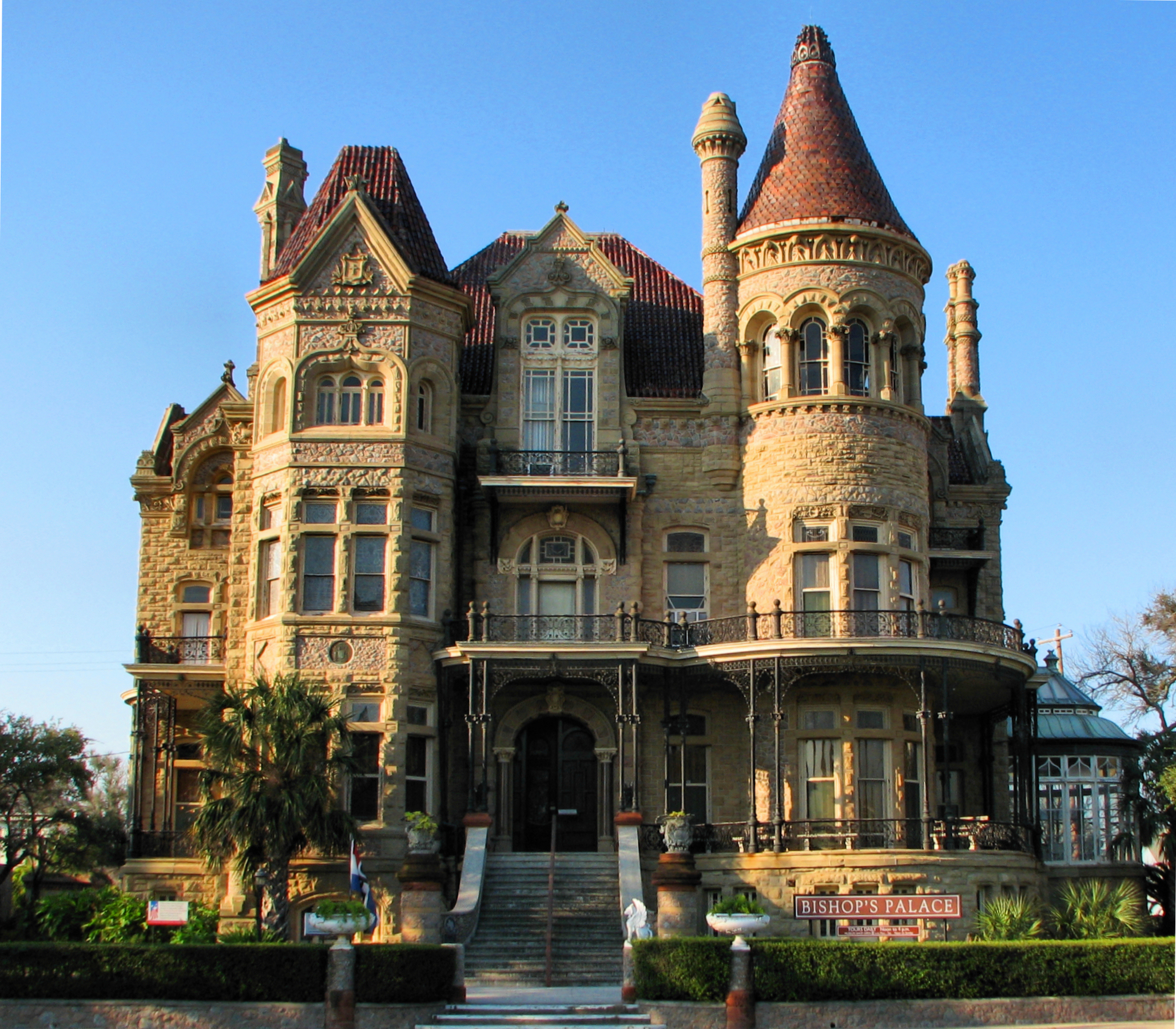
What Galveston lost in commerce, it gained in tourism. The seawall boulevard stretches along the Gulf, lined with hotels, restaurants, and souvenir shops. Stewart Beach and East Beach draw families and spring breakers. The Pleasure Pier extends over the Gulf with rides and attractions. Moody Gardens offers pyramids housing aquarium, rainforest, and discovery exhibits. The historic Broadway mansions - Bishop's Palace, Moody Mansion, Ashton Villa - survived the hurricane and offer tours through Galveston's gilded age. The island balances tourism with working-class neighborhoods, university presence (Texas A&M-Galveston, UTMB medical school), and a port that still handles cargo and cruise ships.
The Island
Galveston Island is a barrier island 27 miles long and 3 miles wide at its broadest, connected to the mainland by a causeway carrying I-45. Houston's Hobby Airport (45 miles) and George Bush Intercontinental (60 miles) serve visitors. The Bolivar Ferry crosses the ship channel to the Bolivar Peninsula, free and running continuously. From altitude, Galveston appears as a narrow sand island between Galveston Bay and the Gulf of Mexico - the seawall visible as a line separating development from beach, the Strand district clustered near the port, cruise ships occasionally docked. What appears from the air as a typical Gulf Coast resort island is where America's deadliest hurricane struck and where survivors literally raised their city to survive.
From the Air
Located at 29.30°N, 94.79°W on a barrier island between Galveston Bay and the Gulf of Mexico. From altitude, Galveston appears as a narrow strip of sand - the seawall visible along the Gulf shore, the historic Strand district clustered near the port, the causeway connecting to the mainland. What appears from the air as a typical Texas beach town is where America's deadliest hurricane killed 8,000 people and where survivors responded by raising the entire city above future floods.