Gamkaskloof
For more than a century, the families of Gamkaskloof asked the government to build them a road. In 1962, they got one. Within a generation, the valley was empty. The irony is almost too perfect: the road that was supposed to connect this narrow, isolated valley to the outside world instead gave its young people a way to leave and never come back. Today Gamkaskloof, a 20-kilometre-long cleft in the Swartberg mountains of the Western Cape, is a national monument and nature reserve, its renovated cottages equipped with solar panels and bathrooms that the original settlers never had.
The Lion's Canyon
The name is a hybrid. 'Gamka' comes from the Khoisan word for lion, and 'kloof' is the Afrikaans word for valley or canyon. The residents, who never much liked the more famous nickname, called themselves 'Klowers,' Afrikaans for canyon dwellers. Pieter Swanepoel was the first permanent settler, arriving in the 1830s and finding a valley no more than 600 metres wide at its broadest point, hemmed in by the Swartberg range on all sides. The Marais, Cordier, and Joubert Nel Mostert families followed, and the community grew to around 160 people. They farmed grain, vegetables, fruits, tea, and tobacco. They distilled witblits, a potent grape brandy, and brewed beer from wild honey. To reach the outside world, they used donkeys and walked across the mountains to Prince Albert and Calitzdorp, journeys that could take days over rugged terrain.
A World Apart
Isolation shaped every aspect of life in the valley. A school was eventually established, with the teacher doubling as Sunday church leader, combining education and worship in a community too small to support separate institutions. The settlers were resourceful by necessity, growing what they needed and making what they could not buy. Their self-sufficiency was not a lifestyle choice but a condition imposed by geography, and they endured it for generations while petitioning for the road that would change everything. The valley's residents were practical people who understood their situation clearly: without a road, their children had limited futures. With one, those children might not need the valley at all. That was the bargain, though no one knew it yet.
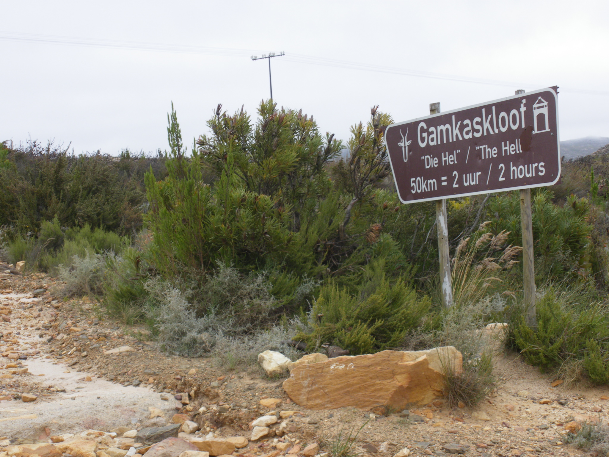
The Road That Emptied the Valley
When the road was finally completed in 1962, it dropped almost 579 metres in a vertiginous descent to the valley floor. The name most outsiders know the valley by, 'Die Hel,' is popularly attributed to an animal inspector named Piet Botha, who visited in the 1940s using a particularly treacherous route called Die Leer on Kleinberg and reportedly described the experience as 'hell.' The residents believe the name actually derives from 'helling,' the Afrikaans word for a steep incline, and they have always disliked it. Whatever its origin, the road transformed the valley's relationship with the outside world. Young people left for high school in nearby towns and discovered they preferred lives that did not involve subsistence farming in a 600-metre-wide canyon. The elderly retired to villages outside the valley. One by one, the properties were sold to the Western Cape Nature Conservation Board, the last transaction closing in 1991.
Monument to What Was Lost
In 1997, the Gamkaskloof valley was declared a national monument and incorporated into the Swartberg Nature Reserve. The old cottages have been renovated for visitors, fitted with solar power and modern bathrooms. Hikers now walk trails through the valley, and the isolation that once defined daily hardship has become a selling point for adventure tourism. A mountain bike race called 'To Hell and Back' uses the valley, as does the MadScientists' Midnight Hell Run. The Freedom Challenge, a multi-day adventure race, passes through as well. The valley's beauty is undeniable: the Swartberg walls rise steeply on either side, the Gamka River winds along the valley floor, and the quiet is the kind that city dwellers pay to experience. But beneath the tourism lies a more complicated story of a community that survived for over a century through sheer determination, then dissolved within decades once the barrier that held it together was finally breached.
From the Air
Coordinates: 33.34S, 21.88E. Gamkaskloof is a narrow valley within the Swartberg mountain range, visible from altitude as a deep cleft in the east-west trending mountains. The access road from the Swartberg Pass is visible as a winding line descending steeply into the valley. Nearest airports: Oudtshoorn Airfield approximately 50 km southeast; George Airport (FAGG) approximately 100 km south. The valley floor sits well below the surrounding ridgelines; expect turbulence and strong valley winds. The Swartberg Pass crossroad marks the turn-off to the valley.