Garden Route
The name is generous but accurate. Between Mossel Bay and Storms River, where the Outeniqua and Tsitsikamma mountains crowd within ten to thirty kilometers of the Indian Ocean, the landscape gardens itself. Indigenous forests fill the valleys, fynbos carpets the slopes, and lagoons pool behind sand dunes along a coast fed by the warm Mozambique Current, which keeps the sea at a swimming-friendly 21 degrees Celsius. The Garden Route receives about 700 millimeters of rain annually, enough to sustain the dense vegetation that gives it its name, while just forty kilometers to the north, across the mountain wall, the Little Karoo bakes in semi-arid heat. The contrast is sharp enough to feel like a border crossing.
The Coast That Made Itself Inaccessible
The Garden Route's beauty is partly a consequence of its isolation. With no easy routes inland from this section of coastline, the area never attracted heavy industry. Forestry has been the dominant economic activity for generations, and the indigenous forests that survive, particularly around Knysna and along the Tsitsikamma, are among the most significant remnants of the temperate forest that once covered much of the southern Cape. The N2 highway changed everything. Once good roads connected the coast to Cape Town 350 kilometers to the west and Gqeberha 150 kilometers to the east, tourists arrived in numbers. Knysna drew them with its forests and lagoon, Plettenberg Bay with its beaches, and the Tsitsikamma with its river gorges and coastal trails. Mossel Bay anchors the western end, the place where Bartolomeu Dias stepped ashore in 1488 and where South Africa's first post office was established under a milkwood tree in 1500.
Mountains, Steam, and Oysters
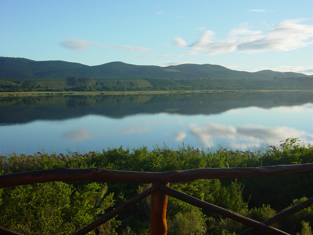
George, the largest town on the Route, sits cradled between the Outeniqua Mountains and the sea, serving as the gateway and transport hub with the region's main airport. From George, the Outeniqua Choo-Tjoe, a narrow-gauge steam railway, once wound 67 kilometers through to Knysna, crossing the Kaaimans River bridge in one of South Africa's most photographed rail journeys. Severe flooding in 2006 shut the line down, but as of 2025, contracts for rebuilding have been awarded. Knysna itself is where you eat oysters. The lagoon town has built its identity around the bivalve and the indigenous forests that press in from every side, while nearby Sedgefield and Wilderness offer quieter lakeside alternatives. The Garden Route District Municipality also encompasses the Little Karoo to the north, including Oudtshoorn with its ostrich farms and the Cango Caves, a semi-arid counterpoint to the lush coast that technically falls under the same administrative umbrella.
Where the Route Ends and the Wild Begins
East of Knysna, the Garden Route grows wilder. Plettenberg Bay draws beach lovers, but the real shift comes at Nature's Valley and the Tsitsikamma, where the coastline turns dramatic and the forest closes in. The Tsitsikamma National Park protects one of South Africa's most striking stretches of coast, where deep river gorges cut through indigenous forest and the Storms River mouth trail hangs above churning surf. Campers at the Ebb and Flow campsite in Wilderness wake to birdsong and lake mist, while those at Storms River mouth share the beach with Cape clawless otters during the quiet off-season months. The entire corridor is also a living archaeological record. The caves at Pinnacle Point near Mossel Bay have yielded evidence of human occupation stretching back 170,000 years, while stone fish traps near Stilbaai represent one of humanity's oldest continuous technologies. The Garden Route is scenic in the conventional sense, but its deepest beauty lies in what it preserves: forests that predate European contact, marine ecosystems sustained by ancient currents, and the traces of people who lived along this coast when the rest of the continent had turned to dust.
From the Air
The Garden Route stretches along the coast at approximately 34.01°S, 22.01°E, running 170 km from Mossel Bay in the west to Storms River in the east. George Airport (FAGG) is the primary airport, offering scheduled domestic flights to Cape Town (FACT), Durban (FAKN), and Johannesburg (FAOR). From cruising altitude, the Garden Route is identifiable by the narrow strip of green vegetation compressed between the Indian Ocean to the south and the Outeniqua-Tsitsikamma mountain range to the north. The Knysna lagoon, the Kaaimans River bridge near Wilderness, and the river gorges of the Tsitsikamma are prominent visual landmarks. The contrast between the green coastal strip and the arid Little Karoo behind the mountains is striking from altitude.