Georgian Bay
The Ojibwe called it Spirit Lake. The Huron-Wendat knew it as Lake Attigouatan. When Samuel de Champlain became the first European to chart these waters in 1615, he called it La Mer douce - the calm sea, the fresh sea - because a body of water this vast seemed impossible without salt. Georgian Bay covers nearly eighty percent of the area of Lake Ontario and contains more islands than most countries have towns. It is so large, so distinct from Lake Huron proper, that geographers have long argued it deserves recognition as the sixth Great Lake. The argument is more than academic: if Georgian Bay stood alone, it would be the fourth largest lake entirely within Canada, after Great Bear, Great Slave, and Winnipeg. It is a freshwater inland sea in everything but name.
Granite, Ice, and the Shield's Edge
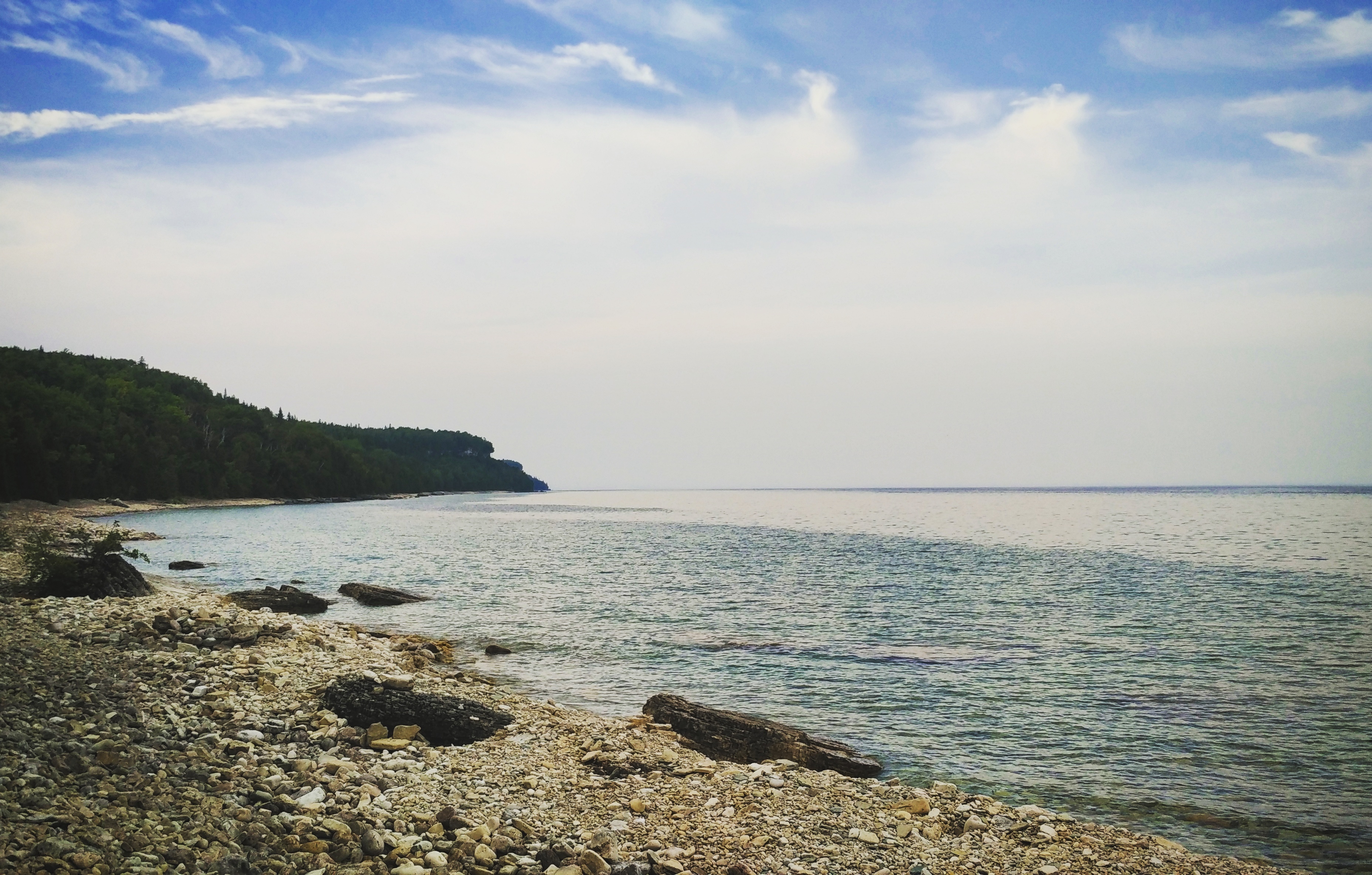
The eastern shore of Georgian Bay sits on the southern edge of the Canadian Shield - the ancient granite bedrock that forms the geological backbone of North America, exposed here by glaciers retreating at the end of the last Ice Age roughly 11,000 years ago. These are among the oldest rocks on the planet's surface, scraped clean and polished by kilometers of ice. The granite formations and windswept eastern white pines that cling to them became the defining imagery of Canadian landscape painting when the Group of Seven turned their easels toward these shores in the early twentieth century. Tom Thomson painted Pine Island, Georgian Bay in the winter of 1914-1916, capturing the stark beauty that would come to symbolize the Canadian wilderness in the national imagination. The western shore tells a different geological story: here the Niagara Escarpment defines the coastline, the same ancient dolostone formation that creates Niagara Falls and runs from New York State through Ontario and into Wisconsin.
Thirty Thousand Islands
The number is not an exaggeration. Along the eastern coast of Georgian Bay, tens of thousands of islands - granite knobs, pine-crowned outcrops, and low-slung reefs - scatter across the water in a labyrinth that has delighted canoeists and confounded navigators for centuries. Collectively known as the Thirty Thousand Islands, they range from bare rocks barely breaking the surface to Parry Island, large enough to support communities. At the bay's northern edge sits Manitoulin Island, the world's largest island in a freshwater lake, separating Georgian Bay from the North Channel that connects it to Lake Huron. In October 2004, UNESCO recognized the significance of this landscape by declaring the Georgian Bay Littoral a Biosphere Reserve. The islands shelter a summer cottage culture stretching back generations - communities like Cognashene, Sans Souci, and Pointe au Baril, many accessible only by boat, where families return to the same wind-battered docks year after year.
The Legend of Kitchikewana
Wyandot oral tradition offers its own explanation for the bay's extraordinary geography. Kitchikewana was a god large enough to guard the entirety of Georgian Bay, known for a temper as vast as his size. His people decided a wife would calm him. At a grand celebration, Kitchikewana met a woman named Wanakita and declared her his bride, planning the wedding the moment she departed. When Wanakita returned, she told him she was already engaged. In his fury, Kitchikewana tore apart the celebration, ran to one end of Beausoleil Island, scooped up a massive ball of earth, and hurled it into the Great Lakes. The fragments became the Thirty Thousand Islands. The gouges left by his fingers formed five bays: Midland, Penetang, Hog, Sturgeon, and Matchedash. Exhausted, Kitchikewana lay down to sleep and became Giant's Tomb Island, where he rests still. A large statue of Kitchikewana now stands on the main street of Penetanguishene.
Waterways and Portages
Georgian Bay is a crossroads. For thousands of years, its shores and waterways served as a major trade route between the Anishinaabe peoples to the north and the Huron-Petun to the south, an Algonquian-Iroquoian highway written in water. The Trent-Severn Waterway connects the bay's southeastern corner at Port Severn through Lake Simcoe to Lake Ontario near Trenton - a 386-kilometer chain of locks, canals, and rivers. To the north, Lake Nipissing drains into Georgian Bay through the French River, another ancient travel corridor. The North Channel between Manitoulin Island and the mainland, once busy with steamships hauling passengers and cargo, now carries pleasure craft retracing routes that were old when Champlain first paddled them. Parry Sound, on the eastern shore, claims the distinction of being the world's deepest freshwater port.
Shoreline Towns and the Cottage Shore
The communities around Georgian Bay reflect its scale and character. Wasaga Beach, now the largest town on the bay, sprawls along Nottawasaga Bay at the southern end. Owen Sound served for decades as a shipping and rail depot for the Upper Great Lakes, a gateway north. Tobermory perches at the tip of the Bruce Peninsula where the Main Channel separates it from Manitoulin Island, and the passenger ferry Chi-Cheemaun makes the crossing daily in season. Collingwood and Meaford anchor the southern shore. But the bay's true character reveals itself in the cottage communities along the north and east coasts - clusters of seasonal homes on rocky islands and in sheltered inlets, places where the only road is the water and the only schedule is the weather. It is a landscape that rewards patience: the light shifts, the wind changes, the granite islands glow pink at sunset and silver at dawn, and the freshwater sea stretches on without apparent limit.
From the Air
Located at approximately 45.5N, 81.0W. Georgian Bay is a massive water body easily identified from cruising altitude - it forms the eastern arm of Lake Huron, separated by the Bruce Peninsula and Manitoulin Island. Look for the distinctive Thirty Thousand Islands along the eastern shore, appearing as a dense scattering of dark dots on clear water. The Bruce Peninsula extends northward as a narrow finger of land. Manitoulin Island stretches across the bay's northern boundary. Key airports: Parry Sound Area Municipal (CNK4) on the eastern shore; Wiarton Keppel International (CYVV) on the Bruce Peninsula; Muskoka Airport (CYQA) to the southeast. Best viewed at 10,000-15,000 ft to appreciate the bay's full extent and island geography. The Niagara Escarpment cliff line along the western shore is visible as a white line contrasting with forest and water.