Gibb River Road
Somewhere between Derby and Kununurra, where the corrugated dirt shakes loose every bolt you forgot to tighten, the Gibb River Road stops being a route and becomes a state of mind. For 647 kilometers this unpaved track cuts across the Kimberley region of Western Australia, threading through a landscape so ancient and empty that the red dust feels like it has been waiting for you specifically. There is no mobile signal. Fuel stations are separated by hundreds of kilometers. Crocodiles inhabit the river pools where you might want to swim. And yet every dry season, from June through August, a procession of 4WD vehicles sets out from Derby or Broome, loaded with jerrycans and tinned food, to attempt what has become one of Australia's bucket-list adventures.
Hooves to Horsepower
The road owes its existence to cattle. In the early twentieth century, stockmen drove herds across the Kimberley to the port at Wyndham, wearing a trail into the landscape through sheer repetition. Andrew Gibb Maitland and Charles Crossland were the first Europeans to sight the river in 1901, and the watercourse that bears Maitland's middle name became an organizing line for the country's pastoral industry. From 1950, the old drove trail was graded into something a truck could navigate, allowing livestock to be transported rather than walked to market. Then as now, the road was only passable in the dry season. The three major tributaries and countless smaller creeks that cross its path become churning muddy torrents during the wet, cutting the route into isolated segments for weeks at a time.
A Landscape That Haunts
The Kimberley is not gentle country. It is older than almost any inhabited landscape on Earth, carved by water and wind into gorges, escarpments, and boab-studded plains that stretch to every horizon. The road traverses what early travelers called "haunting lonely scenery," and the description still holds. Side tracks lead to places like Bell Gorge, Manning Gorge, and the sandstone cathedrals of Windjana Gorge and Tunnel Creek national parks. Detour north along the Kalumburu Road and you can reach Mitchell Falls, one of the Kimberley's most spectacular cascades. The western 125 kilometers and eastern 60 kilometers have been sealed in recent years, but the middle stretch remains graded gravel with no plans for paving. At 70 kilometers per hour, you find the sweet spot that minimizes the bone-rattling corrugations left by passing road trains.
The Art of Going Without
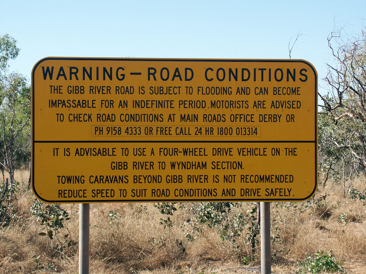
Driving the Gibb demands a particular kind of self-reliance. A high-clearance 4WD vehicle is not optional; caravans cannot make the crossing, and only the most robust trailers survive. Fuel is available at just two points along the road, Imintji and Mount Barnett, plus Drysdale Station 59 kilometers off the main track. All are expensive, but not as expensive as being stranded. Travelers fill their tanks and strap on extra fuel bowsers before leaving Derby or Kununurra. They pack food and water with surplus to spare. There is no mobile reception anywhere along the road, nor on the sealed highways at either end. A satellite phone is not a luxury but a lifeline. Night driving is discouraged, not because of floods in the dry season, but because every local animal, from kangaroos to feral cattle, chooses the road as its evening promenade.
Fire, Teeth, and Corrugations
The dangers of the Gibb are real but specific. During the dry season, the threat is not water but fire. Bushfires can spread faster than they appear, and driving through one is a gamble that rarely pays off. The river pools that dot the route look inviting after a day of dust, but freshwater crocodiles inhabit many of them. They might shy away from an adult, or they might not. Saltwater crocodiles, like the enormous specimen displayed in Wyndham, are less ambiguous about their intentions. When a road train bears down behind you, the protocol is simple: pull aside and let the multi-trailer behemoth pass. Road maintenance crews work only in the dry season, and their presence means delays, sometimes hours of waiting while heavy equipment rearranges the landscape ahead.
Three Days of Red Dust
Most travelers reckon three to four days at a leisurely pace, camping along the route and exploring the gorges and swimming holes that branch off the main track. The road begins at the south edge of Derby, marked by a giant boab tree, and ends near El Questro and Emma Gorge, a 30-minute drive from the eastern terminus. Broome, 220 kilometers west of Derby, is the natural base for the journey, with flights from Perth and Darwin and rental companies familiar with their vehicles tackling the Gibb. The return can loop south via the Great Northern Highway, making possible a side trip to the Bungle Bungles. Coming back by the sealed road, the corrugations still humming in your hands, you understand why people talk about this drive the way they do. It is not the destination. It is not even the gorges or the swimming holes. It is the sheer, unmediated emptiness that the Kimberley offers and that few places left on Earth can match.
From the Air
The Gibb River Road stretches from approximately 17.3°S, 123.6°E (Derby) to 15.8°S, 128.1°E (near Kununurra), crossing the Kimberley at roughly 16.1°S, 126.5°E. From altitude, the unpaved track is visible as a red-brown line cutting through the green and ochre Kimberley landscape. Nearest airports include Derby (YDBY), Broome International (YBRM), and East Kimberley Regional at Kununurra (YPKU). Fly at 3,000-5,000 feet for best views of the gorges and river crossings along the route.