Glorioso Islands
Two countries claim these islands. None of them have anyone living here. The only permanent human presence on the Glorioso archipelago is a French Foreign Legion garrison and a meteorological station, watching the weather from a patch of coral and sand that totals just five square kilometers. Situated in the northern Mozambique Channel between Mayotte and Madagascar, the Glorieuses are among the most remote and most disputed specks of land in the Indian Ocean -- and their strategic value has always been wildly disproportionate to their size.
Coconuts, Guano, and a Formal Claim
The islands were likely known to Arab navigators -- particularly Yemeni traders plying routes between East Africa and the spice islands -- long before Europeans mapped them. In 1880, a Frenchman named Hippolyte Caltaux arrived and planted coconuts on Grande Glorieuse, the largest island, a roughly circular atoll about three kilometers across. The coconut plantation he established would outlast him; its remnants, alongside casuarina trees, still give the island its incongruous greenery. France formalized the claim in 1892, when Captain Richard of the warship Primauget raised the tricolor. Three years later, the archipelago was folded into the colony of Mayotte and its dependencies. From 1914 to 1958, concessions to exploit the islands went to companies based in the Seychelles, and on smaller Ile du Lys -- a 600-meter strip of sand dunes and scrub eight kilometers to the northeast -- phosphate was quarried from accumulated seabird guano.
Sovereignty as a Parlor Game
The Glorioso Islands have never had a settled civilian population, yet they have attracted claims from Comoros, Madagascar, and formerly the Seychelles. Madagascar has asserted sovereignty since 1972, despite the islands never having been part of the Malagasy Protectorate. The Comoros, which claims all of Mayotte and its former dependencies, includes the Glorieuses in that demand. The Seychelles pressed their own case until the France-Seychelles Maritime Boundary Agreement of 2001 settled the matter between those two nations. What makes the dispute worth having is not the land itself but the sea around it. The Glorieuses command an Exclusive Economic Zone of 48,350 square kilometers -- nearly ten thousand times the area of the islands themselves. In the arithmetic of maritime law, five square kilometers of coral reef can project sovereignty over a vast stretch of ocean.
Sanctuary in the Channel
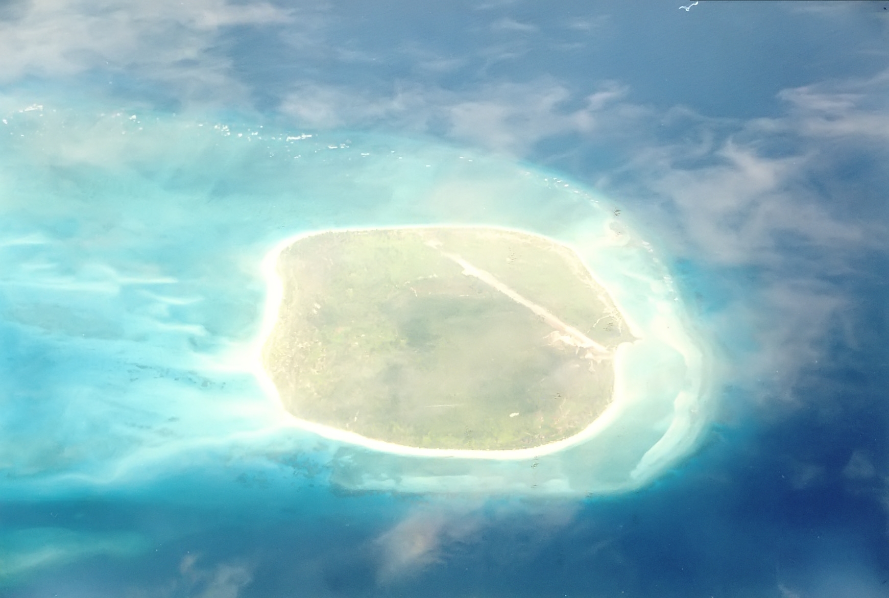
Whatever the diplomatic arguments, the islands' real significance may be ecological. Ile du Lys is a major nesting ground for migratory seabirds, and sea turtles lay eggs on beaches across the archipelago. In the surrounding waters, humpback whales and whale sharks pass through on seasonal migrations. The native vegetation that once covered the islands -- bois de rose, portia, banyan, and other large trees -- was largely felled after the French settlement began, replaced by coconut palms and introduced species. In 2012, France established the Glorioso Islands Marine Natural Park, a marine protected area designed to preserve what the land itself has lost. The terrain is low and flat, rising no higher than twelve meters above sea level, and Grande Glorieuse has a 1,300-meter airstrip -- the only infrastructure beyond the garrison. From the air, the islands are a thin green line inside a turquoise halo of reef and lagoon, easy to miss if you are not looking, impossible to forget once seen.
From the Air
Located at 11.55S, 47.33E in the northern Mozambique Channel. From altitude, Grande Glorieuse appears as a small circular green island inside a coral reef and lagoon system. A 1,300-meter airstrip is visible on the main island. Ile du Lys is a narrow sand strip approximately 8 km to the northeast. The archipelago sits roughly between Mayotte (FMCZ) to the west and the northern tip of Madagascar to the southeast. No civilian airport; the airstrip serves military logistics only. The islands are extremely low-lying, reaching only 12 meters at their highest point.